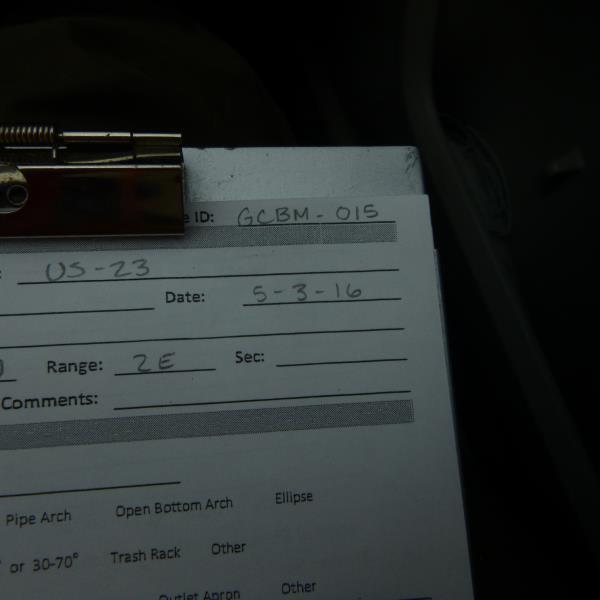
Road Stream Crossing Site CLHW_GCBM-015
Greene Creek-Black Mallard River Watershed, Greene Creek
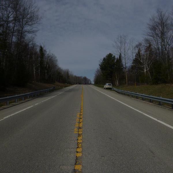
US-23
Benton Twp,
Cheboygan County
Information collected by:
Site Location
GPS Coordinates: 45.63622
, -84.2347
T38N
R2E
Sec 31
Owned by Private
Fish Passability 0
Perch Height: 2.8 ft.
Total Erosion: 0.557 tons/year
Severity: Severe
Year Inventoried: 2016
Site ID
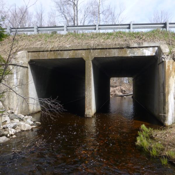
Inlet
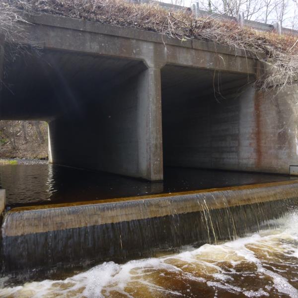
Outlet
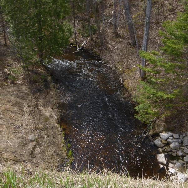
Upstream Conditions
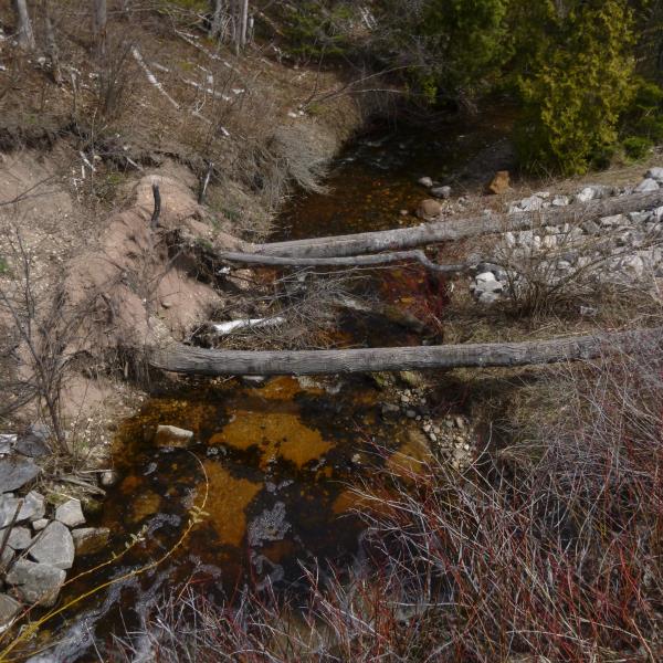
Downstream Conditions
Road Approach - Left

Road Approach - Right
Crossing Information
Type of Crossing: culvert(s)
Number of Structures: 2
Structure Shape: Square/Rectangle
Inlet Type: Headwall
Outlet Type: Freefall onto Riprap
Structure Material: Concrete
Structure Substrate: None
General Conditions: Fair
Multiple Culverts/Spans | ||||
Culvert/Span | Width | Length | Height | Material |
1 |
10 ft. |
54 ft. |
10 ft. |
Concrete |
2 |
10 ft. |
54 ft. |
10 ft. |
Concrete |
Structure Interior: smooth
Dimensions of Structure: Length 54 ft.
, Width 10 ft.
, Height 10 ft.
Percentage Crushed:
Inlet: 1% to 25%
Outlet: 0%
In Pipe: 0%
Perch Height: 2.8 ft.
Structure Inlet
Water Depth: 0.6 ft.
Embedded Depth of Structure: 0 ft.
Water Velocity*: 0.4 ft./sec.
Structure Outlet
Water Depth: 1.2 ft.
Embedded Depth of Structure: 0 ft.
Water Velocity*: 0.4 ft./sec.
*Water Velocities were measured at the Surface
(with Float Test)
Stream Information
Stream Flow: Less than 1/2 Bankfull
Riffle Information
Water Depth: 0.6 ft.
Bankfull Width: 18 ft.
Wetted Width: 14 ft.
Water Velocity: 1.7 ft./sec.
(Measured with Float Test)
Dominant Substrate: Cobble
Road Information
Paved
Federal Road
Road Condition: Good
Road Width at Culvert: 32 ft.
Location of Low Point: At Stream
Runoff Path: Ditch
Embankments
Upstream
Fill Depth: 3 ft.
Slope: Vertical
Downstream
Fill Depth: 6 ft.
Slope: Vertical
Approaches
Left Approach
Length: 200 ft.
Slope: 6% to 10%
Vegetation: Heavy
LS Factor: 1.23
Erosion: 0.2602 tons/year
Right Approach
Length: 550 ft.
Slope: 1% to 5%
Vegetation: Heavy
LS Factor: 0.51
Erosion: 0.2967 tons/year
Erosion Information
Total Erosion at Crossing: 0.557 tons/year
Summary Information
Fish Passability 0
Fish Passage is an area of concern for this site.
I watched about 100 white suckers sitting at the bottom of the outlet waiting to go upstream to spawn. Unfortunately they are unable to surpass this barrier, making upstream impossible to reach. This may be a priority stream, however I believe the reason behind the perch is to prevent the passage of sea lamprey into the rivers
A future visit to this site is recommended. Although perch may be present to prevent sea lamprey from reaching upstream riffles, it is preventing every other species trying to do the same. Not sure how to approach this crossing with information at hand
�