Road Stream Crossing Site CLHW_GCBM-018
Greene Creek-Black Mallard River Watershed, Unnamed stream
US-23
Benton Twp,
Cheboygan County
Information collected by:
Site Location
GPS Coordinates: 45.64549
, -84.29668
T38N
R1E
Sec 27
Owned by Private
Fish Passability 1
Structure is NOT Perched
Total Erosion: 0.1931 tons/year
Severity: Minor
Year Inventoried: 2016
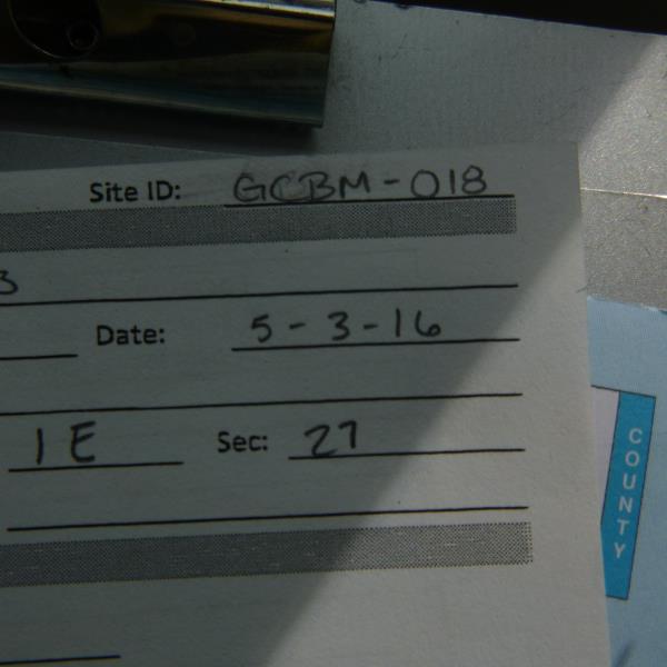
Site ID
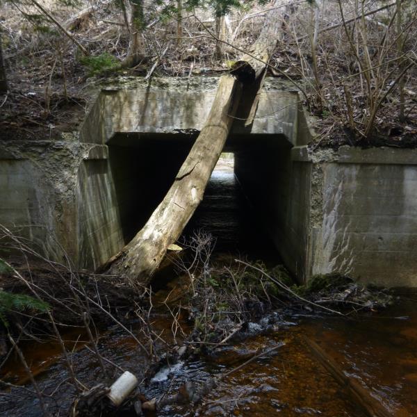
Inlet
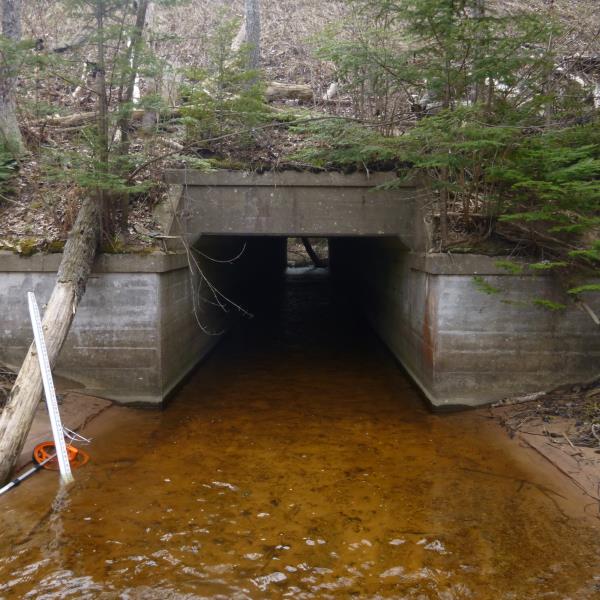
Outlet
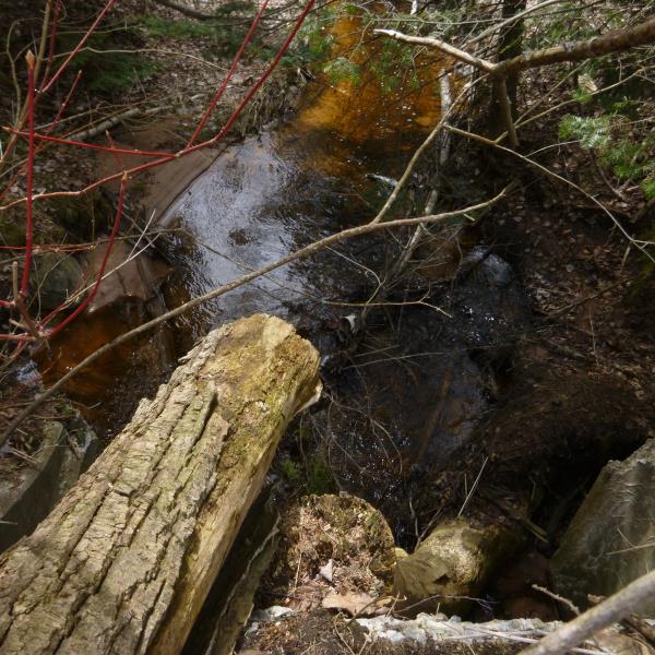
Upstream Conditions
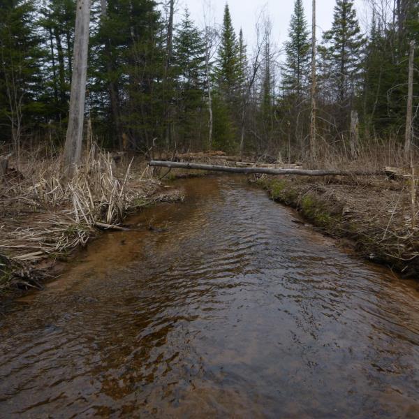
Downstream Conditions
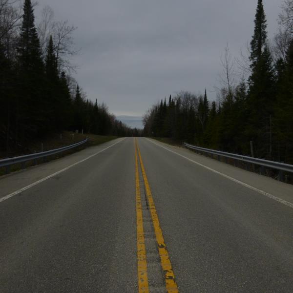
Road Approach - Left
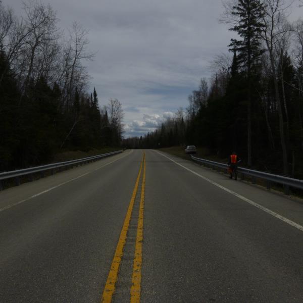
Road Approach - Right
Crossing Information
Type of Crossing: culvert(s)
Number of Structures: 1
Structure Shape: Square/Rectangle
Inlet Type: Headwall
Outlet Type: At Stream Grade
Structure Material: Concrete
Structure Substrate: Sand
General Conditions: Poor
Structure Interior: smooth
Dimensions of Structure: Length 100 ft.
, Width 8 ft.
, Height 6 ft.
Percentage Plugged:
Inlet: 26% to 50%
Outlet: 0%
In Pipe: 0%
Percentage Crushed:
Inlet: 1% to 25%
Outlet: 0%
In Pipe: 0%
Structure is NOT Perched
Structure Inlet
Water Depth: 0.4 ft.
Embedded Depth of Structure: 0 ft.
Water Velocity*: 1.6 ft./sec.
Structure Outlet
Water Depth: 0.5 ft.
Embedded Depth of Structure: 0.2 ft.
Water Velocity*: 1.6 ft./sec.
*Water Velocities were measured at the Surface
(with Float Test)
Stream Information
Stream Flow: Less than 1/2 Bankfull
Riffle Information
Water Depth: 0.5 ft.
Bankfull Width: 14 ft.
Wetted Width: 9 ft.
Water Velocity: 1.5 ft./sec.
(Measured with Float Test)
Dominant Substrate: Sand
Road Information
Paved
Federal Road
Road Condition: Good
Road Width at Culvert: 34 ft.
Location of Low Point: At Stream
Runoff Path: Ditch
Embankments
Upstream
Fill Depth: 14 ft.
Slope: 1:2
Downstream
Fill Depth: 16 ft.
Slope: 1:2
Approaches
Left Approach
Length: 150 ft.
Slope: 1% to 5%
Vegetation: Heavy
LS Factor: 0.4
Erosion: 0.0674 tons/year
Right Approach
Length: 250 ft.
Slope: 1% to 5%
Vegetation: Heavy
LS Factor: 0.44
Erosion: 0.1236 tons/year
Erosion Information
Total Erosion at Crossing: 0.1931 tons/year
Extent of Erosion: Minor
Location of Erosion | Erosion Dimensions | Eroded Material | Material Eroded | Total Erosion | ||
facing downstream | Length | Width | Depth | Reaching Stream? | (tons/year) | |
Right Upstream Embankment |
4 ft. |
3 ft. |
0.5 ft. |
no |
Gravel |
0.002 |
Summary Information
Fish Passability 1
�