Road Stream Crossing Site CLHW_LBR-003
Little Black River Watershed, West Branch Little Black River
Rose Rd
Beaugrand Twp,
Cheboygan County
Information collected by:
Site Location
GPS Coordinates: 45.6605
, -84.54949
T38N
R2W
Sec 28
Owned by Private
Fish Passability 0.5
Structure is NOT Perched
Total Erosion: 4.374 tons/year
Severity: Severe
Year Inventoried: 2016
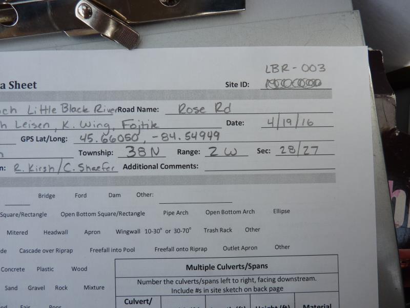
Site ID
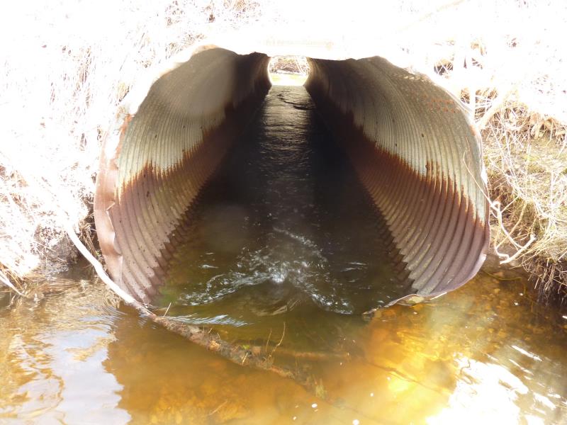
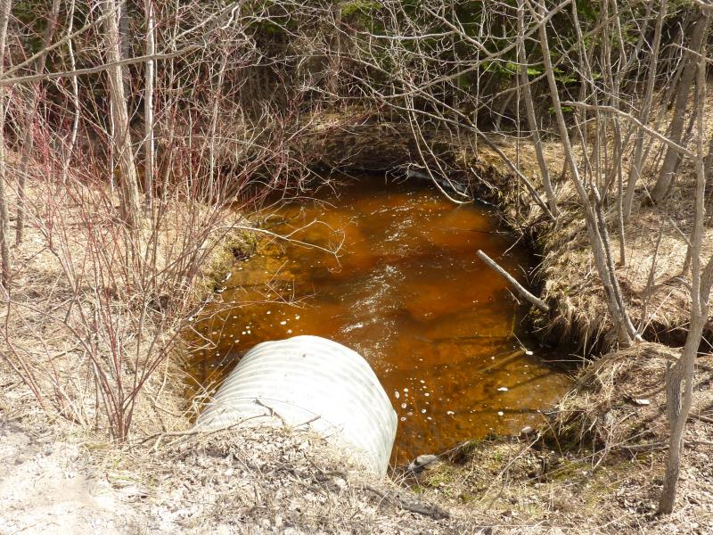
Inlet
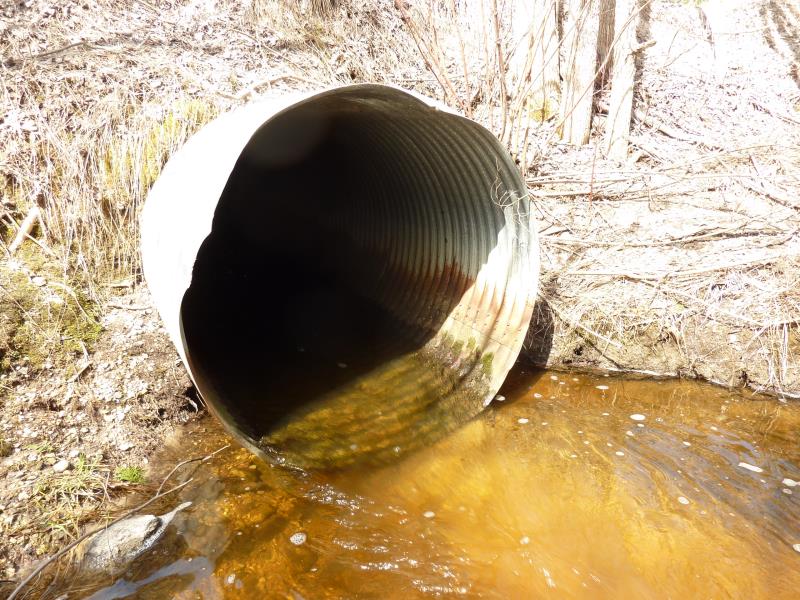
Outlet
Upstream Conditions
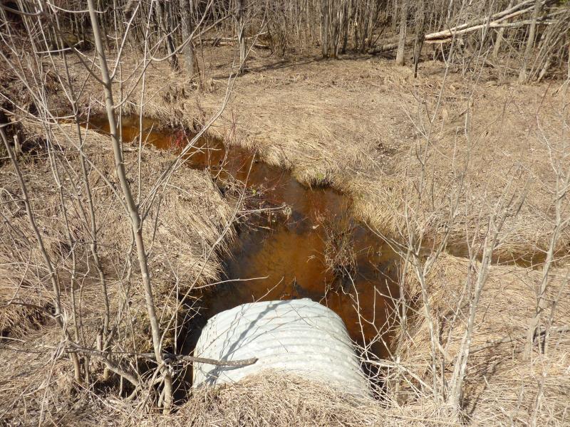
Downstream Conditions
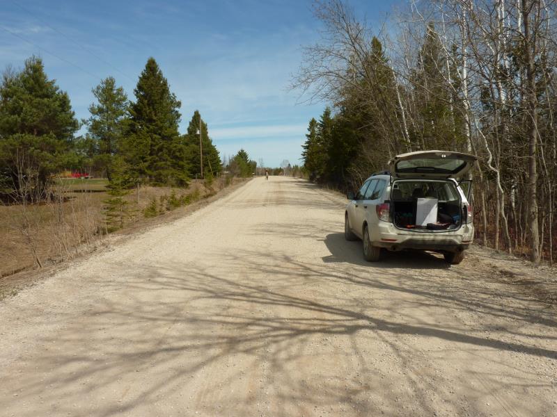
Road Approach - Left
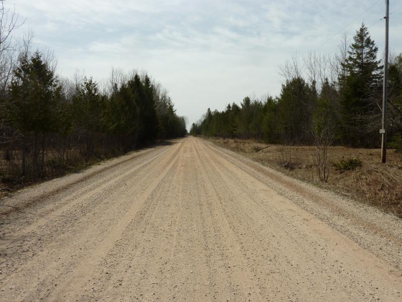
Road Approach - Right
Crossing Information
Type of Crossing: culvert(s)
Number of Structures: 1
Structure Shape: Round
Inlet Type: Projecting
Outlet Type: At Stream Grade
Structure Material: Metal
Structure Substrate: Sand
General Conditions: Good
Structure Interior: corrugated
Dimensions of Structure: Length 42 ft.
, Width 3.9 ft.
, Height 4 ft.
Percentage Plugged:
Inlet: 1% to 25%
Outlet: 0%
In Pipe: 0%
Percentage Crushed:
Inlet: 1% to 25%
Outlet: 0%
In Pipe: 0%
Structure is NOT Perched
Structure Inlet
Water Depth: 1 ft.
Embedded Depth of Structure: 0.1 ft.
Water Velocity*: 2.5 ft./sec.
Structure Outlet
Water Depth: 0.7 ft.
Embedded Depth of Structure: 0 ft.
Water Velocity*: 2.5 ft./sec.
*Water Velocities were measured at the Surface
(with Float Test)
Stream Information
Stream Flow: Less than 1/2 Bankfull
Scour Pool: Length 25 ft.
, Width 13 ft.
, Depth 2.8 ft.
Upstream Pond: Length 13 ft.
, Width 8 ft.
, Depth 1.6 ft.
Riffle Information
Water Depth: 0.4 ft.
Bankfull Width: 10 ft.
Wetted Width: 8.2 ft.
Water Velocity: 1.4 ft./sec.
(Measured with Float Test)
Dominant Substrate: Gravel
Road Information
Gravel
County Road
Road Condition: Fair
Road Width at Culvert: 24 ft.
Location of Low Point: At Stream
Runoff Path: Ditch
Embankments
Upstream
Fill Depth: 2.9 ft.
Slope: 1:2
Downstream
Fill Depth: 2.5 ft.
Slope: 1:2
Approaches
Left Approach
Length: 950 ft.
Slope: 1% to 5%
Vegetation: Heavy
LS Factor: 0.565
Erosion: 3.5488 tons/year
Right Approach
Length: 275 ft.
Slope: 1% to 5%
Vegetation: Heavy
LS Factor: 0.45
Erosion: 0.8182 tons/year
Erosion Information
Total Erosion at Crossing: 4.374 tons/year
Extent of Erosion: Minor
Erosion is occurring and corrective actions can be installed to address the problem.
Notes: Undercutting/erosion under culvert; could place stone
Location of Erosion | Erosion Dimensions | Eroded Material | Material Eroded | Total Erosion | ||
facing downstream | Length | Width | Depth | Reaching Stream? | (tons/year) | |
Right Upstream Embankment |
2 ft. |
1 ft. |
1 ft. |
yes |
Loam |
0.0018 |
Left Upstream Embankment |
4 ft. |
2 ft. |
1.5 ft. |
yes |
Loam |
0.0053 |
Summary Information
Fish Passability 0.5
�