Road Stream Crossing Site CLHW_LBR-012
Little Black River Watershed, Unnamed Branch of Little Black River
Woiderski Rd
Inverness Twp,
Cheboygan County
Information collected by:
Site Location
GPS Coordinates: 45.63427
, -84.50525
T37N
R2W
Sec 1
Owned by Private
Fish Passability 1
Structure is NOT Perched
Total Erosion: 0.6905 tons/year
Severity: Minor
Year Inventoried: 2016
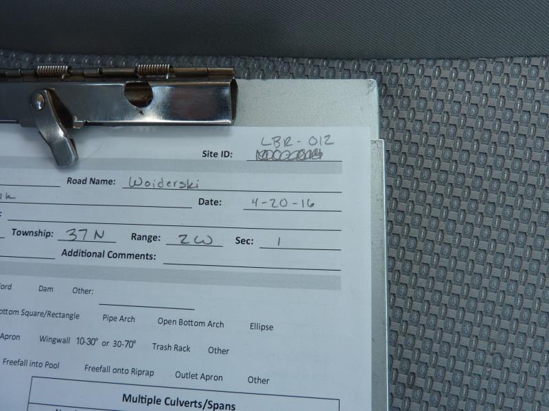
Site ID
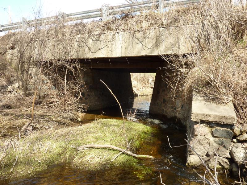
Inlet
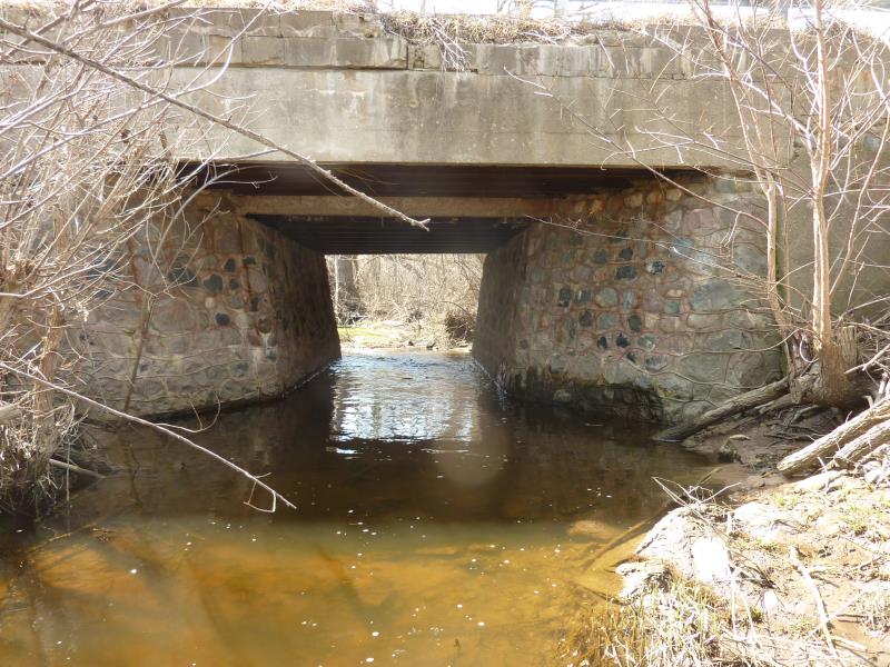
Outlet
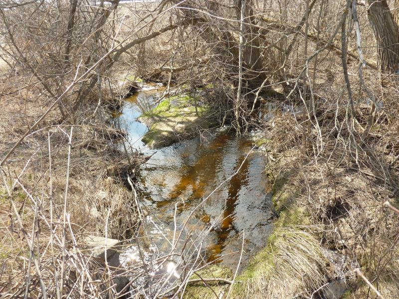
Upstream Conditions
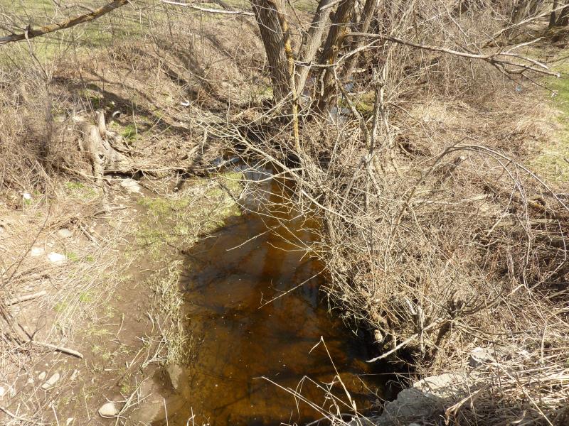
Downstream Conditions

Road Approach - Left
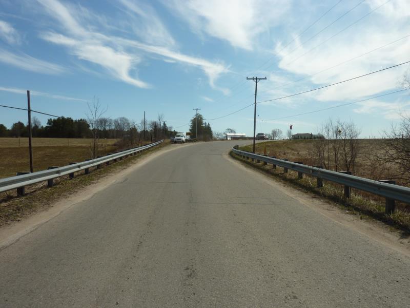
Road Approach - Right
Crossing Information
Type of Crossing: Bridge
Structure Shape: Square/Rectangle
Inlet Type: Headwall
Outlet Type: At Stream Grade
Structure Material: Concrete
Structure Substrate: Mixture
General Conditions: Fair
Structure Interior: smooth
Dimensions of Structure: Length 32 ft.
, Width 20 ft.
, Height 7.2 ft.
Percentage Plugged:
Inlet: 1% to 25%
Outlet: 0%
In Pipe: 0%
Structure is NOT Perched
Structure Inlet
Water Depth: 0.6 ft.
Embedded Depth of Structure: 0 ft.
Water Velocity*: 1.3 ft./sec.
Structure Outlet
Water Depth: 1.5 ft.
Embedded Depth of Structure: 0 ft.
Water Velocity*: 1.3 ft./sec.
*Water Velocities were measured at the Surface
(with Float Test)
Additional Comments
Crossings are mostly fine, the stream itself needs MAJOR clearing; Power company contractors have cut around powerline above stream and have dropped all trimmings into stream causing major blockages.
Stream Information
Stream Flow: Less than 1/2 Bankfull
Riffle Information
Water Depth: 2.1 ft.
Bankfull Width: 11 ft.
Wetted Width: 7 ft.
Water Velocity: 0.6 ft./sec.
(Measured with Float Test)
Dominant Substrate: Organics
Road Information
Paved
County Road
Road Condition: Fair
Road Width at Culvert: 22 ft.
Location of Low Point: At Stream
Runoff Path: Ditch
Fill Depth: 0 ft.
Slope: Vertical
Fill Depth: 0 ft.
Slope: Vertical
Approaches
Left Approach
Length: 1000 ft.
Slope: 1% to 5%
Vegetation: Heavy
LS Factor: 0.57
Erosion: 0.4145 tons/year
Right Approach
Length: 278 ft.
Slope: 6% to 10%
Vegetation: Heavy
LS Factor: 1.365
Erosion: 0.2759 tons/year
Erosion Information
Total Erosion at Crossing: 0.6905 tons/year
Summary Information
Fish Passability 1
A future visit to this site is recommended. Stream needs major clearing of tree trimmings left in stream
�