Road Stream Crossing Site CLHW_LBR-015
Little Black River Watershed, South Branch Little Black River
Riggsville Rd
Inverness Twp,
Cheboygan County
Information collected by:
Site Location
GPS Coordinates: 45.62183
, -84.50909
T37N
R2W
Sec 2
Owned by Private
Fish Passability 0.9
Structure is NOT Perched
Total Erosion: 0.3831 tons/year
Severity: Moderate
Year Inventoried: 2016
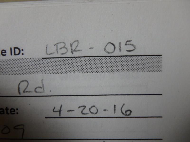
Site ID
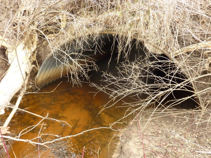
Inlet
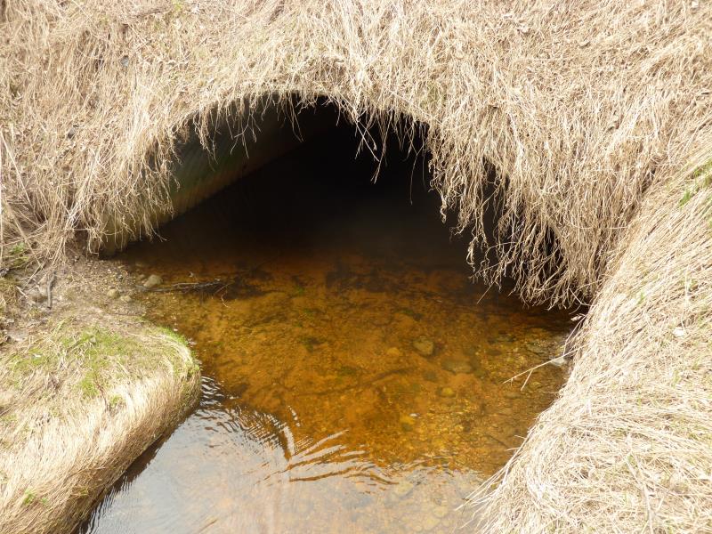
Outlet
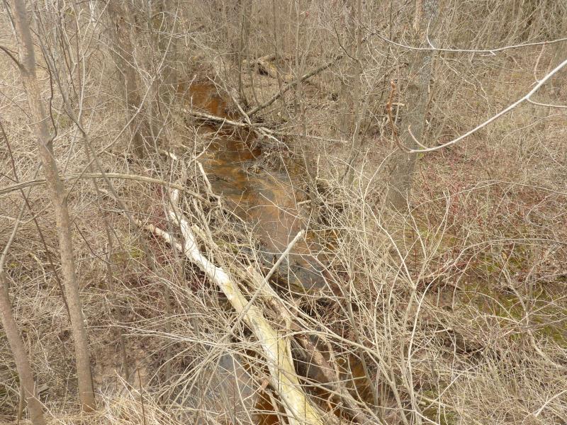
Upstream Conditions
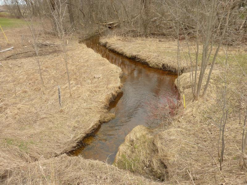
Downstream Conditions
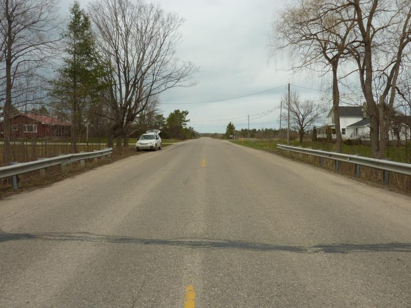
Road Approach - Left
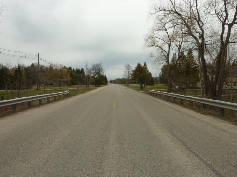
Road Approach - Right
Crossing Information
Type of Crossing: culvert(s)
Number of Structures: 1
Structure Shape: Open Bottom Square/Rectangle
Inlet Type: Projecting
Outlet Type: At Stream Grade
Structure Material: Metal
Structure Substrate: Mixture
General Conditions: Fair
Structure Interior: corrugated
Dimensions of Structure: Length 56 ft.
, Width 11.3 ft.
, Height 5 ft.
Structure is NOT Perched
Structure Inlet
Water Depth: 1 ft.
Embedded Depth of Structure: 0.1 ft.
Water Velocity*: 0.5 ft./sec.
Structure Outlet
Water Depth: 0.7 ft.
Embedded Depth of Structure: 0.1 ft.
Water Velocity*: 0.5 ft./sec.
*Water Velocities were measured at the Surface
(with Float Test)
Stream Information
Stream Flow: Less than Bankfull
Scour Pool: Length 37 ft.
, Width 11.7 ft.
, Depth 1.6 ft.
Riffle Information
Water Depth: 1.3 ft.
Bankfull Width: 13 ft.
Wetted Width: 9.4 ft.
Water Velocity: 1 ft./sec.
(Measured with Float Test)
Dominant Substrate: Sand
Road Information
Paved
County Road
Road Condition: Fair
Road Width at Culvert: 23 ft.
Location of Low Point: Other
Runoff Path: Ditch
Embankments
Upstream
Fill Depth: 5 ft.
Slope: 1:2
Downstream
Fill Depth: 6 ft.
Slope: 1:1.5
Approaches
Left Approach
Length: 227 ft.
Slope: 1% to 5%
Vegetation: Heavy
LS Factor: 0.435
Erosion: 0.0751 tons/year
Right Approach
Length: 0 ft.
Slope: Less Than 1%
Vegetation: Heavy
LS Factor: 0.05
Erosion: 0 tons/year
Erosion Information
Total Erosion at Crossing: 0.3831 tons/year
Extent of Erosion: Moderate
Notes: Near vertical slope
Location of Erosion | Erosion Dimensions | Eroded Material | Material Eroded | Total Erosion | ||
facing downstream | Length | Width | Depth | Reaching Stream? | (tons/year) | |
Left Upstream Embankment |
5 ft. |
3 ft. |
10 ft. |
yes |
Loam |
0.308 |
Summary Information
Fish Passability 0.9
These non-native species were observerd at this site: Honeysuckle, Garlic Mustard
�