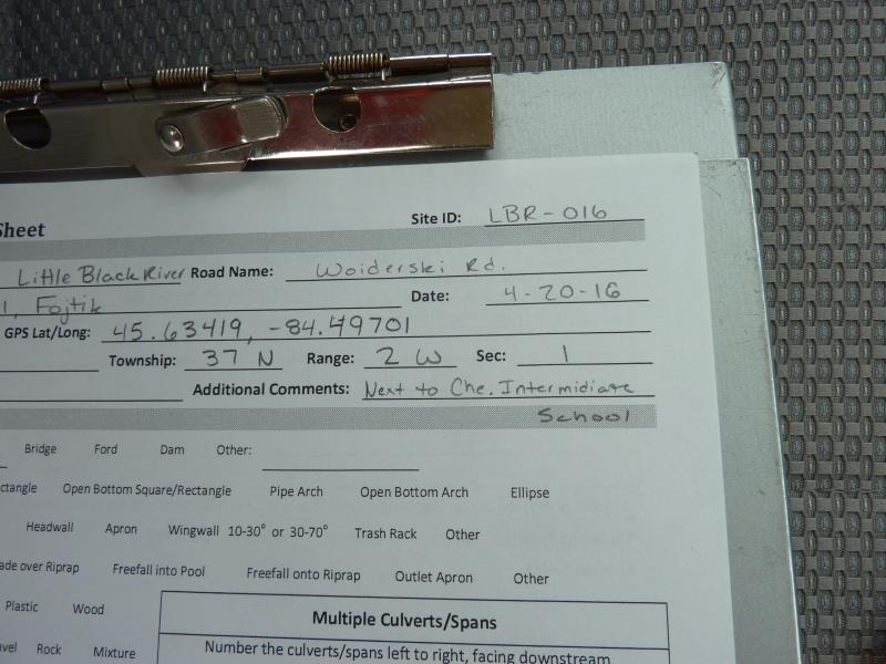
Road Stream Crossing Site CLHW_LBR-016
Little Black River Watershed, South Branch Little Black River
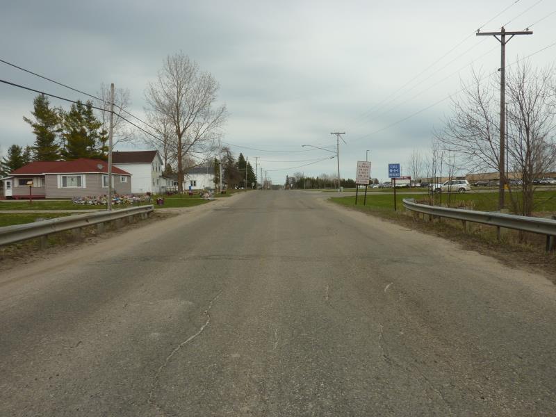
Woiderski Rd
Inverness Twp,
Cheboygan County
Information collected by:
Site Location
GPS Coordinates: 45.63419
, -84.49701
T37N
R2W
Sec 1
Owned by Private
Fish Passability 1
Structure is NOT Perched
Total Erosion: 0.6717 tons/year
Severity: Moderate
Year Inventoried: 2016
Site ID
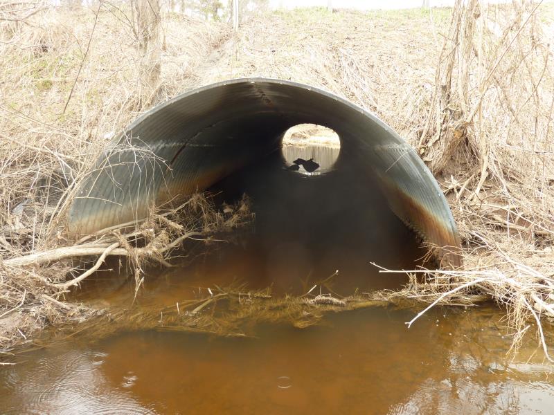
Inlet
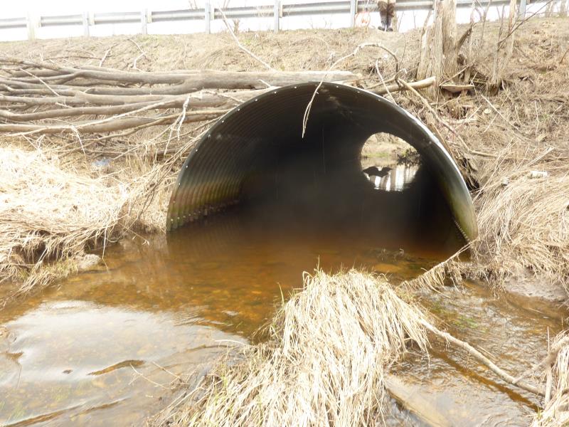
Outlet
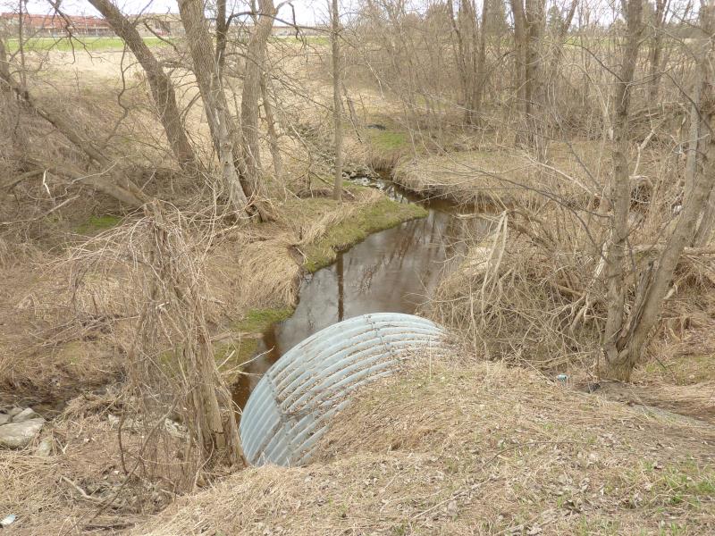
Upstream Conditions
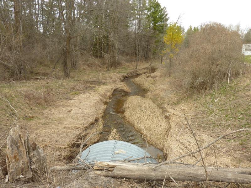
Downstream Conditions
Road Approach - Left
Road Approach - Right
Crossing Information
Type of Crossing: culvert(s)
Number of Structures: 1
Structure Shape: Pipe Arch
Inlet Type: Projecting
Outlet Type: At Stream Grade
Structure Material: Metal
Structure Substrate: Sand
General Conditions: Poor
Structure Interior: corrugated
Structure is Rusted through
Dimensions of Structure: Length 76 ft.
, Width 12 ft.
, Height 7.7 ft.
Percentage Plugged:
Inlet: 26% to 50%
Outlet: 0%
In Pipe: 0%
Percentage Crushed:
Inlet: 0%
Outlet: 0%
In Pipe: 1% to 25%
Structure is NOT Perched
Structure Inlet
Water Depth: 0.6 ft.
Embedded Depth of Structure: 0.1 ft.
Water Velocity*: 0.3 ft./sec.
Structure Outlet
Water Depth: 1 ft.
Embedded Depth of Structure: 0.1 ft.
Water Velocity*: 0.3 ft./sec.
*Water Velocities were measured at the Surface
(with Float Test)
Additional Comments
Landowner on Left side of downstream was distraught by our presence and nearly ran over Dylan with her car
Stream Information
Stream Flow: Less than 1/2 Bankfull
Riffle Information
Water Depth: 1.8 ft.
Bankfull Width: 9 ft.
Wetted Width: 5 ft.
Water Velocity: 0.7 ft./sec.
(Measured with Float Test)
Dominant Substrate: Silt
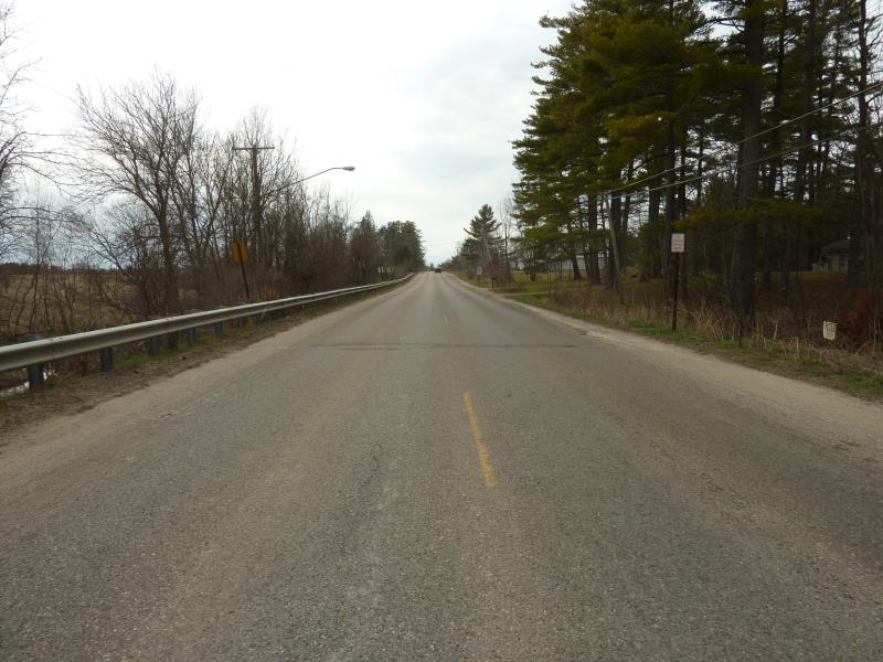
Road Information
Paved
County Road
Road Condition: Fair
Road Width at Culvert: 22 ft.
Location of Low Point: At Stream
Runoff Path: Ditch
Embankments
Upstream
Fill Depth: 6.5 ft.
Slope: 1:2
Downstream
Fill Depth: 6.7 ft.
Slope: 1:2
Approaches
Left Approach
Length: 1000 ft.
Slope: 1% to 5%
Vegetation: Heavy
LS Factor: 0.57
Erosion: 0.4145 tons/year
Right Approach
Length: 300 ft.
Slope: 1% to 5%
Vegetation: Heavy
LS Factor: 0.46
Erosion: 0.1004 tons/year
Erosion Information
Total Erosion at Crossing: 0.6717 tons/year
Extent of Erosion: Moderate
Notes: Could stablize with more vegetation; there are a lot of branches there now helping to stablize
Location of Erosion | Erosion Dimensions | Eroded Material | Material Eroded | Total Erosion | ||
facing downstream | Length | Width | Depth | Reaching Stream? | (tons/year) | |
Right Upstream Embankment |
8 ft. |
5 ft. |
4 ft. |
yes |
Clay |
0.1568 |
Summary Information
Fish Passability 1
A future visit to this site is recommended. To clear debris up and down stream of crossing
�