Road Stream Crossing Site CLHW_LBR-017
Little Black River Watershed, Unnamed Branch of Little Black River
Lahaie Rd
Beaugrand Twp,
Cheboygan County
Information collected by:
Site Location
GPS Coordinates: 45.60948
, -84.43423
T38N
R2W
Sec 36
Owned by Private
Fish Passability 0.5
Structure is NOT Perched
Total Erosion: 2.1103 tons/year
Severity: Moderate
Year Inventoried: 2016
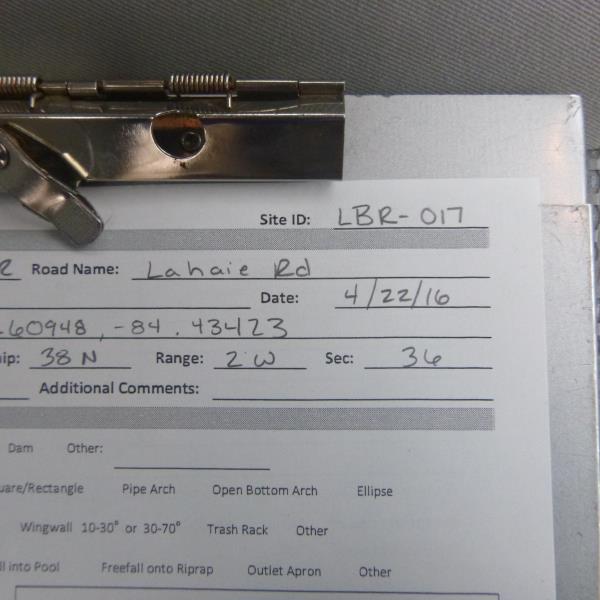
Site ID
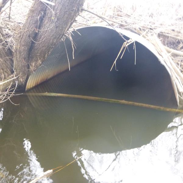
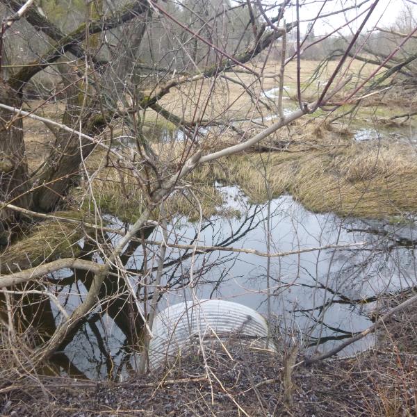
Inlet
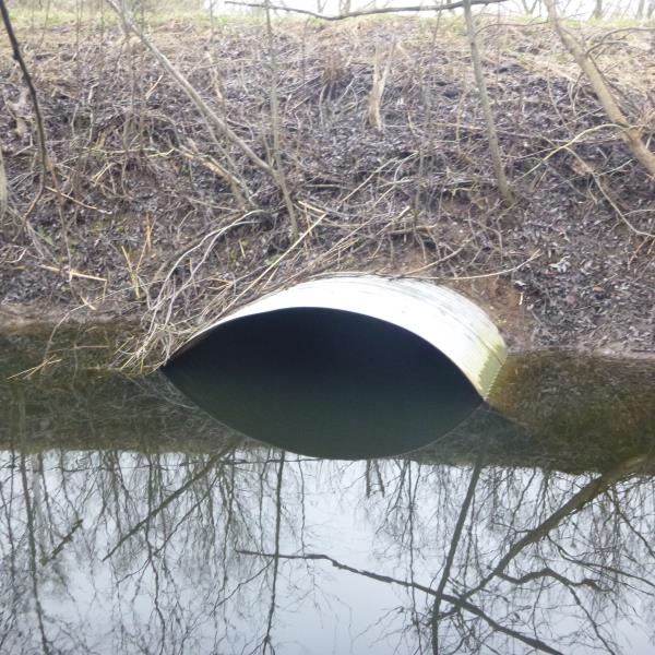
Outlet
Upstream Conditions
Downstream Conditions
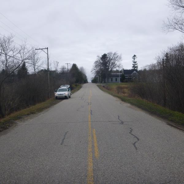
Road Approach - Left
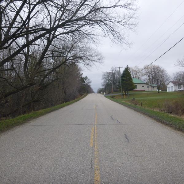
Road Approach - Right
Crossing Information
Type of Crossing: culvert(s)
Number of Structures: 1
Structure Shape: Pipe Arch
Inlet Type: Projecting
Outlet Type: At Stream Grade
Structure Material: Metal
Structure Substrate: None
General Conditions: Fair
Structure Interior: corrugated
Dimensions of Structure: Length 70 ft.
, Width 8 ft.
, Height 7.1 ft.
Percentage Plugged:
Inlet: 1% to 25%
Outlet: 0%
In Pipe: 0%
Structure is NOT Perched
Structure Inlet
Water Depth: 4 ft.
Embedded Depth of Structure: 0 ft.
Water Velocity*: 0.1 ft./sec.
Structure Outlet
Water Depth: 4 ft.
Embedded Depth of Structure: 0 ft.
Water Velocity*: 0.1 ft./sec.
*Water Velocities were measured at the Surface
(with Float Test)
Additional Comments
Recent flooding at site is noticable; water very high at this time of year
Stream Information
Stream Flow: Bankfull
Scour Pool: Length 15 ft.
, Width 24 ft.
, Depth 5 ft.
Upstream Pond: Length 10 ft.
, Width 15 ft.
, Depth 4 ft.
Riffle Information
Water Depth: 1.7 ft.
Bankfull Width: 7.5 ft.
Wetted Width: 7 ft.
Water Velocity: 0.8 ft./sec.
(Measured with Float Test)
Dominant Substrate: Sand
Road Information
Paved
County Road
Road Condition: Fair
Road Width at Culvert: 23 ft.
Location of Low Point: Other
Runoff Path: Ditch
Embankments
Upstream
Fill Depth: 4.6 ft.
Slope: More than 1:2
Downstream
Fill Depth: 6.5 ft.
Slope: 1:2
Approaches
Left Approach
Length: 447 ft.
Slope: More Than 10%
Vegetation: Heavy
LS Factor: 4.153
Erosion: 1.4115 tons/year
Right Approach
Length: 546 ft.
Slope: 6% to 10%
Vegetation: Heavy
LS Factor: 1.683
Erosion: 0.6988 tons/year
Erosion Information
Total Erosion at Crossing: 2.1103 tons/year
Summary Information
Fish Passability 0.5
�