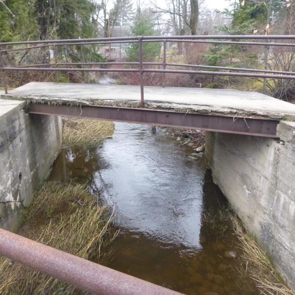
Road Stream Crossing Site CLHW_LBR-018
Little Black River Watershed, South Branch Little Black River
Lahaie Rd
Beaugrand Twp,
Cheboygan County
Information collected by:
Site Location
GPS Coordinates: 45.64147
, -84.49654
T38N
R2W
Sec 36
Owned by Private
Fish Passability 1
Structure is NOT Perched
Total Erosion: 1.1423 tons/year
Severity: Moderate
Year Inventoried: 2016
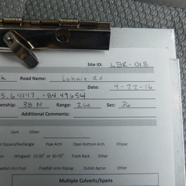
Site ID
Inlet
Outlet
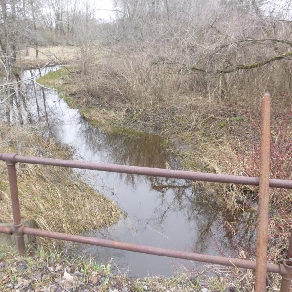
Upstream Conditions
Downstream Conditions
Road Approach - Left
Road Approach - Right
Crossing Information
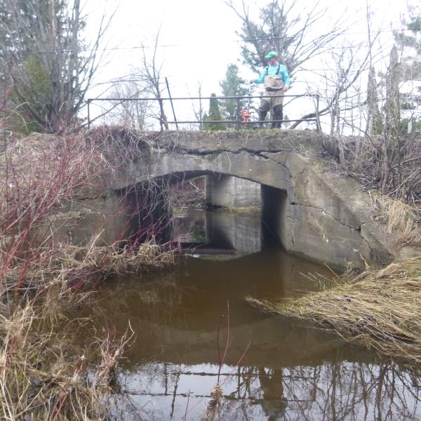
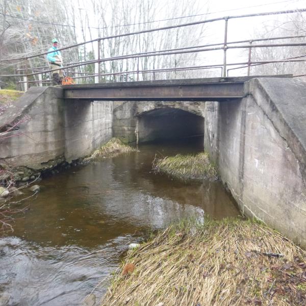
Type of Crossing: Bridge
Structure Shape: Open Bottom Square/Rectangle
Inlet Type: Wingwall 10-30 Degree
Outlet Type: At Stream Grade
Structure Material: Concrete
Structure Substrate: Mixture
General Conditions: Poor
Structure Interior: smooth
Dimensions of Structure: Length 47 ft.
, Width 12 ft.
, Height 7.5 ft.
Percentage Crushed:
Inlet: 0%
Outlet: 0%
In Pipe: 26% to 50%
Structure is NOT Perched
Structure Inlet
Water Depth: 1.9 ft.
Embedded Depth of Structure: 0 ft.
Water Velocity*: 0.9 ft./sec.
Structure Outlet
Water Depth: 1.2 ft.
Embedded Depth of Structure: 0 ft.
Water Velocity*: 0.9 ft./sec.
*Water Velocities were measured at the Surface
(with Float Test)
Stream Information
Stream Flow: Less than 1/2 Bankfull
Upstream Pond: Length 9 ft.
, Width 15 ft.
, Depth 1.5 ft.
Riffle Information
Water Depth: 1.2 ft.
Bankfull Width: 15 ft.
Wetted Width: 10.5 ft.
Water Velocity: 1.4 ft./sec.
(Measured with Float Test)
Dominant Substrate: Cobble
Road Information
Paved
County Road
Road Condition: Poor
Road Width at Culvert: 20 ft.
Location of Low Point: At Stream
Runoff Path: Ditch
Fill Depth: 0 ft.
Slope: Vertical
Fill Depth: 0 ft.
Slope: Vertical
Approaches
Left Approach
Length: 491 ft.
Slope: 1% to 5%
Vegetation: Partial
LS Factor: 0.636
Erosion: 0.2066 tons/year
Right Approach
Length: 1000 ft.
Slope: Less Than 1%
Vegetation: Partial
LS Factor: 0.06
Erosion: 0.0397 tons/year
Erosion Information
Total Erosion at Crossing: 1.1423 tons/year
Extent of Erosion: Moderate
Notes: Brige is also crumbling in many places
Location of Erosion | Erosion Dimensions | Eroded Material | Material Eroded | Total Erosion | ||
facing downstream | Length | Width | Depth | Reaching Stream? | (tons/year) | |
Right Upstream Embankment |
16 ft. |
5 ft. |
8 ft. |
yes |
Gravel |
0.896 |
Summary Information
Fish Passability 1
A future visit to this site is recommended. State of bridge
�