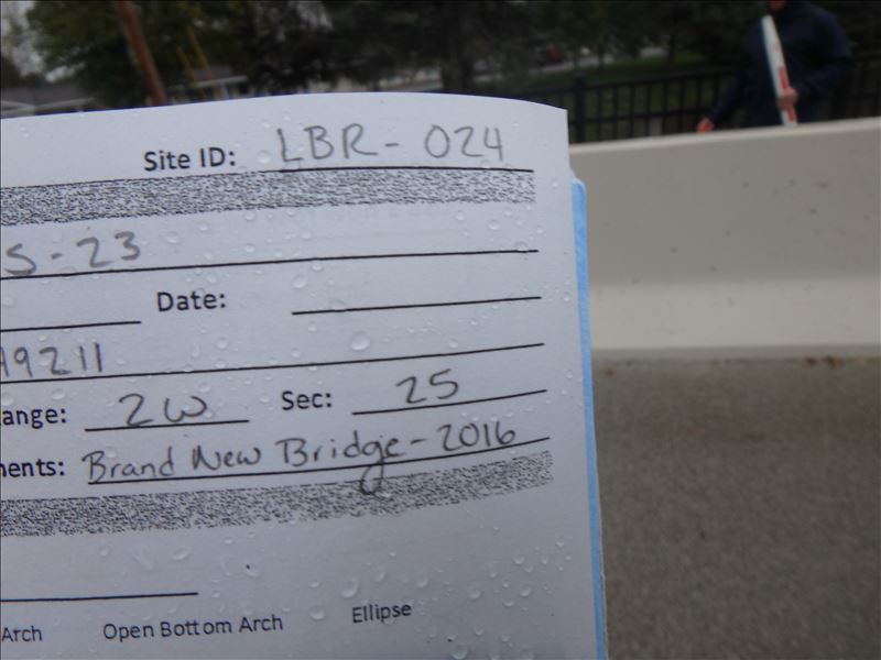
Road Stream Crossing Site CLHW_LBR-024
Little Black River Watershed, Little Black River
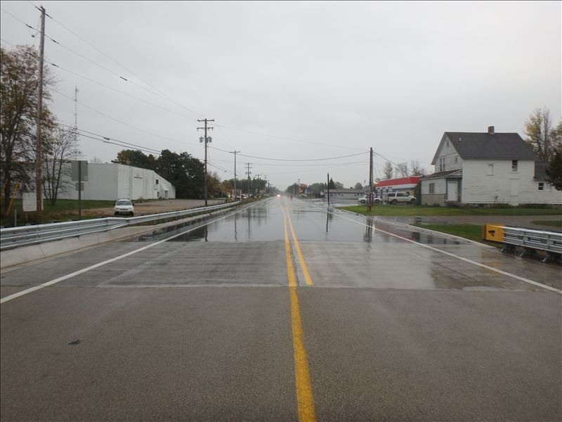
US-23
Cheboygan,
Cheboygan County
Information collected by:
Site Location
GPS Coordinates: 45.65881
, -84.49211
T38N
R2W
Sec 25
Owned by Local Government
Structure is NOT Perched
Severity: Minor
Year Inventoried: 2016
Road Approach - Right
Site ID
Inlet
Outlet
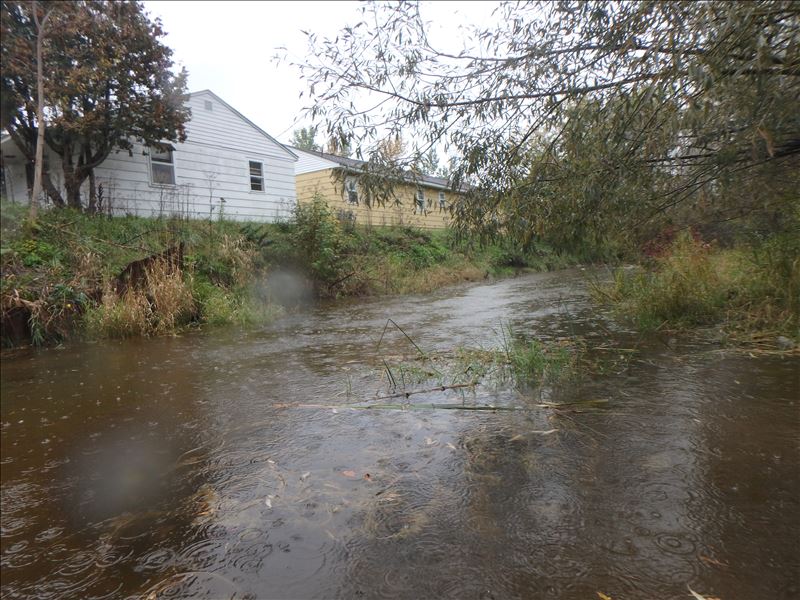
Upstream Conditions
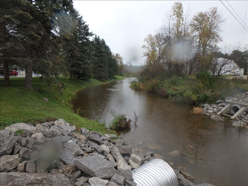
Downstream Conditions
Road Approach - Left
Crossing Information
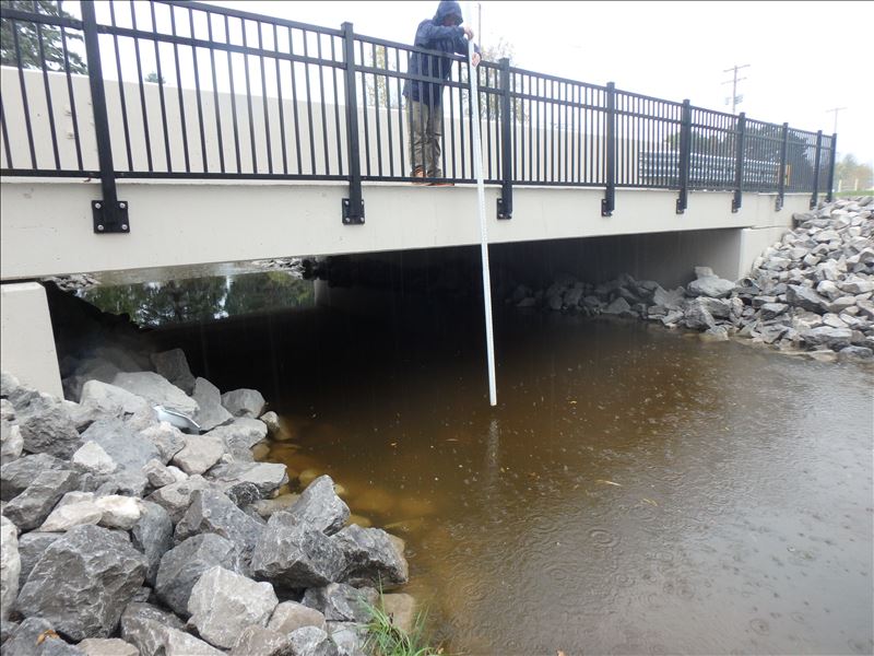
Type of Crossing: Bridge
Structure Shape: Open Bottom Square/Rectangle
Inlet Type: Headwall
Outlet Type: At Stream Grade
Structure Material: Concrete
Structure Substrate: Rock
General Conditions: New
Structure Interior: smooth
Dimensions of Structure: Length 60 ft.
, Width 35 ft.
, Height 9 ft.
Structure is NOT Perched
Structure Inlet
Water Depth: 2.8 ft.
Embedded Depth of Structure: 0 ft.
Water Velocity*: 0.5 ft./sec.
Structure Outlet
Water Depth: 3.8 ft.
Embedded Depth of Structure: 0 ft.
Water Velocity*: 0.5 ft./sec.
(with Float Test)
Additional Comments
Within Cheboygan City Limits
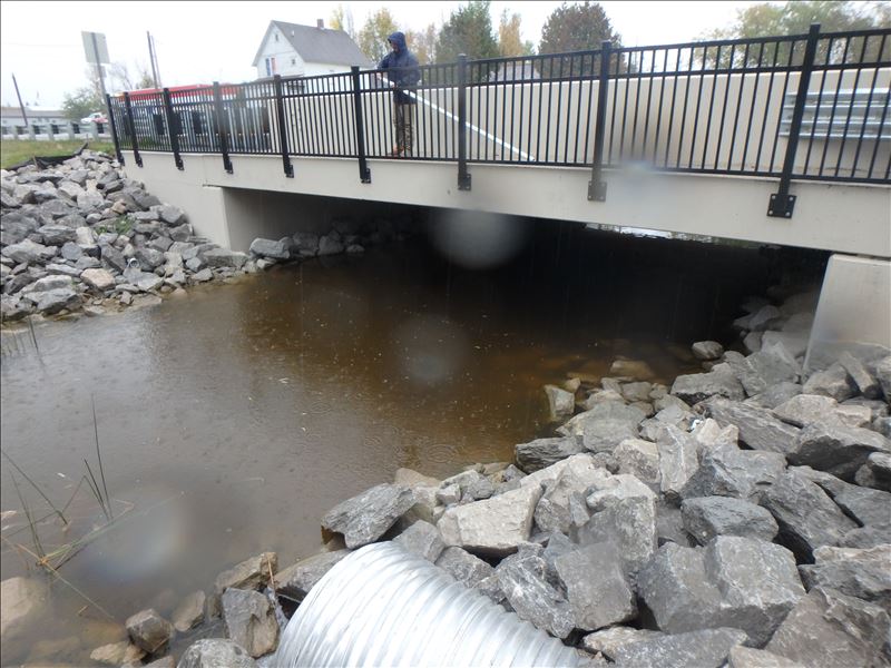
Stream Information
Stream Flow: Less than 1/2 Bankfull
Riffle Information
Water Depth: 3.2 ft.
Bankfull Width: 68 ft.
Wetted Width: 30 ft.
Water Velocity: 0.5 ft./sec.
(Measured with Float Test)
Dominant Substrate: Cobble
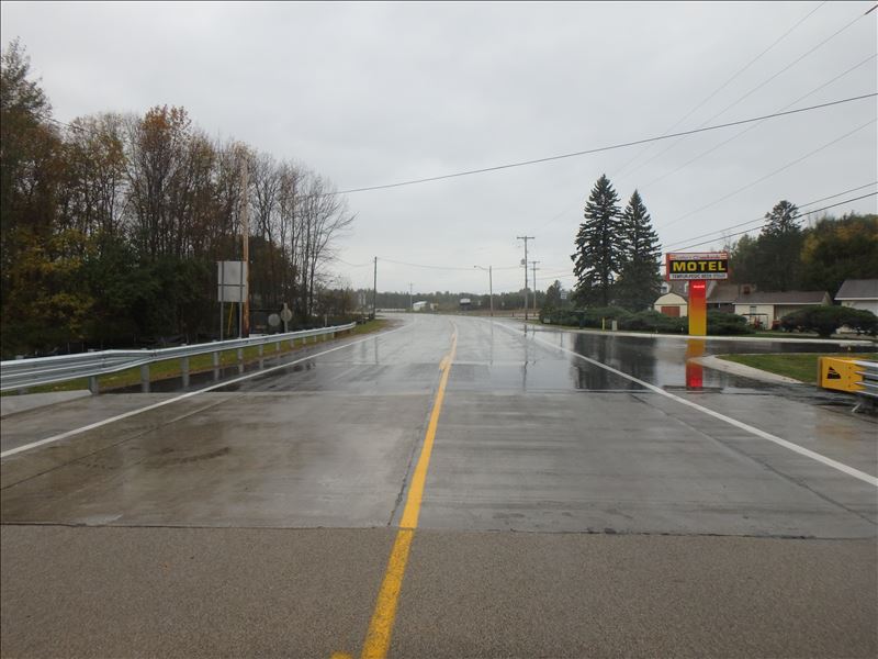
Road Information
Paved
Federal Road
Road Condition: Good
Road Width at Culvert: 34 ft.
Location of Low Point: Other
Runoff Path: Ditch
Fill Depth: 0 ft.
Slope: Vertical
Fill Depth: 0 ft.
Slope: Vertical
Length: 1000 ft.
Slope: 1% to 5%
Vegetation: Heavy
Length: 0 ft.
Slope: Less Than 1%
Vegetation: Heavy
Erosion Information
Extent of Erosion: Moderate
Summary Information
Erosion is an area of concern for this site.
�