Road Stream Crossing Site CLHW_LLM-010
Long Lake-Monaghan Creek Watershed, Unnamed branch of Monaghan Creek
Miller Rd
Krakow Twp,
Presque Isle County
Information collected by:
Site Location
GPS Coordinates: 45.27863
, -83.61324
T33N
R7E
Sec 5
Owned by Private
Structure is NOT Perched
Total Erosion: 0.728 tons/year
Severity: Moderate
Year Inventoried: 2016
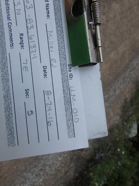
Site ID
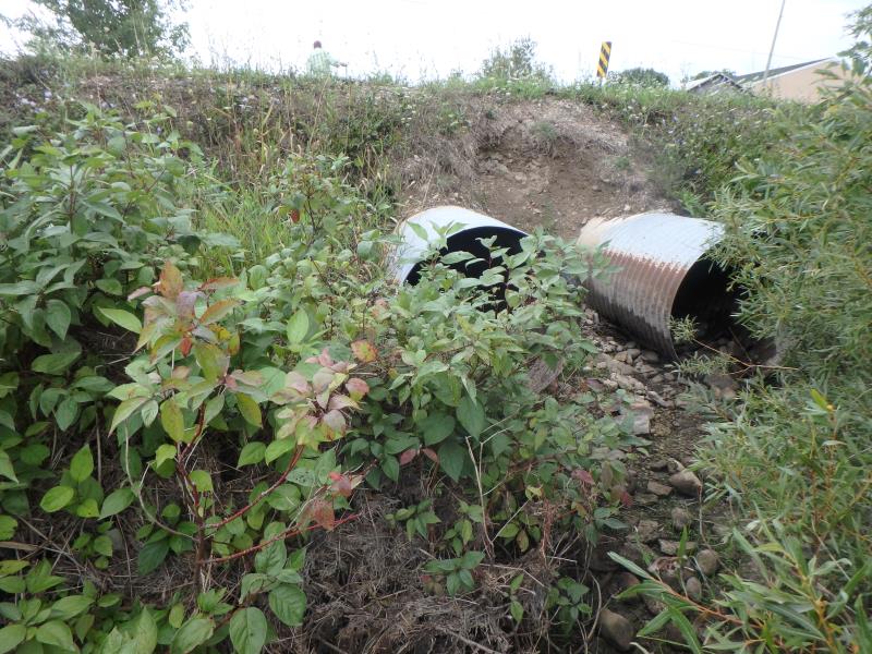
Inlet
Outlet
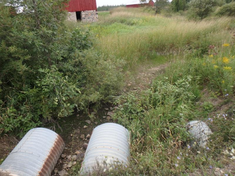
Upstream Conditions
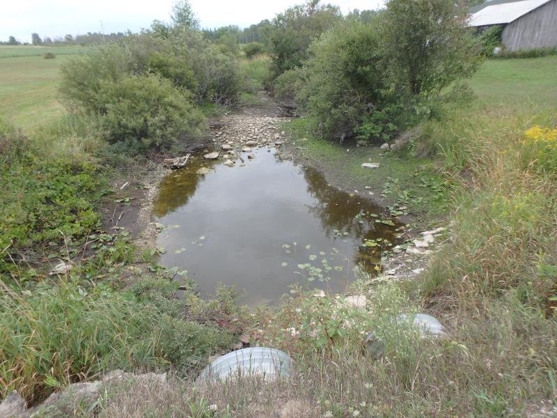
Downstream Conditions
Road Approach - Left
Road Approach - Right
Crossing Information
Type of Crossing: culvert(s)
Number of Structures: 3
Structure Shape: Round
Inlet Type: Projecting
Outlet Type: At Stream Grade
Structure Material: Metal
Structure Substrate: None
General Conditions: Poor
Multiple Culverts/Spans | ||||
Culvert/Span | Width | Length | Height | Material |
1 |
2.1 ft. |
40 ft. |
2.1 ft. |
Metal |
2 |
3.1 ft. |
40 ft. |
3.1 ft. |
Metal |
3 |
3.1 ft. |
40 ft. |
3.1 ft. |
Metal |
Structure Interior: corrugated
Structure is Rusted through
Dimensions of Structure: Length 40 ft.
, Width 3.1 ft.
, Height 3.1 ft.
Percentage Crushed:
Inlet: 1% to 25%
Outlet: 0%
In Pipe: 1% to 25%
Structure is NOT Perched
Water Depth: 0 ft.
Embedded Depth of Structure: 0 ft.
Water Velocity*: 0 ft./sec.
Water Depth: 0 ft.
Embedded Depth of Structure: 0 ft.
Water Velocity*: 0 ft./sec.
(with Float Test)
Stream Information
Stream Flow: None
Riffle Information
Water Depth: 0 ft.
Bankfull Width: 22 ft.
Wetted Width: 11 ft.
Water Velocity: 0 ft./sec.
(Measured with Meter)
Dominant Substrate: Cobble
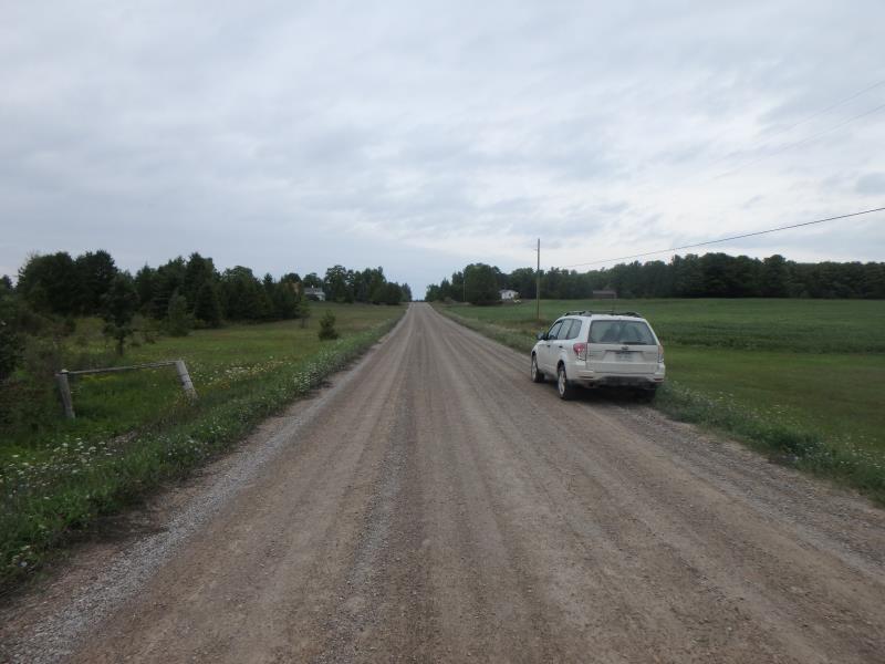
Road Information
Gravel
County Road
Road Condition: Good
Road Width at Culvert: 18 ft.
Location of Low Point: Other
Runoff Path: Ditch
Embankments
Upstream
Fill Depth: 3 ft.
Slope: 1:1.5
Downstream
Fill Depth: 3.7 ft.
Slope: 1:1.5
Approaches
Left Approach
Length: 0 ft.
Slope: Less Than 1%
Vegetation: Partial
LS Factor: 0.05
Erosion: 0 tons/year
Right Approach
Length: 120 ft.
Slope: 1% to 5%
Vegetation: Partial
LS Factor: 0.41
Erosion: 0.244 tons/year
Erosion Information
Total Erosion at Crossing: 0.728 tons/year
Extent of Erosion: Severe
Notes:
Needs to be addressed; will continue to erode in spring time high water and may eventually cause crossing to fial
Location of Erosion | Erosion Dimensions | Eroded Material | Material Eroded | Total Erosion | ||
facing downstream | Length | Width | Depth | Reaching Stream? | (tons/year) | |
Left Upstream Embankment |
4 ft. |
4 ft. |
5.5 ft. |
yes |
Sand |
0.484 |
Summary Information
Erosion is an area of concern for this site.
No, is an intermittent stream
�