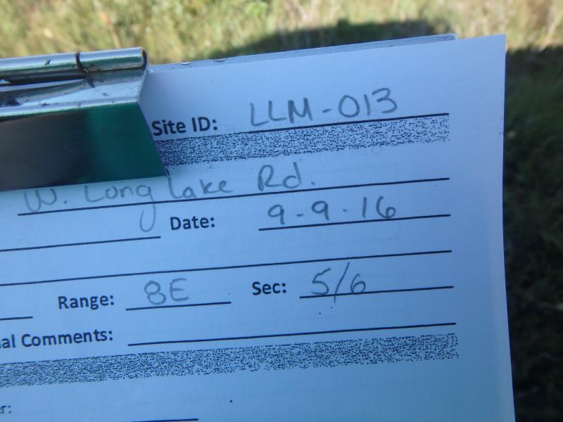
Road Stream Crossing Site CLHW_LLM-013
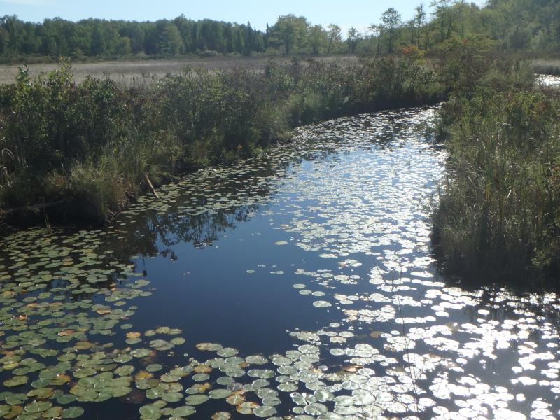
Long Lake-Monaghan Creek Watershed, Fitzgerald Creek
W Long Lake Rd
Alpena,
Alpena County
Information collected by:
Site Location
GPS Coordinates: 45.20265
, -83.49538
T32N
R8E
Sec 5
Owned by Private
Fish Passability 0.5
Structure is NOT Perched
Total Erosion: 0.694 tons/year
Severity: Moderate
Year Inventoried: 2016
Site ID
Inlet
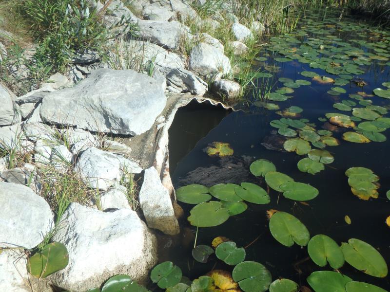
Outlet
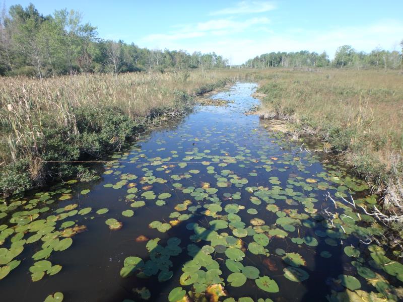
Upstream Conditions
Downstream Conditions
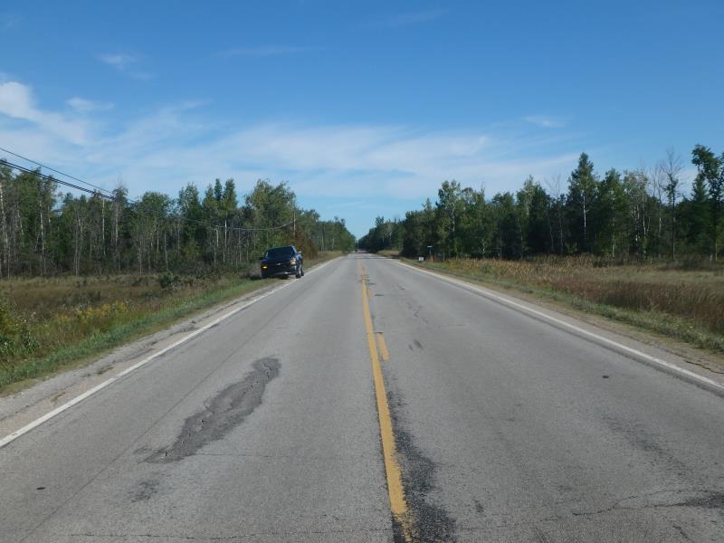
Road Approach - Left
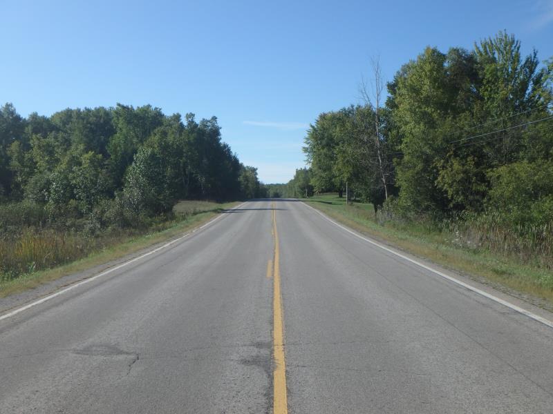
Road Approach - Right
Crossing Information
Type of Crossing: culvert(s)
Number of Structures: 1
Structure Shape: Pipe Arch
Inlet Type: Mitered
Outlet Type: At Stream Grade
Structure Material: Metal
Structure Substrate: None
General Conditions: Poor
Structure Interior: corrugated
Structure is Rusted through
Dimensions of Structure: Length 53 ft.
, Width 5 ft.
, Height 4 ft.
Percentage Crushed:
Inlet: 1% to 25%
Outlet: 1% to 25%
In Pipe: 0%
Structure is NOT Perched
Structure Inlet
Water Depth: 2.5 ft.
Embedded Depth of Structure: 0 ft.
Water Velocity*: 0.1 ft./sec.
Structure Outlet
Water Depth: 3 ft.
Embedded Depth of Structure: 0 ft.
Water Velocity*: 0.1 ft./sec.
*Water Velocities were measured at the Surface
(with Float Test)
Stream Information
Stream Flow: Less than Bankfull
Riffle Information
Water Depth: 1.3 ft.
Bankfull Width: 28 ft.
Wetted Width: 18 ft.
Water Velocity: 0.1 ft./sec.
(Measured with Float Test)
Dominant Substrate: Organics
Road Information
Paved
County Road
Road Condition: Good
Road Width at Culvert: 28 ft.
Location of Low Point: At Stream
Runoff Path: Ditch
Embankments
Upstream
Fill Depth: 3.7 ft.
Slope: More than 1:2
Downstream
Fill Depth: 3.5 ft.
Slope: More than 1:2
Approaches
Left Approach
Length: 1000 ft.
Slope: 1% to 5%
Vegetation: Heavy
LS Factor: 0.57
Erosion: 0.5276 tons/year
Right Approach
Length: 378 ft.
Slope: 1% to 5%
Vegetation: Heavy
LS Factor: 0.476
Erosion: 0.1664 tons/year
Erosion Information
Total Erosion at Crossing: 0.694 tons/year
Summary Information
Fish Passability 0.5
�