Road Stream Crossing Site CLHW_MC-006
Mill Creek Watershed, Unnamed
N Old Mackinaw Rd
Beaugrand Twp,
Cheboygan County
Information collected by:
Site Location
GPS Coordinates: 45.67451
, -84.52955
T38N
R2W
Sec 22/23
Owned by Private
Fish Passability 0
Perch Height: 2 ft.
Total Erosion: 0.0793 tons/year
Severity: Severe
Year Inventoried: 2016
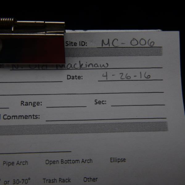
Site ID
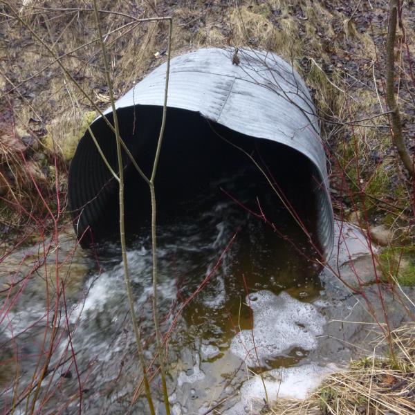
Inlet
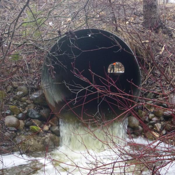
Outlet
Upstream Conditions
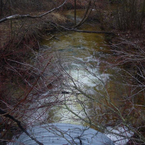
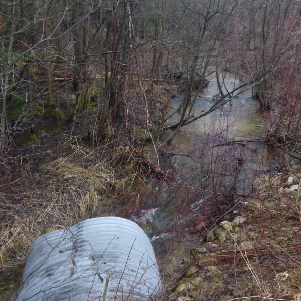
Downstream Conditions
Road Approach - Left
Road Approach - Right
Crossing Information
Type of Crossing: culvert(s)
Number of Structures: 1
Structure Shape: Round
Inlet Type: Projecting
Outlet Type: Freefall into Pool
Structure Material: Metal
Structure Substrate: None
General Conditions: Poor
Structure Interior: corrugated
Dimensions of Structure: Length 90 ft.
, Width 5 ft.
, Height 5 ft.
Percentage Plugged:
Inlet: 1% to 25%
Outlet: 0%
In Pipe: 0%
Percentage Crushed:
Inlet: 1% to 25%
Outlet: 0%
In Pipe: 0%
Perch Height: 2 ft.
Structure Inlet
Water Depth: 0.7 ft.
Embedded Depth of Structure: 0 ft.
Water Velocity*: 4.5 ft./sec.
Structure Outlet
Water Depth: 0.5 ft.
Embedded Depth of Structure: 0 ft.
Water Velocity*: 4.5 ft./sec.
*Water Velocities were measured at the Surface
(with Float Test)
Additional Comments
Terrance Prykucki/Douglas Hayward II
Stream Information
Stream Flow: Less than 1/2 Bankfull
Scour Pool: Length 32 ft.
, Width 15.5 ft.
, Depth 1.3 ft.
Upstream Pond: Length 0 ft.
, Width 0 ft.
, Depth 0 ft.
Riffle Information
Water Depth: 1.3 ft.
Bankfull Width: 15 ft.
Wetted Width: 10 ft.
Water Velocity: 2.6 ft./sec.
(Measured with Float Test)
Dominant Substrate: Gravel
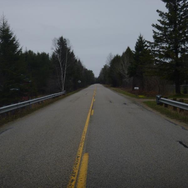
Road Information
Paved
County Road
Road Condition: Poor
Road Width at Culvert: 24 ft.
Location of Low Point: At Stream
Runoff Path: Ditch
Embankments
Upstream
Fill Depth: 6 ft.
Slope: 1:2
Downstream
Fill Depth: 6 ft.
Slope: More than 1:2
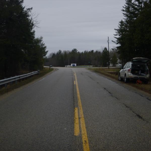
Approaches
Left Approach
Length: 1000 ft.
Slope: Less Than 1%
Vegetation: Heavy
LS Factor: 0.05
Erosion: 0.0397 tons/year
Right Approach
Length: 1000 ft.
Slope: Less Than 1%
Vegetation: Heavy
LS Factor: 0.05
Erosion: 0.0397 tons/year
Erosion Information
Total Erosion at Crossing: 0.0793 tons/year
Summary Information
Fish Passability 0
�