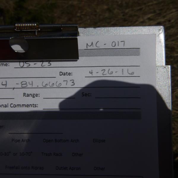
Road Stream Crossing Site CLHW_MC-017
Mill Creek Watershed, Mill Creek
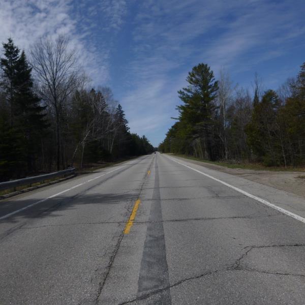
US-23
Mackinaw Twp,
Cheboygan County
Information collected by:
Site Location
GPS Coordinates: 45.74434
, -84.6673
T39N
R3W
Sec 27
Owned by State
Fish Passability 0
Structure is NOT Perched
Total Erosion: 0 tons/year
Severity: Severe
Year Inventoried: 2016
Site ID
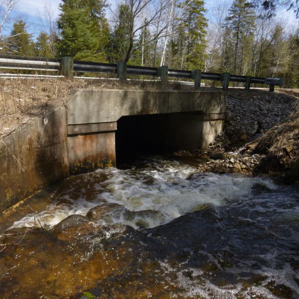
Inlet
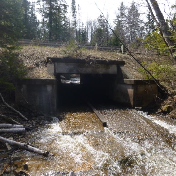
Outlet
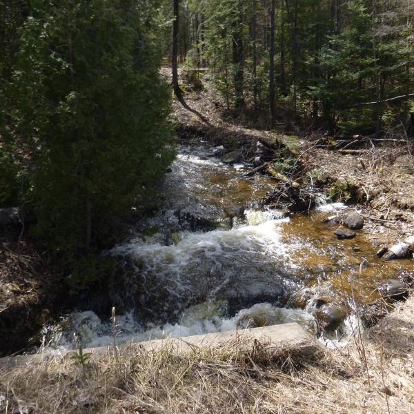
Upstream Conditions
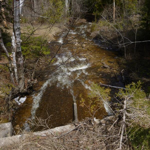
Downstream Conditions
Road Approach - Left
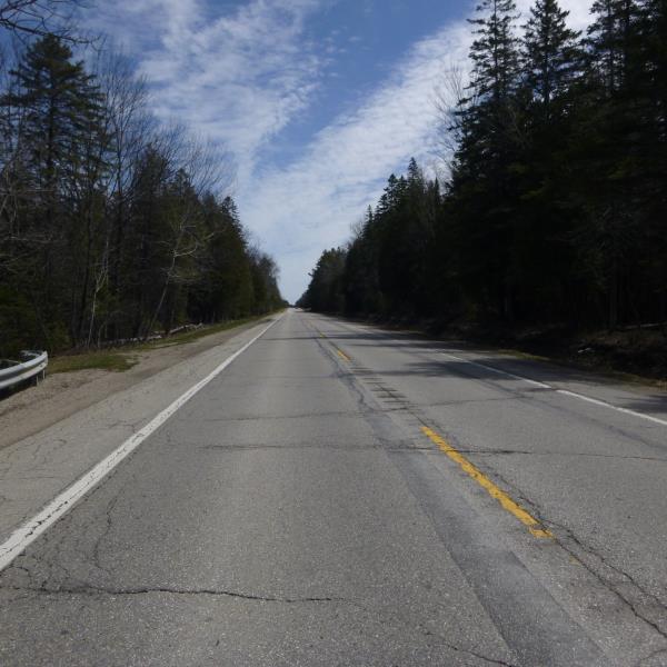
Road Approach - Right
Crossing Information
Type of Crossing: culvert(s)
Number of Structures: 1
Structure Shape: Square/Rectangle
Inlet Type: Wingwall 10-30 Degree
Outlet Type: Outlet Apron
Structure Material: Concrete
Structure Substrate: None
General Conditions: Fair
Structure Interior: smooth
Dimensions of Structure: Length 60 ft.
, Width 11.5 ft.
, Height 5 ft.
Structure is NOT Perched
Structure Inlet
Water Depth: 0.7 ft.
Embedded Depth of Structure: 0 ft.
Water Velocity*: 5.2 ft./sec.
Structure Outlet
Water Depth: 0.3 ft.
Embedded Depth of Structure: 0 ft.
Water Velocity*: 5.2 ft./sec.
*Water Velocities were measured at the Surface
(with Float Test)
Stream Information
Stream Flow: Less than Bankfull
Scour Pool: Length 0 ft.
, Width 0 ft.
, Depth 0 ft.
Upstream Pond: Length 0 ft.
, Width 0 ft.
, Depth 0 ft.
Riffle Information
Water Depth: 0.6 ft.
Bankfull Width: 18 ft.
Wetted Width: 14 ft.
Water Velocity: 2.4 ft./sec.
(Measured with Float Test)
Dominant Substrate: Cobble
Road Information
Paved
Federal Road
Road Condition: Fair
Road Width at Culvert: 34 ft.
Location of Low Point: Other
Runoff Path: Ditch
Fill Depth: 0 ft.
Fill Depth: 0 ft.
Approaches
Left Approach
Length: 0 ft.
Slope: Less Than 1%
Vegetation: Heavy
LS Factor: 0.05
Erosion: 0 tons/year
Right Approach
Length: 0 ft.
Slope: Less Than 1%
Vegetation: Heavy
LS Factor: 0.05
Erosion: 0 tons/year
Erosion Information
Total Erosion at Crossing: 0 tons/year
Summary Information
Fish Passability 0
Fish Passage is an area of concern for this site.
The flow through culvert is too fast and too shallow for fish passage (0.3-0.7 depth at 5.2 ft/sec of flow)
A future visit to this site is recommended. This is the first/last RSX before outlet into Lake Huron. If this culvert is chosen, we could reconnect many upstream miles
�