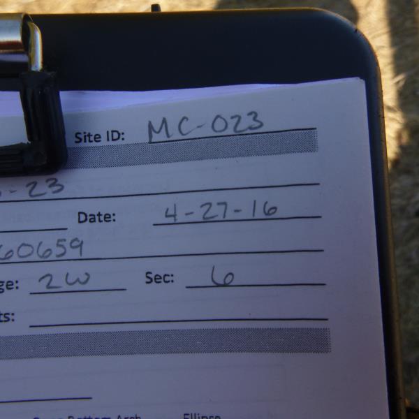
Road Stream Crossing Site CLHW_MC-023
Mill Creek Watershed, Unnamed
US-23
Beaugrand Twp,
Cheboygan County
Information collected by:
Site Location
GPS Coordinates: 45.72086
, -84.60659
T38N
R2W
Sec 6
Owned by Private
Fish Passability 0
Perch Height: 1.8 ft.
Total Erosion: 0 tons/year
Severity: Severe
Year Inventoried: 2016
Site ID
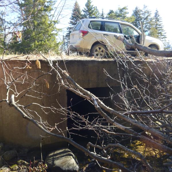
Inlet
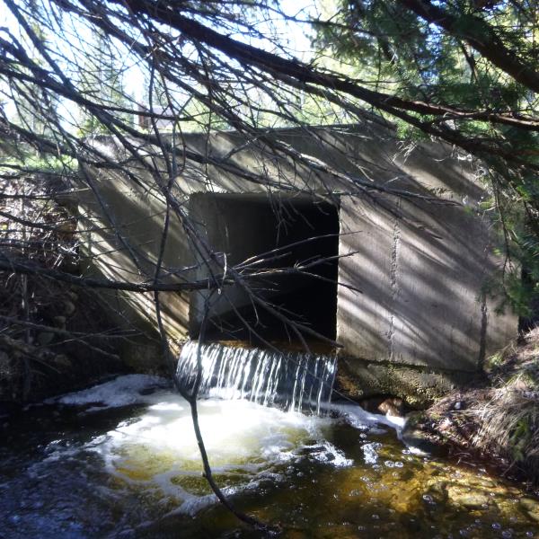
Outlet
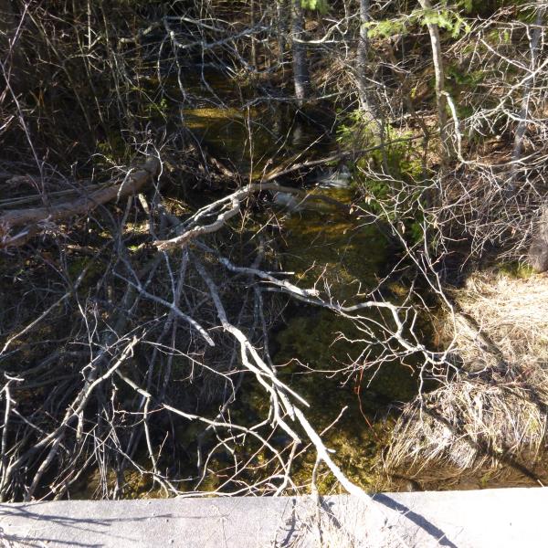
Upstream Conditions
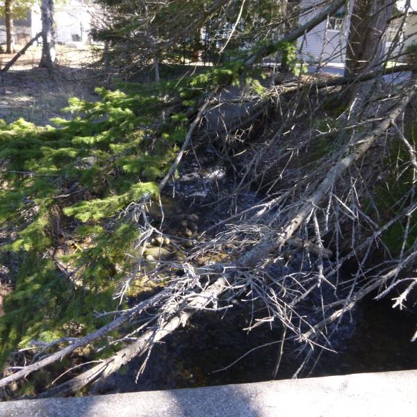
Downstream Conditions
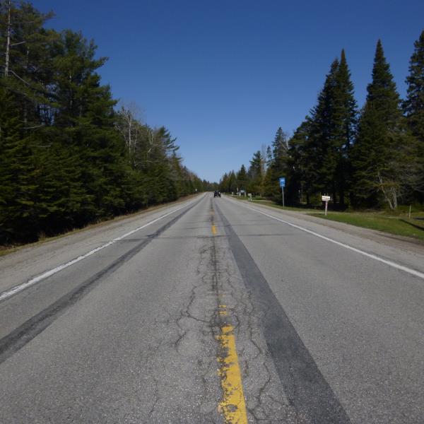
Road Approach - Left
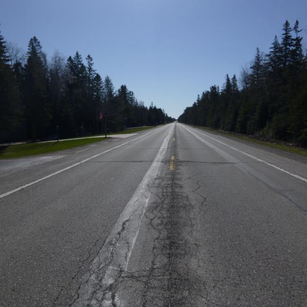
Road Approach - Right
Crossing Information
Type of Crossing: culvert(s)
Number of Structures: 1
Structure Shape: Square/Rectangle
Inlet Type: Headwall
Outlet Type: Freefall into Pool
Structure Material: Concrete
Structure Substrate: Sand
General Conditions: Good
Structure Interior: smooth
Dimensions of Structure: Length 80 ft.
, Width 4 ft.
, Height 4 ft.
Perch Height: 1.8 ft.
Structure Inlet
Water Depth: 0.3 ft.
Embedded Depth of Structure: 0.1 ft.
Water Velocity*: 2.4 ft./sec.
Structure Outlet
Water Depth: 0.2 ft.
Embedded Depth of Structure: 0 ft.
Water Velocity*: 2.4 ft./sec.
*Water Velocities were measured at the Surface
(with Float Test)
Stream Information
Stream Flow: Less than 1/2 Bankfull
Scour Pool: Length 13 ft.
, Width 11.5 ft.
, Depth 2 ft.
Upstream Pond: Length 0 ft.
, Width 0 ft.
, Depth 0 ft.
Riffle Information
Water Depth: 0.7 ft.
Bankfull Width: 9 ft.
Wetted Width: 5 ft.
Water Velocity: 0.7 ft./sec.
(Measured with Float Test)
Dominant Substrate: Sand
Road Information
Paved
Federal Road
Road Condition: Fair
Road Width at Culvert: 34 ft.
Location of Low Point: Other
Runoff Path: Ditch
Embankments
Upstream
Fill Depth: 0.3 ft.
Slope: More than 1:2
Downstream
Fill Depth: 0.3 ft.
Slope: More than 1:2
Approaches
Left Approach
Length: 0 ft.
Slope: Less Than 1%
Vegetation: Heavy
LS Factor: 0.05
Erosion: 0 tons/year
Right Approach
Length: 0 ft.
Slope: Less Than 1%
Vegetation: Heavy
LS Factor: 0.05
Erosion: 0 tons/year
Erosion Information
Total Erosion at Crossing: 0 tons/year
Summary Information
Fish Passability 0
�