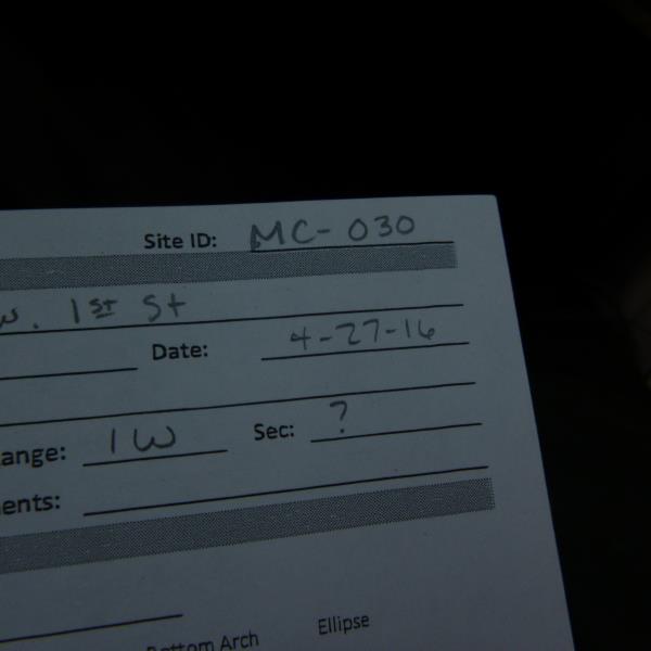
Road Stream Crossing Site CLHW_MC-030
Mill Creek Watershed, Unnamed
W 1st Street
Benton Twp,
Cheboygan County
Information collected by:
Site Location
GPS Coordinates: 45.65202
, -84.48102
T38N
R1W
Owned by Private
Fish Passability 0.9
Structure is NOT Perched
Severity: Minor
Year Inventoried: 2016
Site ID
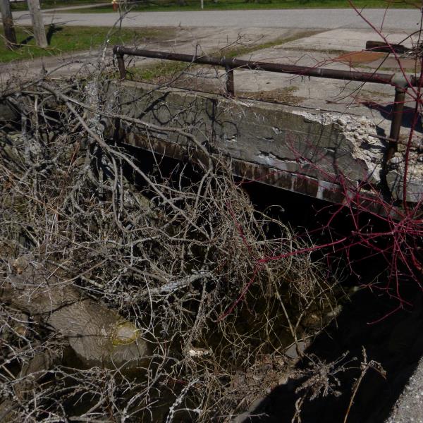
Inlet
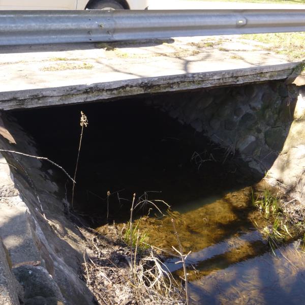
Outlet
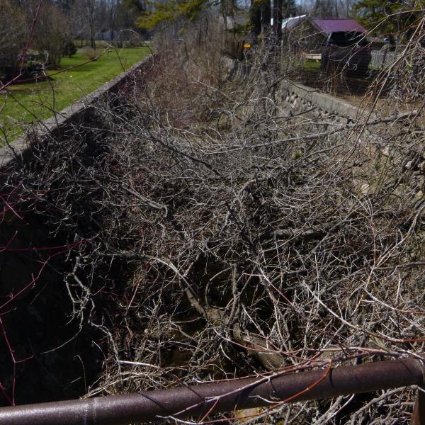
Upstream Conditions
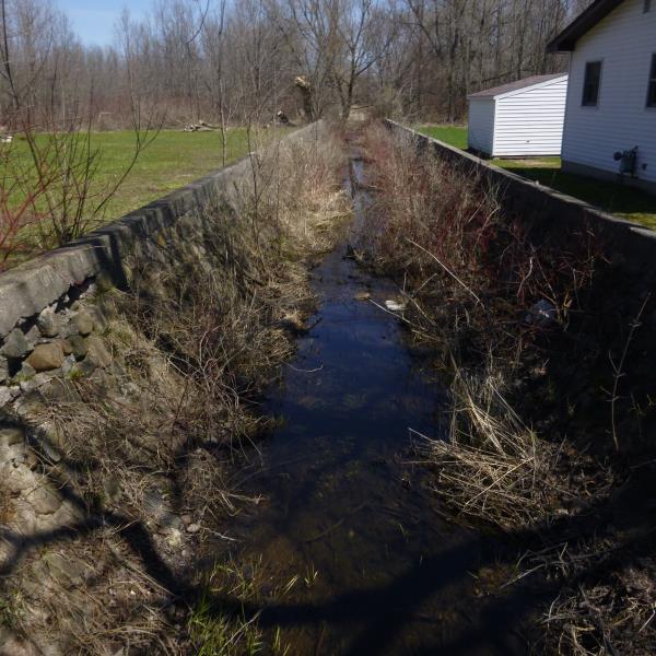
Downstream Conditions
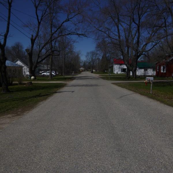
Road Approach - Left
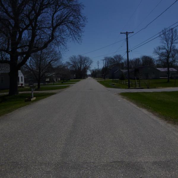
Road Approach - Right
Crossing Information
Type of Crossing: Bridge
Structure Shape: Square/Rectangle
Inlet Type: Other
Outlet Type: At Stream Grade
Structure Material: Concrete
Structure Substrate: Sand
General Conditions: Poor
Structure Interior: smooth
Structure is Rusted through
Dimensions of Structure: Length 56 ft.
, Width 13 ft.
, Height 4.5 ft.
Percentage Plugged:
Inlet: 26% to 50%
Outlet: 26% to 50%
In Pipe: 26% to 50%
Percentage Crushed:
Inlet: 1% to 25%
Outlet: 1% to 25%
In Pipe: 1% to 25%
Structure is NOT Perched
Structure Inlet
Water Depth: 1 ft.
Embedded Depth of Structure: 0.1 ft.
Water Velocity*: 0.1 ft./sec.
Structure Outlet
Water Depth: 1 ft.
Embedded Depth of Structure: 0.1 ft.
Water Velocity*: 0.1 ft./sec.
*Water Velocities were measured at the Surface
(with Float Test)
Additional Comments
Within Cheboygan City Limits
Stream Information
Stream Flow: None
Scour Pool: Length 0 ft.
, Width 0 ft.
, Depth 0 ft.
Upstream Pond: Length 0 ft.
, Width 0 ft.
, Depth 0 ft.
Riffle Information
Water Depth: 0 ft.
Bankfull Width: 0 ft.
Wetted Width: 0 ft.
Water Velocity: 0 ft./sec.
Road Information
Paved
Town Road
Road Condition: Poor
Road Width at Culvert: 20 ft.
Location of Low Point: Other
Runoff Path: Ditch
Fill Depth: 0 ft.
Fill Depth: 0 ft.
Length: 0 ft.
Vegetation: Partial
Length: 0 ft.
Vegetation: Partial
Erosion Information
Summary Information
Fish Passability 0.9
�