Road Stream Crossing Site CLHW_OR-010
Ocqueoc River Watershed, Ocqueoc River
W 634 Hwy
Bismarck Twp,
Presque Isle County
Information collected by:
Site Location
GPS Coordinates: 45.22902
, -83.94443
T33N
R4E
Sec 28
Owned by Private
State
State
Structure is NOT Perched
Total Erosion: 0.0904 tons/year
Severity: Moderate
Year Inventoried: 2016
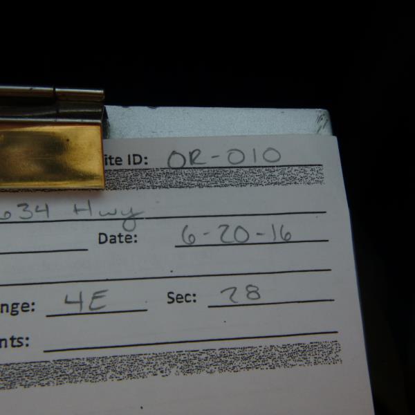
Site ID
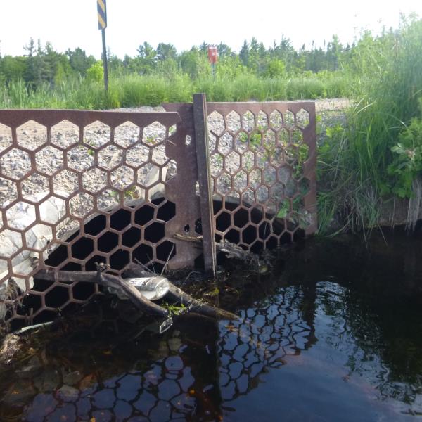
Inlet
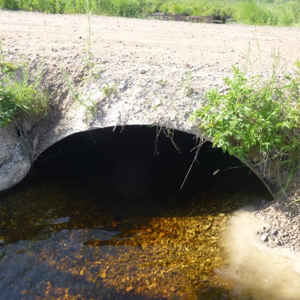
Outlet
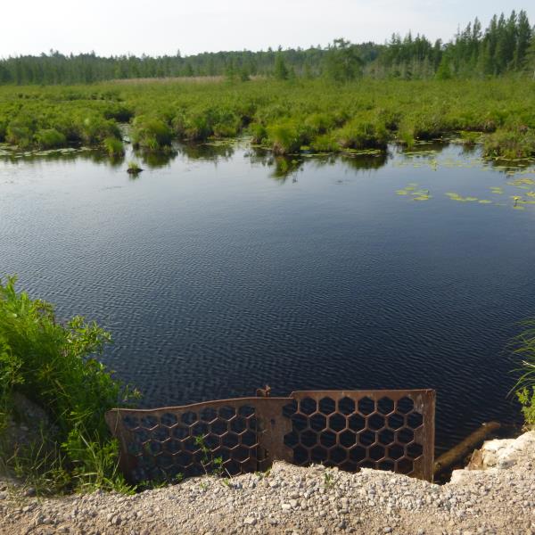
Upstream Conditions
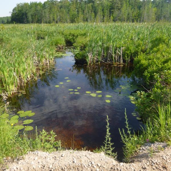
Downstream Conditions
Road Approach - Left
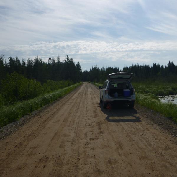
Road Approach - Right
Crossing Information
Type of Crossing: culvert(s)
Number of Structures: 1
Structure Shape: Open Bottom Square/Rectangle
Inlet Type: Trash Rack
Outlet Type: At Stream Grade
Structure Material: Metal
Structure Substrate: Sand
General Conditions: Poor
Structure Interior: corrugated
Structure is Rusted through
Dimensions of Structure: Length 20 ft.
, Width 5 ft.
, Height 3 ft.
Percentage Plugged:
Inlet: 26% to 50%
Outlet: 0%
In Pipe: 0%
Percentage Crushed:
Inlet: 1% to 25%
Outlet: 1% to 25%
In Pipe: 0%
Structure is NOT Perched
Structure Inlet
Water Depth: 1.8 ft.
Embedded Depth of Structure: 0.4 ft.
Water Velocity*: 0.5 ft./sec.
Structure Outlet
Water Depth: 1 ft.
Embedded Depth of Structure: 0.1 ft.
Water Velocity*: 0.5 ft./sec.
*Water Velocities were measured at the Surface
(with Float Test)
Additional Comments
Flooding/wetland area at the upstream reach of Ocqueoc River; Not in river form at this point; riffle unavailable
Stream Information
Stream Flow: Less than Bankfull
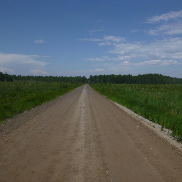
Road Information
Gravel
County Road
Road Condition: Good
Road Width at Culvert: 15.5 ft.
Location of Low Point: Other
Runoff Path: Ditch
Fill Depth: 0 ft.
Slope: Vertical
Fill Depth: 0 ft.
Slope: Vertical
Approaches
Left Approach
Length: 0 ft.
Slope: Less Than 1%
Vegetation: Heavy
LS Factor: 0.05
Erosion: 0 tons/year
Right Approach
Length: 0 ft.
Slope: Less Than 1%
Vegetation: Heavy
LS Factor: 0.05
Erosion: 0 tons/year
Erosion Information
Total Erosion at Crossing: 0.0904 tons/year
Extent of Erosion: Moderate
Notes: Due to rainfall and crowned road
Location of Erosion | Erosion Dimensions | Eroded Material | Material Eroded | Total Erosion | ||
facing downstream | Length | Width | Depth | Reaching Stream? | (tons/year) | |
Right Downstream Embankment |
2 ft. |
1.8 ft. |
2.5 ft. |
yes |
Gravel |
0.035 |
Left Downstream Embankment |
3.6 ft. |
1.6 ft. |
2.2 ft. |
yes |
Gravel |
0.0554 |
Summary Information
�