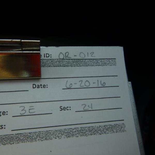
Road Stream Crossing Site CLHW_OR-012
Ocqueoc River Watershed, Unnamed Branch of Upper Barnhart Lake
W 638 Hwy
Case Twp,
Presque Isle County
Information collected by:
Site Location
GPS Coordinates: 45.3138
, -84.0262
T34N
R3E
Sec 24
Owned by Private
Perch Height: 0.9 ft.
Total Erosion: 0.0777 tons/year
Severity: Minor
Year Inventoried: 2016
Site ID
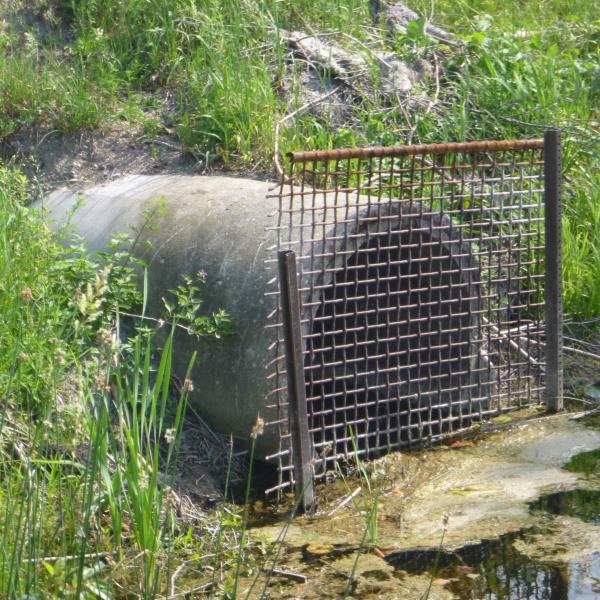
Inlet
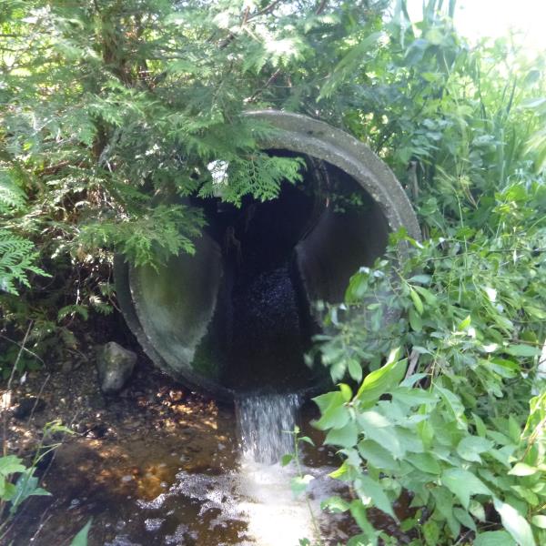
Outlet
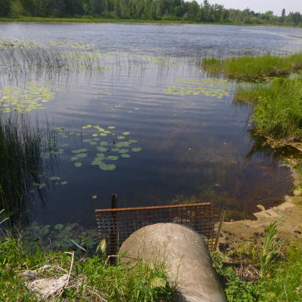
Upstream Conditions
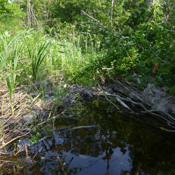
Downstream Conditions
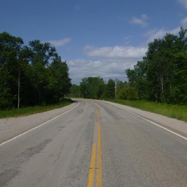
Road Approach - Left
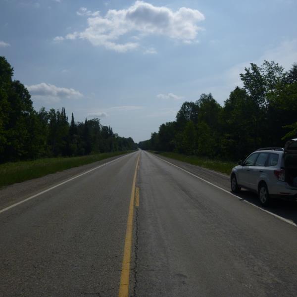
Road Approach - Right
Crossing Information
Type of Crossing: culvert(s)
Number of Structures: 1
Structure Shape: Round
Inlet Type: Trash Rack
Outlet Type: Freefall into Pool
Structure Material: Concrete
Structure Substrate: None
General Conditions: Poor
Structure Interior: smooth
Dimensions of Structure: Length 75 ft.
, Width 3 ft.
, Height 3 ft.
Percentage Crushed:
Inlet: 0%
Outlet: 26% to 50%
In Pipe: 0%
Perch Height: 0.9 ft.
Structure Inlet
Water Depth: 0.2 ft.
Embedded Depth of Structure: 0 ft.
Water Velocity*: 0.5 ft./sec.
Structure Outlet
Water Depth: 0.1 ft.
Embedded Depth of Structure: 0 ft.
Water Velocity*: 0.5 ft./sec.
*Water Velocities were measured at the Surface
(with Float Test)
Additional Comments
Outlet has a broken section (concrete culvert); Stream is dry after scour pond (unable to obtain riffle)
Stream Information
Stream Flow: Less than Bankfull
Scour Pool: Length 20 ft.
, Width 12 ft.
, Depth 2.1 ft.
Road Information
Paved
County Road
Road Condition: Fair
Road Width at Culvert: 23.5 ft.
Location of Low Point: Other
Runoff Path: Ditch
Embankments
Upstream
Fill Depth: 2.2 ft.
Slope: More than 1:2
Downstream
Fill Depth: 3.5 ft.
Slope: More than 1:2
Approaches
Left Approach
Length: 1000 ft.
Slope: Less Than 1%
Vegetation: Heavy
LS Factor: 0.05
Erosion: 0.0388 tons/year
Right Approach
Length: 1000 ft.
Slope: Less Than 1%
Vegetation: Heavy
LS Factor: 0.05
Erosion: 0.0388 tons/year
Erosion Information
Total Erosion at Crossing: 0.0777 tons/year
Summary Information
A future visit to this site is recommended. Possibly to address broken culvert at outlet
�