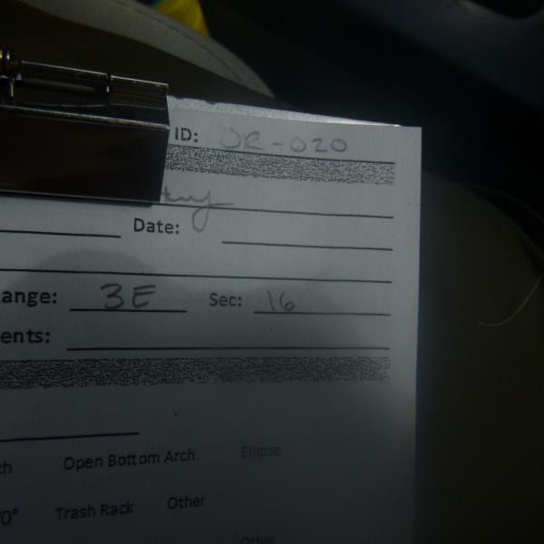
Road Stream Crossing Site CLHW_OR-020
Ocqueoc River Watershed, Ocqueoc River
Walker Hwy
Case Twp,
Presque Isle County
Information collected by:
Site Location
GPS Coordinates: 45.33767
, -84.07299
T34N
R3E
Sec 16
Owned by Private
Fish Passability 0.9
Structure is NOT Perched
Total Erosion: 1.5147 tons/year
Severity: Moderate
Year Inventoried: 2016
Site ID
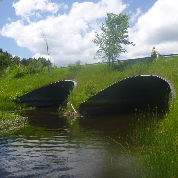
Inlet
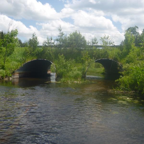
Outlet
Upstream Conditions
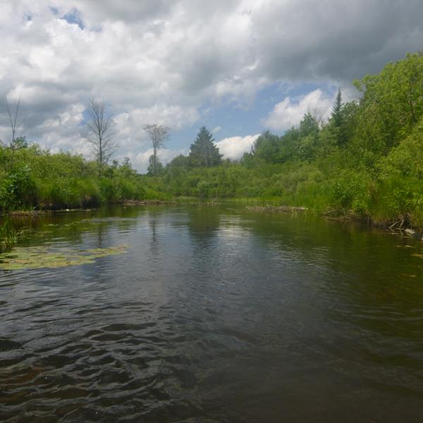
Downstream Conditions
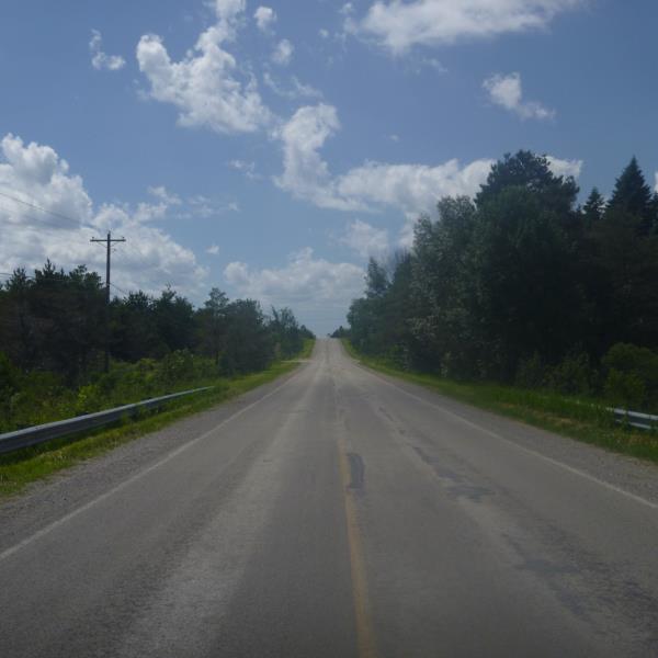
Road Approach - Left
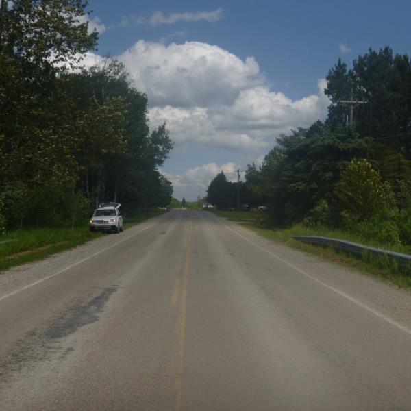
Road Approach - Right
Crossing Information
Type of Crossing: culvert(s)
Number of Structures: 2
Structure Shape: Pipe Arch
Inlet Type: Mitered
Outlet Type: At Stream Grade
Structure Material: Metal
Structure Substrate: Rock
General Conditions: Good
Multiple Culverts/Spans | ||||
Culvert/Span | Width | Length | Height | Material |
1 |
15 ft. |
75 ft. |
9 ft. |
Metal |
2 |
15 ft. |
75 ft. |
9 ft. |
Metal |
Structure Interior: corrugated
Dimensions of Structure: Length 75 ft.
, Width 15 ft.
, Height 9 ft.
Structure is NOT Perched
Structure Inlet
Water Depth: 1 ft.
Embedded Depth of Structure: 0 ft.
Water Velocity*: 0.9 ft./sec.
Structure Outlet
Water Depth: 2.3 ft.
Embedded Depth of Structure: 0 ft.
Water Velocity*: 0.9 ft./sec.
*Water Velocities were measured at the Surface
(with Float Test)
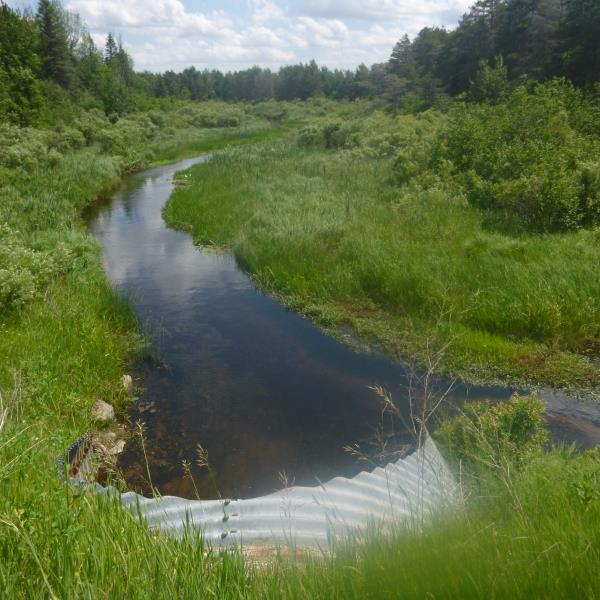
Stream Information
Stream Flow: Less than 1/2 Bankfull
Riffle Information
Water Depth: 1.9 ft.
Bankfull Width: 40 ft.
Wetted Width: 32 ft.
Water Velocity: 1 ft./sec.
(Measured with Float Test)
Dominant Substrate: Sand
Road Information
Paved
County Road
Road Condition: Good
Road Width at Culvert: 20 ft.
Location of Low Point: At Stream
Runoff Path: Ditch
Embankments
Upstream
Fill Depth: 4.4 ft.
Slope: 1:2
Downstream
Fill Depth: 5.5 ft.
Slope: 1:2
Approaches
Left Approach
Length: 1000 ft.
Slope: 6% to 10%
Vegetation: Heavy
LS Factor: 2.05
Erosion: 1.3554 tons/year
Right Approach
Length: 485 ft.
Slope: 1% to 5%
Vegetation: Heavy
LS Factor: 0.497
Erosion: 0.1594 tons/year
Erosion Information
Total Erosion at Crossing: 1.5147 tons/year
Summary Information
Fish Passability 0.9
�