Road Stream Crossing Site CLHW_OR-021
Ocqueoc River Watershed, Ocqueoc River
Millersburg Rd (Main Street)
Case Twp,
Presque Isle County
Information collected by:
Site Location
GPS Coordinates: 45.33202
, -84.0601
T34N
R3E
Sec 15
Owned by Local Government
Structure is NOT Perched
Total Erosion: 0.7636 tons/year
Severity: Minor
Year Inventoried: 2016
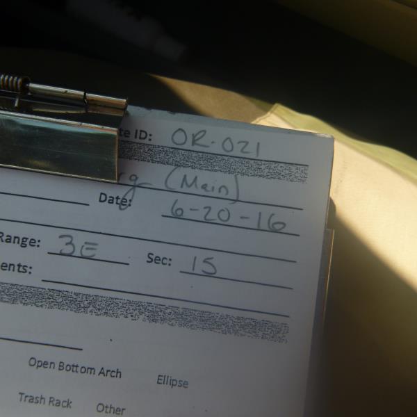
Site ID
Inlet
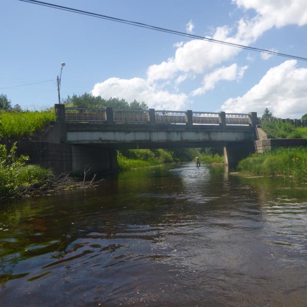
Outlet
Upstream Conditions
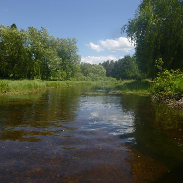
Downstream Conditions
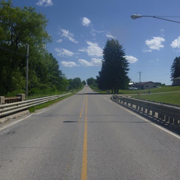
Road Approach - Left
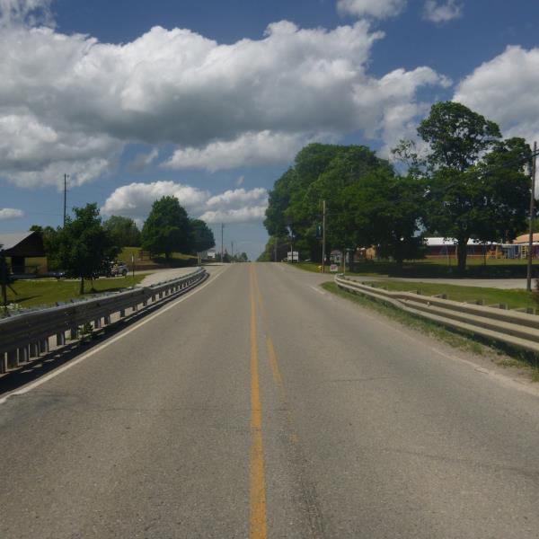
Road Approach - Right
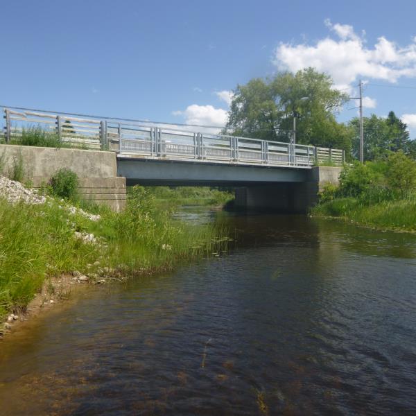
Crossing Information
Type of Crossing: Bridge
Structure Shape: Open Bottom Square/Rectangle
Inlet Type: Headwall
Outlet Type: At Stream Grade
Structure Material: Concrete
Structure Substrate: Rock
General Conditions: New
Structure Interior: smooth
Dimensions of Structure: Length 55 ft.
, Width 48 ft.
, Height 11 ft.
Structure is NOT Perched
Structure Inlet
Water Depth: 1.7 ft.
Embedded Depth of Structure: 0 ft.
Water Velocity*: 1 ft./sec.
Structure Outlet
Water Depth: 1.2 ft.
Embedded Depth of Structure: 0 ft.
Water Velocity*: 1 ft./sec.
*Water Velocities were measured at the Surface
(with Float Test)
Additional Comments
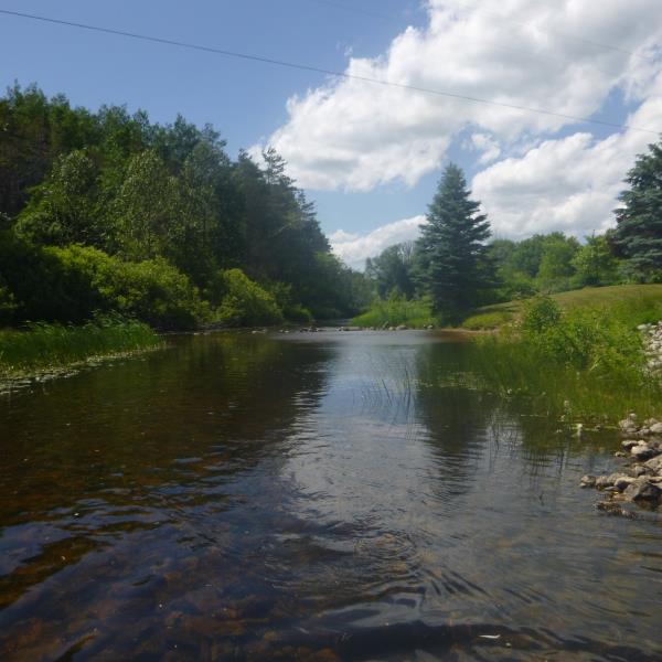
Man made scour pool from people placing rocks to hold up flow for 'swimming hole'
Stream Information
Stream Flow: Less than 1/2 Bankfull
Riffle Information
Water Depth: 1.9 ft.
Bankfull Width: 40 ft.
Wetted Width: 32 ft.
Water Velocity: 1 ft./sec.
(Measured with Float Test)
Dominant Substrate: Sand
Road Information
Paved
Town Road
Road Condition: Good
Road Width at Culvert: 22 ft.
Location of Low Point: At Stream
Runoff Path: Ditch
Fill Depth: 0 ft.
Slope: Vertical
Fill Depth: 0 ft.
Slope: Vertical
Approaches
Left Approach
Length: 1000 ft.
Slope: 1% to 5%
Vegetation: Partial
LS Factor: 0.8
Erosion: 0.5818 tons/year
Right Approach
Length: 413 ft.
Slope: 1% to 5%
Vegetation: Partial
LS Factor: 0.605
Erosion: 0.1818 tons/year
Erosion Information
Total Erosion at Crossing: 0.7636 tons/year
Extent of Erosion: Moderate
Summary Information
Erosion is an area of concern for this site.
No, crossing is in great condition
�