Road Stream Crossing Site CLHW_OR-032
Ocqueoc River Watershed, Silver Creek
N Silver Creek Rd
Ocqueoc Twp,
Presque Isle County
Information collected by:
Site Location
GPS Coordinates: 45.45653
, -84.04729
T36N
R3E
Sec 34
Owned by Private
Fish Passability 0.5
Structure is NOT Perched
Total Erosion: 9.8434 tons/year
Severity: Severe
Year Inventoried: 2016
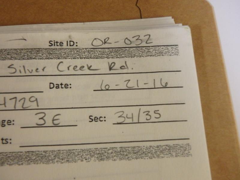
Site ID
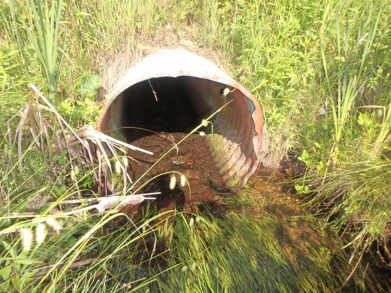
Inlet
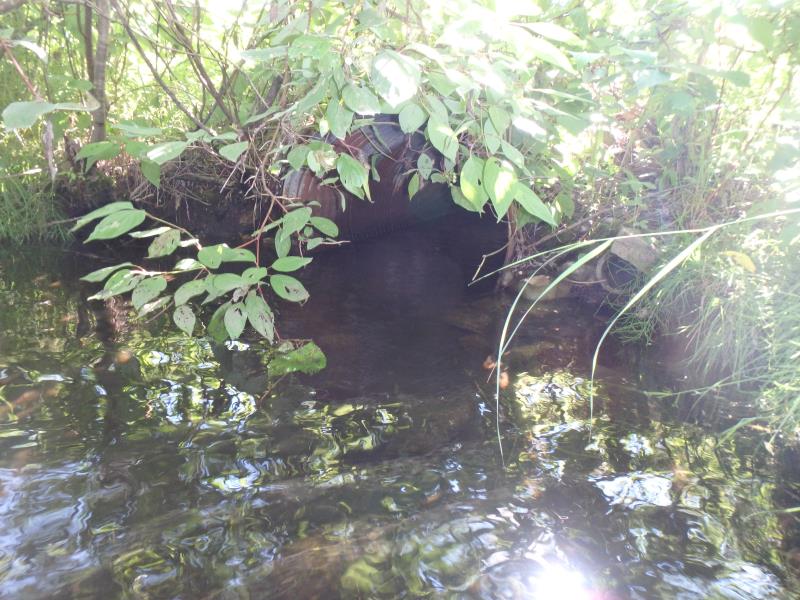
Outlet
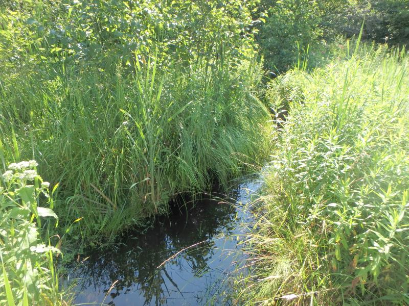
Upstream Conditions
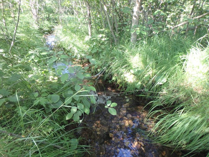
Downstream Conditions
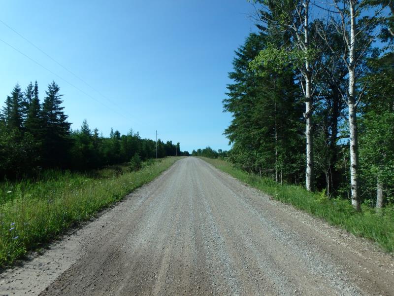
Road Approach - Left
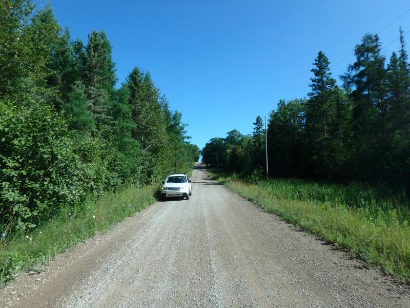
Road Approach - Right
Crossing Information
Type of Crossing: culvert(s)
Number of Structures: 1
Structure Shape: Round
Inlet Type: Trash Rack
Outlet Type: At Stream Grade
Structure Material: Metal
Structure Substrate: None
General Conditions: Poor
Structure Interior: corrugated
Structure is Rusted through
Dimensions of Structure: Length 40 ft.
, Width 2.4 ft.
, Height 2.4 ft.
Structure is NOT Perched
Structure Inlet
Water Depth: 0.3 ft.
Embedded Depth of Structure: 0 ft.
Water Velocity*: 0.6 ft./sec.
Structure Outlet
Water Depth: 0.7 ft.
Embedded Depth of Structure: 0 ft.
Water Velocity*: 0.6 ft./sec.
*Water Velocities were measured at the Surface
(with Float Test)
Additional Comments
Trash rack has been detached from its supports
Stream Information
Stream Flow: Less than 1/2 Bankfull
Scour Pool: Length 11 ft.
, Width 9 ft.
, Depth 1.5 ft.
Upstream Pond: Length 8 ft.
, Width 6 ft.
, Depth 0.9 ft.
Riffle Information
Water Depth: 0.5 ft.
Bankfull Width: 9 ft.
Wetted Width: 6 ft.
Water Velocity: 0.8 ft./sec.
(Measured with Float Test)
Dominant Substrate: Gravel
Road Information
Gravel
County Road
Road Condition: Fair
Road Width at Culvert: 18.5 ft.
Location of Low Point: At Stream
Runoff Path: Ditch
Embankments
Upstream
Fill Depth: 2.7 ft.
Slope: More than 1:2
Downstream
Fill Depth: 2.5 ft.
Slope: More than 1:2
Approaches
Left Approach
Length: 212 ft.
Slope: 1% to 5%
Vegetation: Heavy
LS Factor: 0.432
Erosion: 0.4672 tons/year
Right Approach
Length: 922 ft.
Slope: 6% to 10%
Vegetation: Heavy
LS Factor: 1.995
Erosion: 9.3762 tons/year
Erosion Information
Total Erosion at Crossing: 9.8434 tons/year
Summary Information
Fish Passability 0.5
�