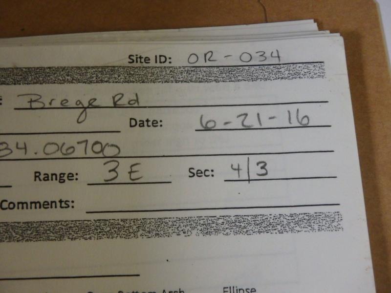
Road Stream Crossing Site CLHW_OR-034
Ocqueoc River Watershed, Unnamed stream
Brege Rd
Ocqueoc Twp,
Presque Isle County
Information collected by:
Site Location
GPS Coordinates: 45.44411
, -84.067
T35N
R3E
Sec 3
Owned by Private
Perch Height: 1.6 ft.
Total Erosion: 2.7503 tons/year
Severity: Severe
Year Inventoried: 2016
Site ID
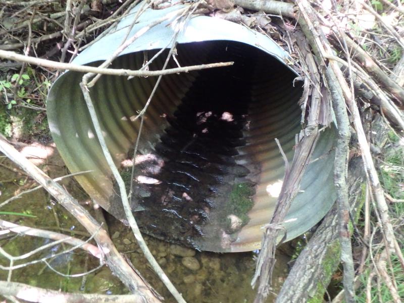
Inlet
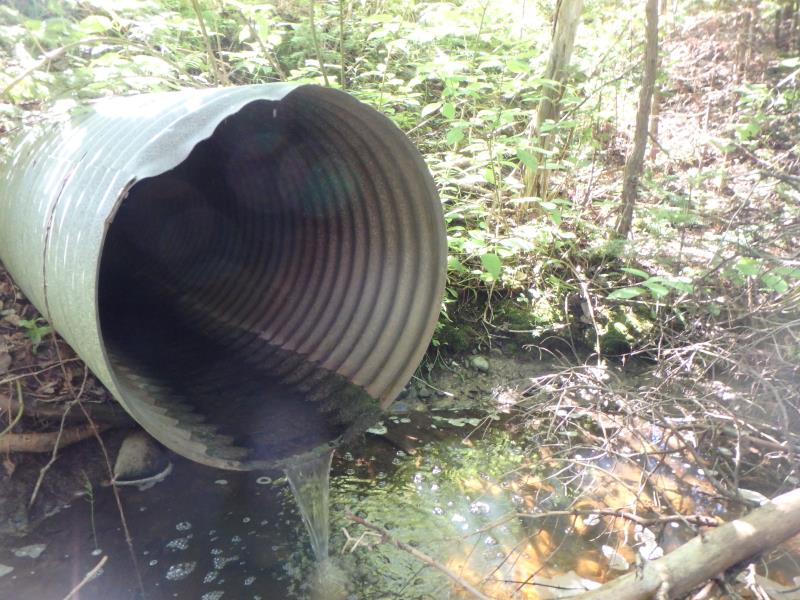
Outlet
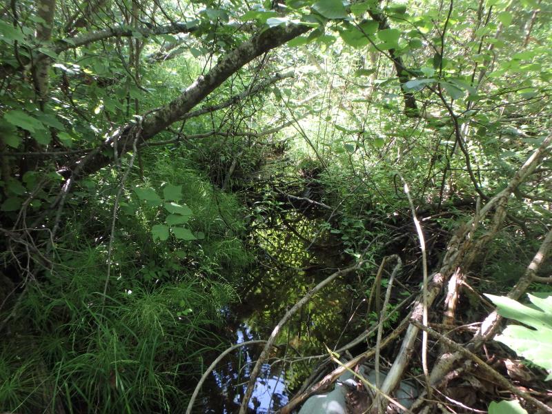
Upstream Conditions
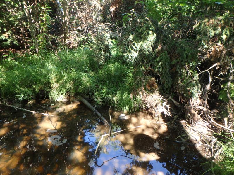
Downstream Conditions
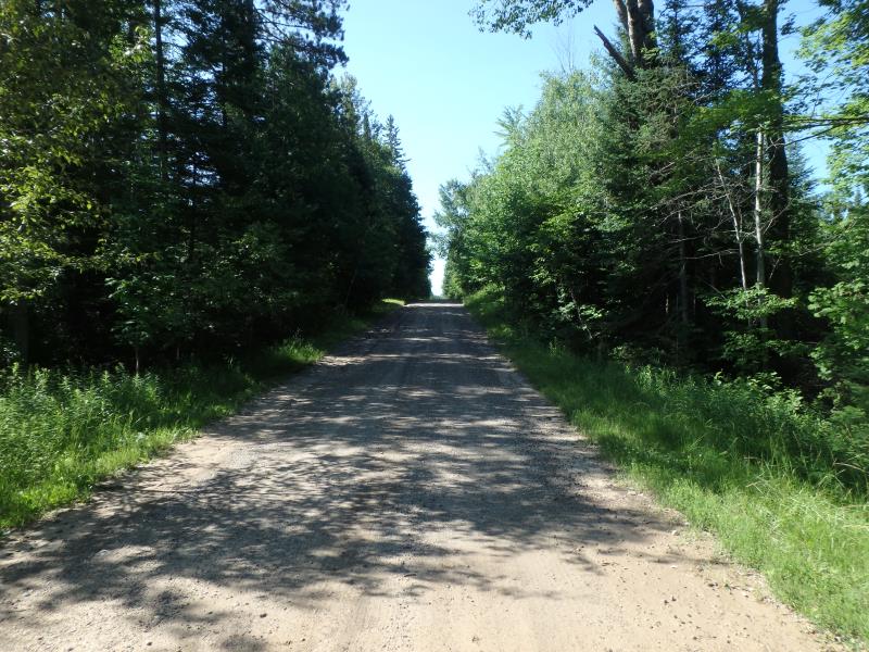
Road Approach - Left
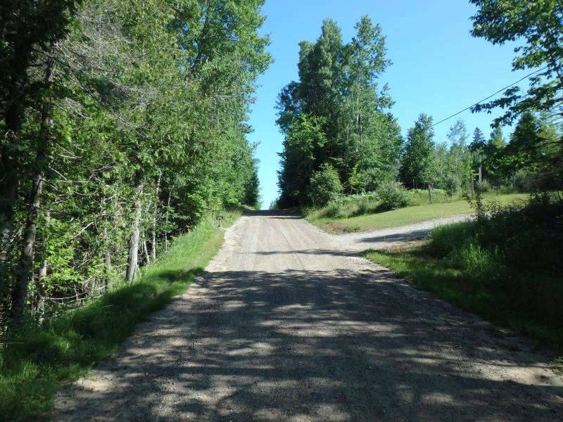
Road Approach - Right
Crossing Information
Type of Crossing: culvert(s)
Number of Structures: 1
Structure Shape: Round
Inlet Type: Projecting
Outlet Type: Freefall into Pool
Structure Material: Metal
Structure Substrate: None
General Conditions: Fair
Structure Interior: corrugated
Dimensions of Structure: Length 60 ft.
, Width 2.5 ft.
, Height 2.5 ft.
Percentage Crushed:
Inlet: 1% to 25%
Outlet: 0%
In Pipe: 0%
Perch Height: 1.6 ft.
Structure Inlet
Water Depth: 0.1 ft.
Embedded Depth of Structure: 0 ft.
Water Velocity*: 0.1 ft./sec.
Structure Outlet
Water Depth: 0.1 ft.
Embedded Depth of Structure: 0 ft.
Water Velocity*: 0.1 ft./sec.
*Water Velocities were measured at the Surface
(with Float Test)
Additional Comments
Riffle unavailable; stream has dried up beyond outlet
Stream Information
Stream Flow: Less than 1/2 Bankfull
Scour Pool: Length 11 ft.
, Width 10 ft.
, Depth 1.3 ft.
Road Information
Gravel
County Road
Road Condition: Good
Road Width at Culvert: 16 ft.
Location of Low Point: At Stream
Runoff Path: Ditch
Embankments
Upstream
Fill Depth: 6 ft.
Slope: 1:2
Downstream
Fill Depth: 7 ft.
Slope: 1:2
Approaches
Left Approach
Length: 257 ft.
Slope: 6% to 10%
Vegetation: Heavy
LS Factor: 1.331
Erosion: 1.508 tons/year
Right Approach
Length: 222 ft.
Slope: 6% to 10%
Vegetation: Heavy
LS Factor: 1.27
Erosion: 1.2423 tons/year
Erosion Information
Total Erosion at Crossing: 2.7503 tons/year
Summary Information
�