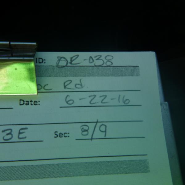
Road Stream Crossing Site CLHW_OR-038
Ocqueoc River Watershed, Unnamed stream
N Ocqueoc Rd
Ocqueoc Twp,
Presque Isle County
Information collected by:
Site Location
GPS Coordinates: 45.43475
, -84.08778
T35N
R3E
Sec 8
Owned by Private
Structure is NOT Perched
Total Erosion: 0.4522 tons/year
Severity: Minor
Year Inventoried: 2016
Site ID
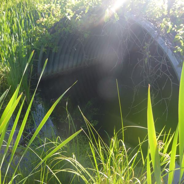
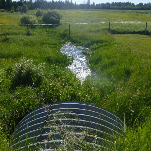
Inlet
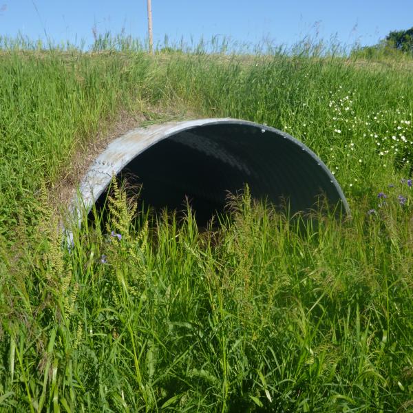
Outlet
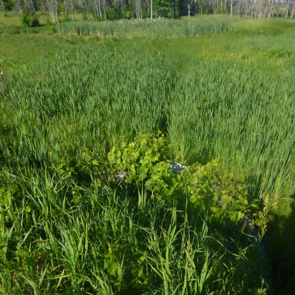
Upstream Conditions
Downstream Conditions
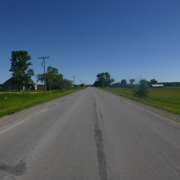
Road Approach - Left
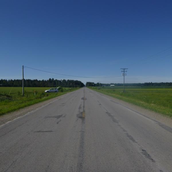
Road Approach - Right
Crossing Information
Type of Crossing: culvert(s)
Number of Structures: 1
Structure Shape: Pipe Arch
Inlet Type: Projecting
Outlet Type: At Stream Grade
Structure Material: Metal
Structure Substrate: Sand
General Conditions: New
Structure Interior: corrugated
Structure is Rusted through
Dimensions of Structure: Length 65 ft.
, Width 9 ft.
, Height 5.8 ft.
Structure is NOT Perched
Structure Inlet
Water Depth: 0.4 ft.
Embedded Depth of Structure: 0.2 ft.
Water Velocity*: 0 ft./sec.
Structure Outlet
Water Depth: 1.1 ft.
Embedded Depth of Structure: 0.1 ft.
Water Velocity*: 0 ft./sec.
Additional Comments
Stream dissapates in the grassy outlet area, no riffle
Stream Information
Stream Flow: None
Road Information
Paved
County Road
Road Condition: Good
Road Width at Culvert: 24 ft.
Location of Low Point: Other
Runoff Path: Ditch
Embankments
Upstream
Fill Depth: 3 ft.
Slope: More than 1:2
Downstream
Fill Depth: 3.4 ft.
Slope: More than 1:2
Approaches
Left Approach
Length: 1000 ft.
Slope: 1% to 5%
Vegetation: Heavy
LS Factor: 0.57
Erosion: 0.4522 tons/year
Right Approach
Length: 0 ft.
Slope: Less Than 1%
Vegetation: Heavy
LS Factor: 0.05
Erosion: 0 tons/year
Erosion Information
Total Erosion at Crossing: 0.4522 tons/year
Summary Information
�