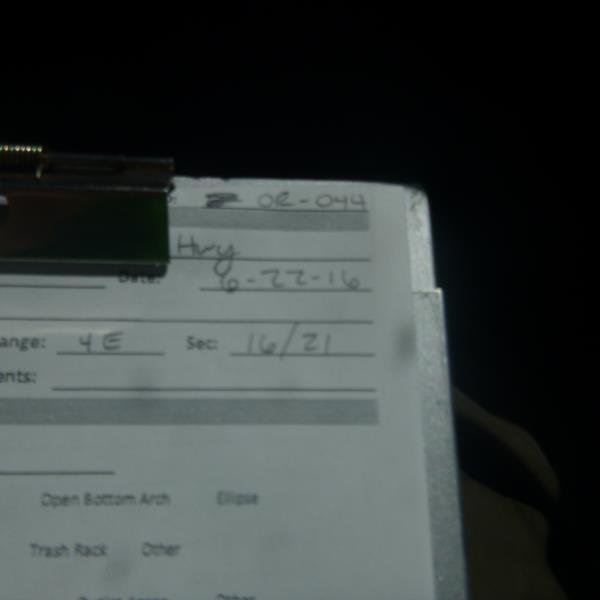
Road Stream Crossing Site CLHW_OR-044
Ocqueoc River Watershed, Silver Creek
Church Hwy
Moltke Twp,
Presque Isle County
Information collected by:
Site Location
GPS Coordinates: 45.4128
, -83.996658
T35N
R4E
Sec 16
Owned by Private
Structure is NOT Perched
Total Erosion: 32.4125 tons/year
Severity: Severe
Year Inventoried: 2016
Site ID
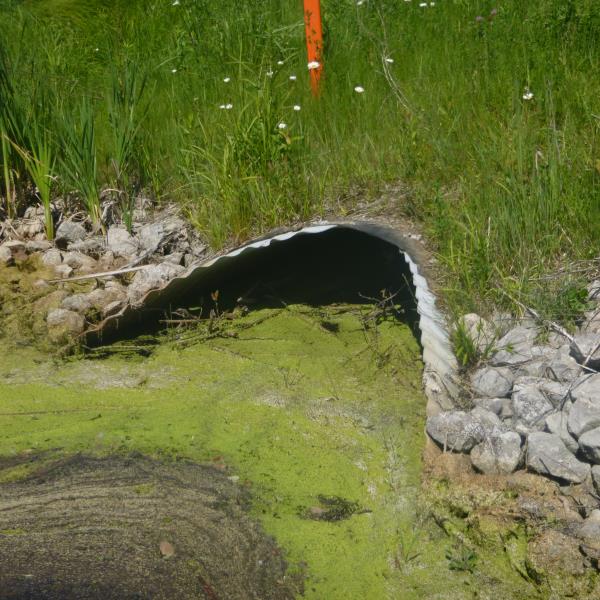
Inlet
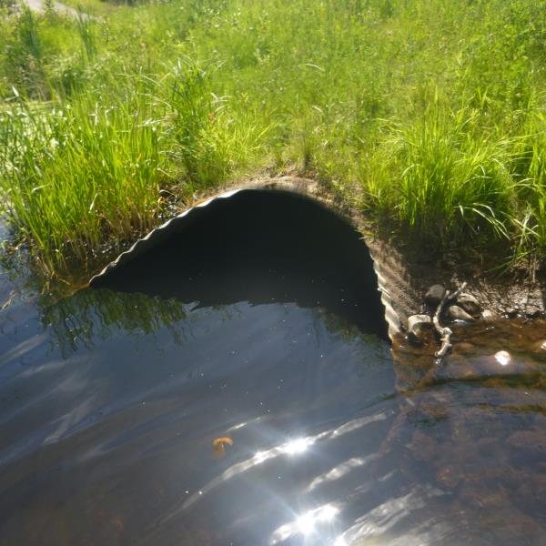
Outlet
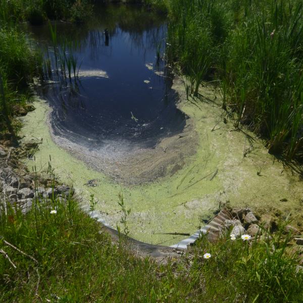
Upstream Conditions
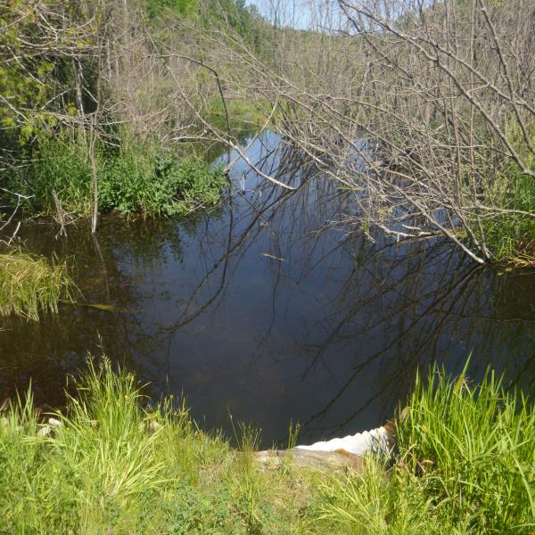
Downstream Conditions
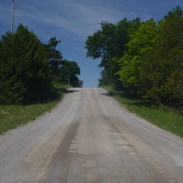
Road Approach - Left
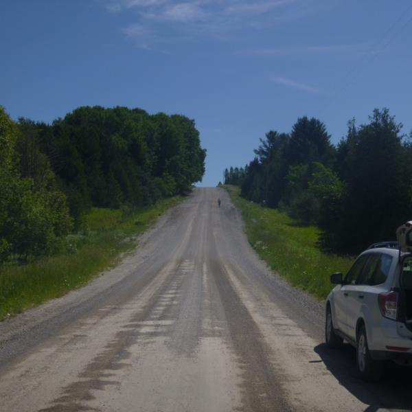
Road Approach - Right
Crossing Information
Type of Crossing: culvert(s)
Number of Structures: 1
Structure Shape: Pipe Arch
Inlet Type: Mitered
Outlet Type: At Stream Grade
Structure Material: Metal
Structure Substrate: Mixture
General Conditions: Good
Structure Interior: corrugated
Structure is Rusted through
Dimensions of Structure: Length 63 ft.
, Width 5 ft.
, Height 3.4 ft.
Percentage Plugged:
Inlet: 26% to 50%
Outlet: 0%
In Pipe: 0%
Structure is NOT Perched
Structure Inlet
Water Depth: 2.1 ft.
Embedded Depth of Structure: 1.2 ft.
Water Velocity*: 0.1 ft./sec.
Structure Outlet
Water Depth: 3.5 ft.
Embedded Depth of Structure: 2 ft.
Water Velocity*: 0.1 ft./sec.
*Water Velocities were measured at the Surface
(with Float Test)
Additional Comments
This is part of a wetland/low lying area; no riffle available
Stream Information
Stream Flow: More than Bankfull
Road Information
Gravel
County Road
Road Condition: Fair
Road Width at Culvert: 20 ft.
Location of Low Point: At Stream
Runoff Path: Ditch
Embankments
Upstream
Fill Depth: 2.4 ft.
Slope: More than 1:2
Downstream
Fill Depth: 3 ft.
Slope: More than 1:2
Approaches
Left Approach
Length: 225 ft.
Slope: 1% to 5%
Vegetation: Heavy
LS Factor: 0.435
Erosion: 0.5393 tons/year
Right Approach
Length: 1000 ft.
Slope: More Than 10%
Vegetation: Heavy
LS Factor: 5.785
Erosion: 31.8733 tons/year
Erosion Information
Total Erosion at Crossing: 32.4125 tons/year
Summary Information
�