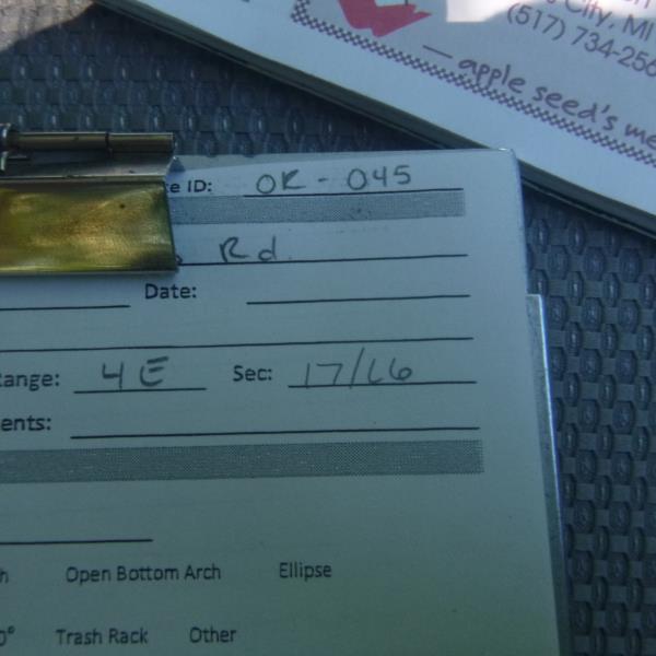
Road Stream Crossing Site CLHW_OR-045
Ocqueoc River Watershed, Silver Creek
N Curtis Rd
Moltke Twp,
Presque Isle County
Information collected by:
Site Location
GPS Coordinates: 45.41497
, -83.96884
T35N
R4E
Sec 17
Owned by Private
Structure is NOT Perched
Total Erosion: 0.9216 tons/year
Severity: Minor
Year Inventoried: 2016
Site ID
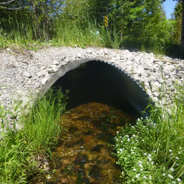
Inlet
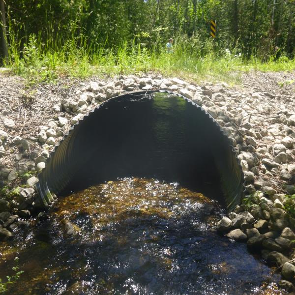
Outlet
Upstream Conditions
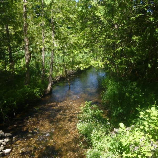
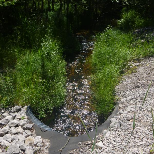
Downstream Conditions
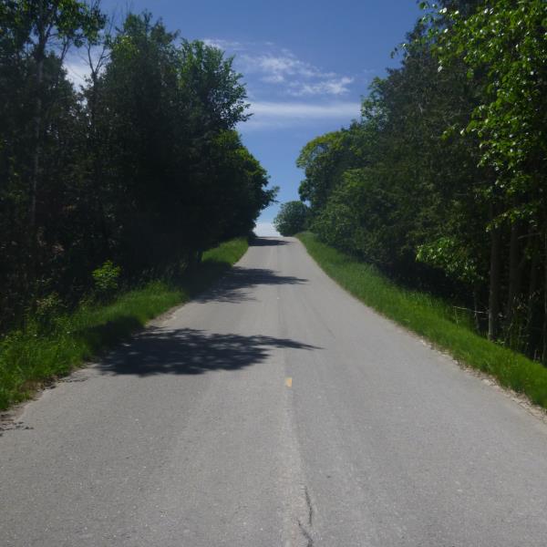
Road Approach - Left
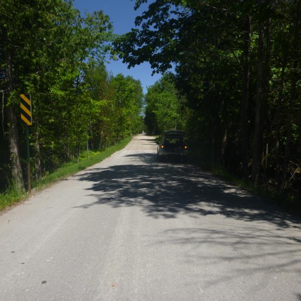
Road Approach - Right
Crossing Information
Type of Crossing: culvert(s)
Number of Structures: 1
Structure Shape: Pipe Arch
Inlet Type: Mitered
Outlet Type: At Stream Grade
Structure Material: Metal
Structure Substrate: Rock
General Conditions: Good
Structure Interior: corrugated
Structure is Rusted through
Dimensions of Structure: Length 44 ft.
, Width 6.5 ft.
, Height 4 ft.
Structure is NOT Perched
Structure Inlet
Water Depth: 0.5 ft.
Embedded Depth of Structure: 0.1 ft.
Water Velocity*: 0.1 ft./sec.
Structure Outlet
Water Depth: 0.3 ft.
Embedded Depth of Structure: 0.1 ft.
Water Velocity*: 0.1 ft./sec.
*Water Velocities were measured at the Surface
(with Float Test)
Additional Comments
Barbed wire prevented us from obtaining a riffle
Stream Information
Stream Flow: Less than 1/2 Bankfull
Road Information
Paved
County Road
Road Condition: Good
Road Width at Culvert: 20 ft.
Location of Low Point: At Stream
Runoff Path: Ditch
Embankments
Upstream
Fill Depth: 0.9 ft.
Slope: More than 1:2
Downstream
Fill Depth: 1.3 ft.
Slope: More than 1:2
Approaches
Left Approach
Length: 1000 ft.
Slope: 1% to 5%
Vegetation: Heavy
LS Factor: 0.57
Erosion: 0.3769 tons/year
Right Approach
Length: 503 ft.
Slope: 6% to 10%
Vegetation: Heavy
LS Factor: 1.638
Erosion: 0.5448 tons/year
Erosion Information
Total Erosion at Crossing: 0.9216 tons/year
Summary Information
�