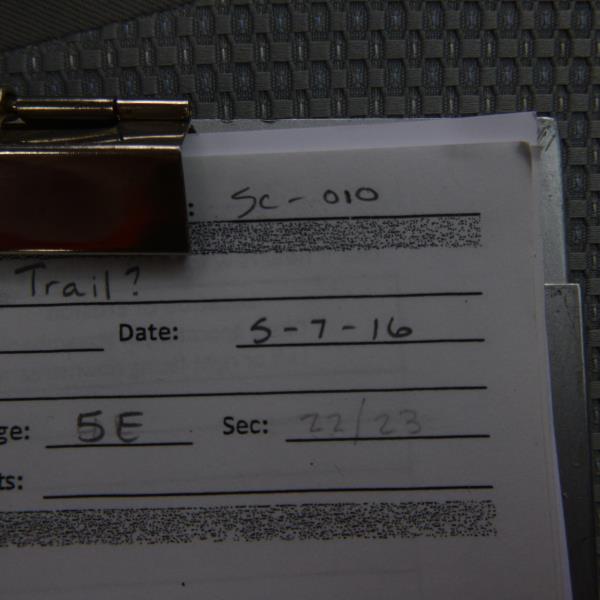
Road Stream Crossing Site CLHW_SC-010
Schmidt Creek Watershed, Hartwick Creek
Huron Sunrise Trail
Rogers Twp,
Presque Isle County
Information collected by:
Site Location
GPS Coordinates: 45.45861
, -83.87198
T36N
R5E
Sec 31
Owned by State
Fish Passability 1
Structure is NOT Perched
Total Erosion: 0.0662 tons/year
Severity: Minor
Year Inventoried: 2016
Site ID
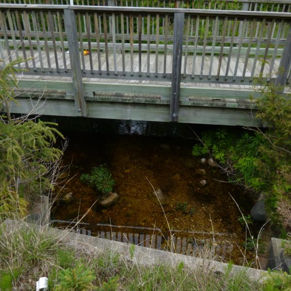
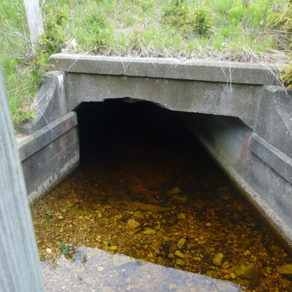
Inlet
Outlet
Upstream Conditions
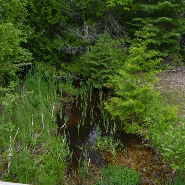
Downstream Conditions
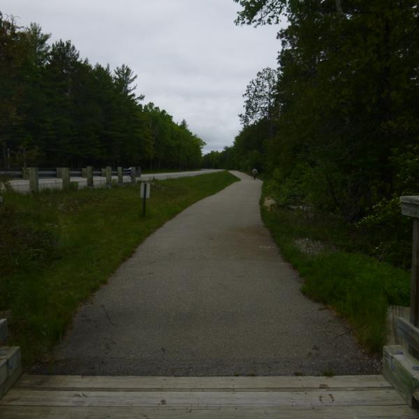
Road Approach - Left
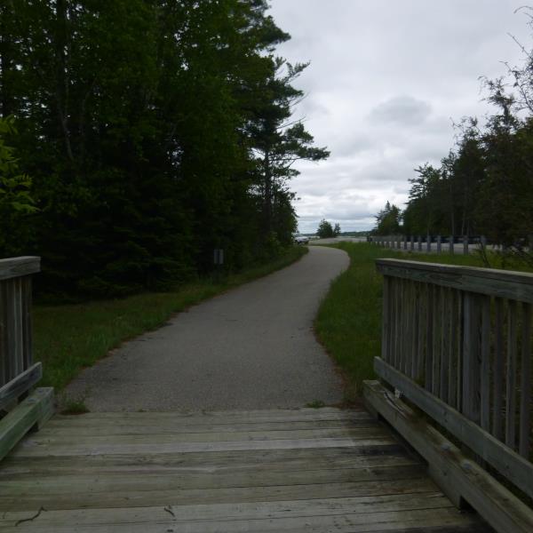
Road Approach - Right
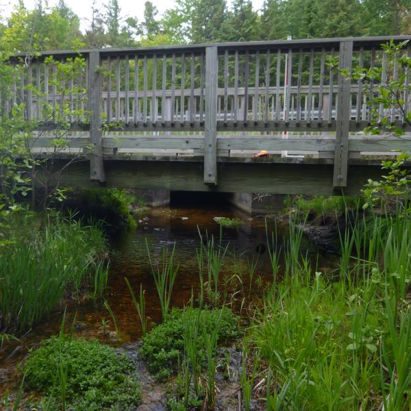
Crossing Information
Type of Crossing: Bridge
Structure Shape: Open Bottom Square/Rectangle
Inlet Type: Other
Outlet Type: At Stream Grade
Structure Material: Wood
Structure Substrate: Gravel
General Conditions: Good
Structure Interior: smooth
Dimensions of Structure: Length 9 ft.
, Width 25.5 ft.
, Height 3.3 ft.
Structure is NOT Perched
Structure Inlet
Water Depth: 0.3 ft.
Embedded Depth of Structure: 0.1 ft.
Water Velocity*: 0.3 ft./sec.
Structure Outlet
Water Depth: 0.3 ft.
Embedded Depth of Structure: 0.1 ft.
Water Velocity*: 0.3 ft./sec.
*Water Velocities were measured at the Surface
(with Float Test)
Additional Comments
Hoeft State Park
Stream Information
Stream Flow: Less than 1/2 Bankfull
Scour Pool: Length 0 ft.
, Width 0 ft.
, Depth 0 ft.
Upstream Pond: Length 0 ft.
, Width 0 ft.
, Depth 0 ft.
Riffle Information
Water Depth: 0.3 ft.
Bankfull Width: 15 ft.
Wetted Width: 12 ft.
Water Velocity: 1.6 ft./sec.
(Measured with Float Test)
Dominant Substrate: Gravel
Road Information
Paved
State Road
(Seasonal)
Road Condition: Good
Road Width at Culvert: 8 ft.
Location of Low Point: At Stream
Runoff Path: Ditch
Fill Depth: 0 ft.
Fill Depth: 0 ft.
Approaches
Left Approach
Length: 352 ft.
Slope: 1% to 5%
Vegetation: Heavy
LS Factor: 0.47
Erosion: 0.0438 tons/year
Right Approach
Length: 198 ft.
Slope: 1% to 5%
Vegetation: Heavy
LS Factor: 0.429
Erosion: 0.0225 tons/year
Erosion Information
Total Erosion at Crossing: 0.0662 tons/year
Summary Information
Fish Passability 1
�