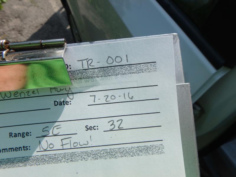
Road Stream Crossing Site CLHW_TR-001
Trout/Swan/Little Trout Watershed, Trout River
Wenzel Hwy
Rogers Twp,
Presque Isle County
Information collected by:
Site Location
GPS Coordinates: 45.38929
, -83.85478
T35N
R5E
Sec 32
Owned by Private
Fish Passability 0.9
Structure is NOT Perched
Severity: Minor
Year Inventoried: 2016
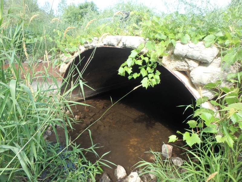
Inlet
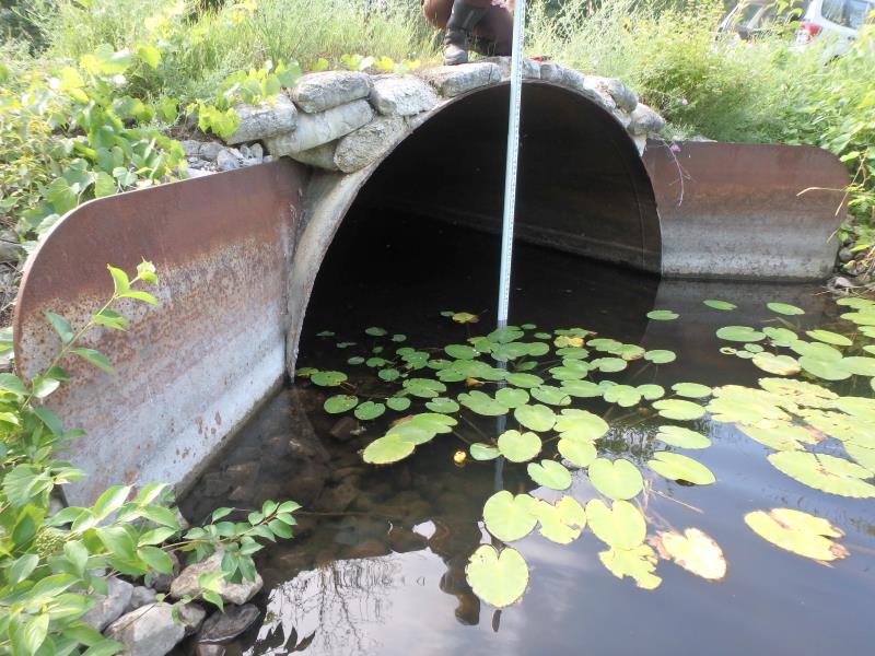
Outlet
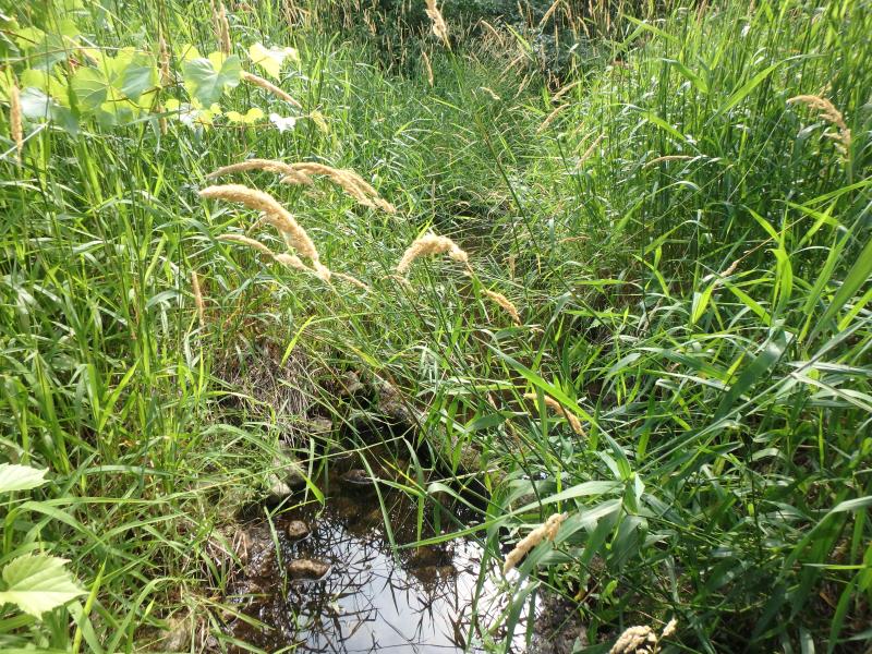
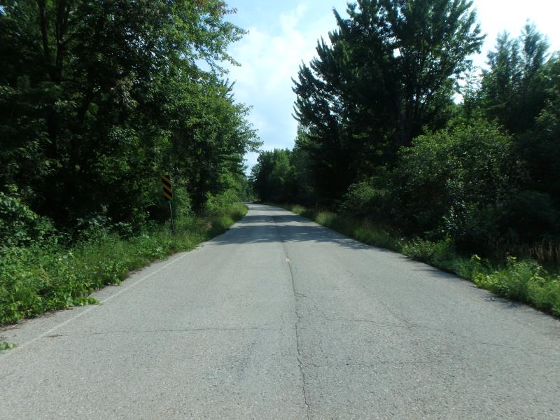
Upstream Conditions
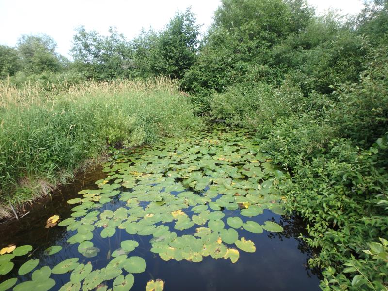
Downstream Conditions
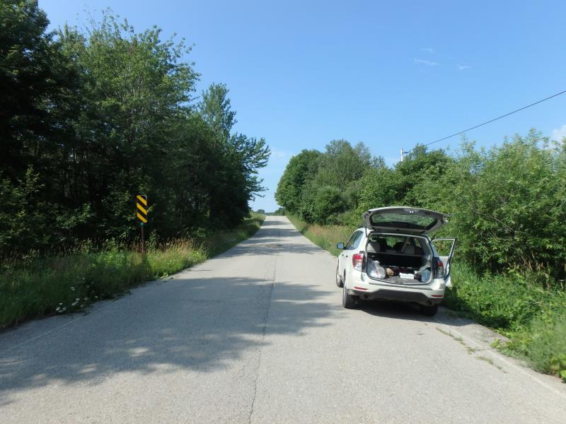
Road Approach - Left
Road Approach - Right
Other
Crossing Information
Type of Crossing: culvert(s)
Number of Structures: 1
Structure Shape: Open Bottom Square/Rectangle
Inlet Type: Wingwall 10-30 Degree
Outlet Type: At Stream Grade
Structure Material: Metal
Structure Substrate: Sand
General Conditions: Poor
Structure Interior: smooth
Structure is Rusted through
Dimensions of Structure: Length 32 ft.
, Width 10 ft.
, Height 5 ft.
Percentage Plugged:
Inlet: 26% to 50%
Outlet: 0%
In Pipe: 0%
Structure is NOT Perched
Structure Inlet
Water Depth: 0.4 ft.
Embedded Depth of Structure: 0.2 ft.
Water Velocity*: 0 ft./sec.
Structure Outlet
Water Depth: 1 ft.
Embedded Depth of Structure: 0 ft.
Water Velocity*: 0 ft./sec.
Stream Information
Stream Flow: None
Scour Pool: Length 0 ft.
, Width 0 ft.
, Depth 0 ft.
Upstream Pond: Length 0 ft.
, Width 0 ft.
, Depth 0 ft.
Riffle Information
Water Depth: 0 ft.
Bankfull Width: 0 ft.
Wetted Width: 0 ft.
Water Velocity: 0 ft./sec.
Road Information
Paved
County Road
Road Condition: Fair
Road Width at Culvert: 26 ft.
Location of Low Point: Other
Runoff Path: Ditch
Fill Depth: 0 ft.
Fill Depth: 0 ft.
Length: 471 ft.
Vegetation: Heavy
Length: 0 ft.
Vegetation: Heavy
Erosion Information
Summary Information
Fish Passability 0.9
A future visit to this site is recommended. Yes because the concrete bags holding in place as a headwall may not always stay put; culvert itself is also very old and may need replacing in the future.
�