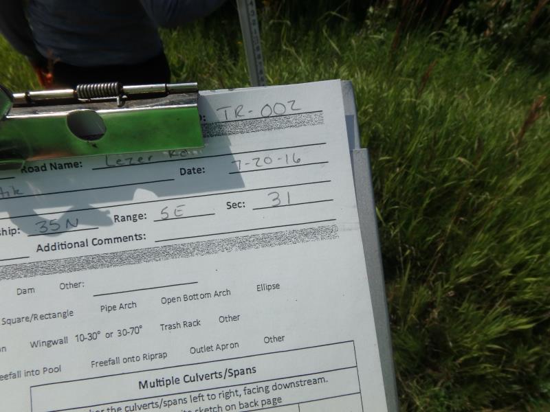
Road Stream Crossing Site CLHW_TR-002
Trout/Swan/Little Trout Watershed, Unnamed Creek
Lezer Rd
Rogers Twp,
Presque Isle County
Information collected by:
Site Location
GPS Coordinates: 45.3806
, -83.87065
T35N
R5E
Sec 31
Owned by Private
Fish Passability 0
Perch Height: 1.3 ft.
Total Erosion: 1.0354 tons/year
Severity: Severe
Year Inventoried: 2016
Site ID
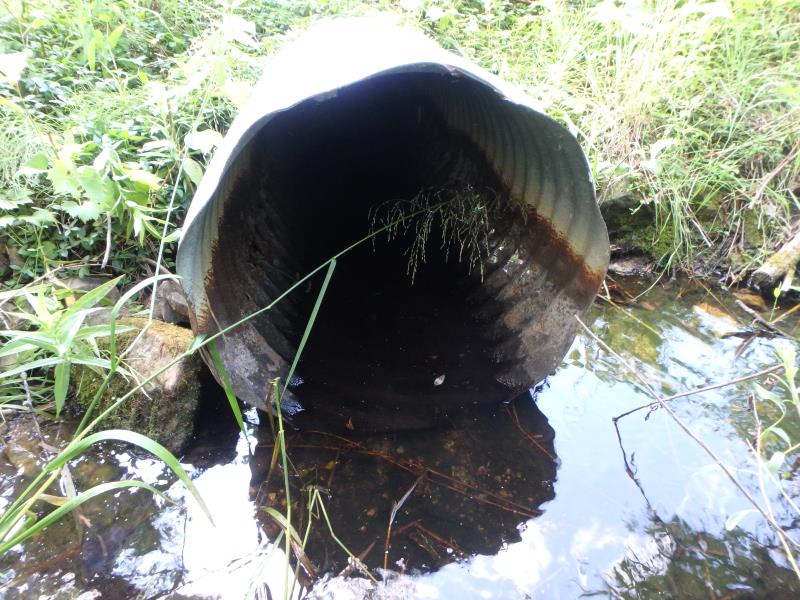
Inlet
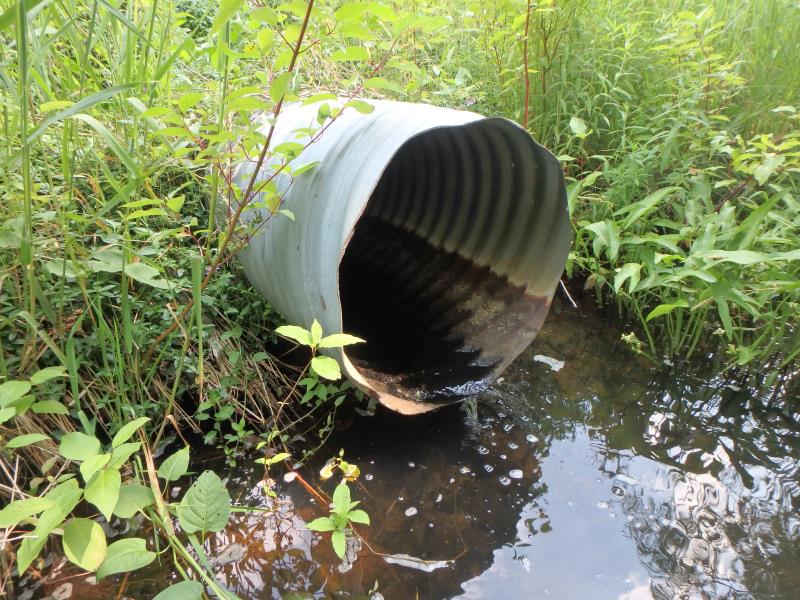
Outlet
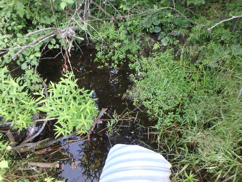
Upstream Conditions
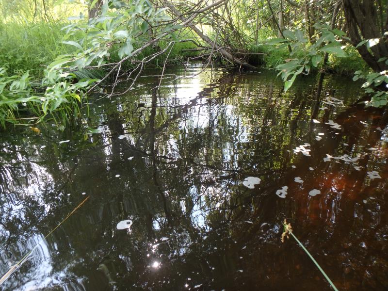
Downstream Conditions
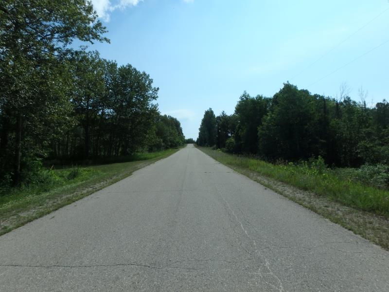
Road Approach - Left
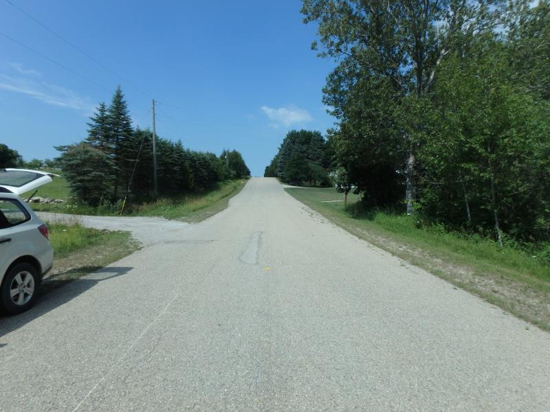
Road Approach - Right
Crossing Information
Type of Crossing: culvert(s)
Number of Structures: 1
Structure Shape: Round
Inlet Type: Projecting
Outlet Type: At Stream Grade
Structure Material: Metal
Structure Substrate: None
General Conditions: Poor
Structure Interior: corrugated
Structure is Rusted through
Dimensions of Structure: Length 72 ft.
, Width 2 ft.
, Height 2 ft.
Perch Height: 1.3 ft.
Structure Inlet
Water Depth: 0.2 ft.
Embedded Depth of Structure: 0 ft.
Water Velocity*: 0 ft./sec.
Water Depth: 0 ft.
Embedded Depth of Structure: 0 ft.
Water Velocity*: 0 ft./sec.
Stream Information
Stream Flow: None
Scour Pool: Length 0 ft.
, Width 0 ft.
, Depth 0 ft.
Upstream Pond: Length 0 ft.
, Width 0 ft.
, Depth 0 ft.
Riffle Information
Water Depth: 0 ft.
Bankfull Width: 0 ft.
Wetted Width: 0 ft.
Water Velocity: 0 ft./sec.
Road Information
Paved
County Road
Road Condition: Good
Road Width at Culvert: 23 ft.
Location of Low Point: At Stream
Runoff Path: Ditch
Embankments
Upstream
Fill Depth: 5 ft.
Slope: More than 1:2
Downstream
Fill Depth: 5.8 ft.
Slope: More than 1:2
Approaches
Left Approach
Length: 1000 ft.
Slope: 1% to 5%
Vegetation: Heavy
LS Factor: 0.57
Erosion: 0.4334 tons/year
Right Approach
Length: 488 ft.
Slope: 6% to 10%
Vegetation: Heavy
LS Factor: 1.622
Erosion: 0.602 tons/year
Erosion Information
Total Erosion at Crossing: 1.0354 tons/year
Summary Information
Fish Passability 0
�