Road Stream Crossing Site CLHW_TR-025
Trout/Swan/Little Trout Watershed, Little Trout River
E 638 Hwy
Pulawski Twp,
Presque Isle County
Information collected by:
Site Location
GPS Coordinates: 45.33478
, -83.6848
T34N
R6E
Sec 15
Owned by Private
Fish Passability 0.5
Structure is NOT Perched
Severity: Moderate
Year Inventoried: 2016
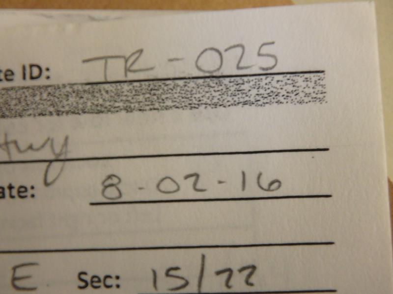
Site ID
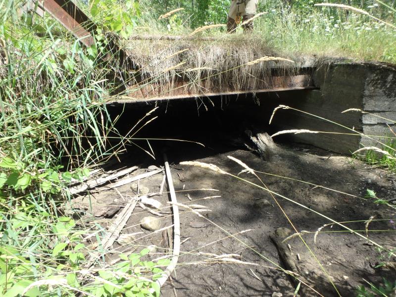
Inlet
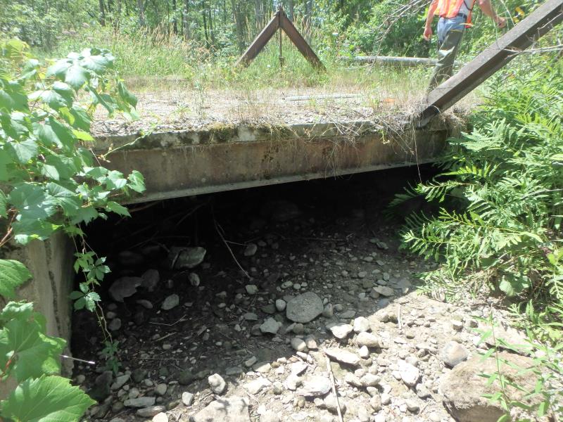
Outlet
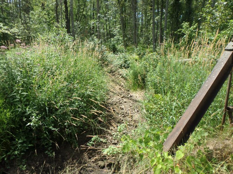
Upstream Conditions
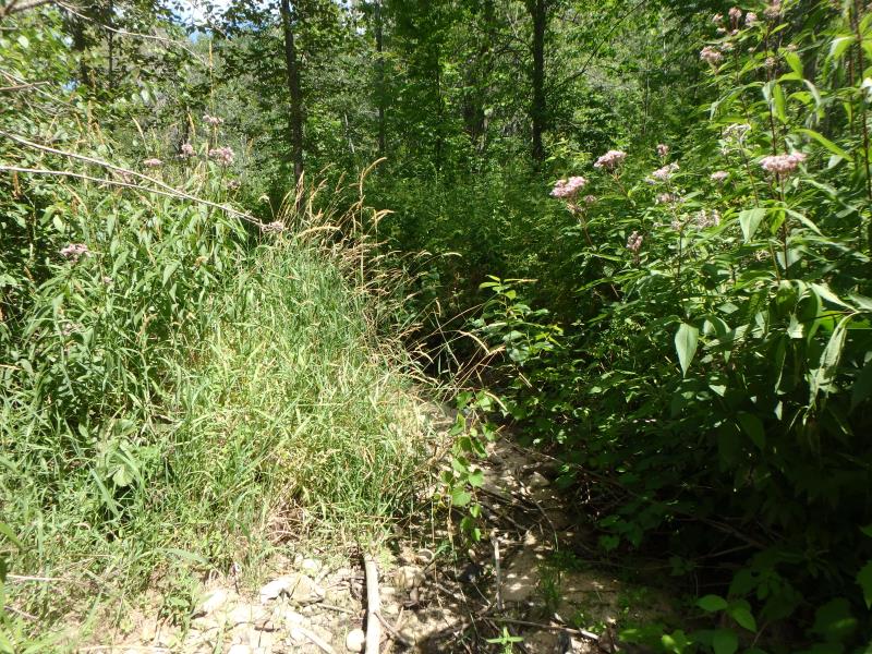
Downstream Conditions
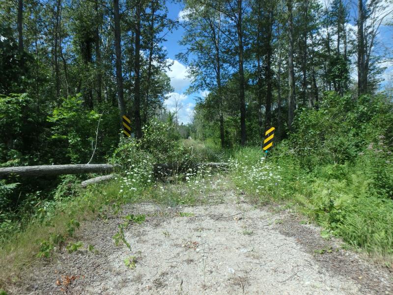
Road Approach - Left
Road Approach - Right
Crossing Information
Type of Crossing: Bridge
Structure Shape: Open Bottom Square/Rectangle
Inlet Type: Wingwall 10-30 Degree
Outlet Type: At Stream Grade
Structure Material: Concrete
Structure Substrate: Gravel
General Conditions: Poor
Structure Interior: smooth
Structure is Rusted through
Dimensions of Structure: Length 14 ft.
, Width 26 ft.
, Height 3 ft.
Percentage Crushed:
Inlet: 0%
Outlet: 0%
In Pipe: 1% to 25%
Structure is NOT Perched
Water Depth: 0 ft.
Embedded Depth of Structure: 0 ft.
Water Velocity*: 0 ft./sec.
Water Depth: 0 ft.
Embedded Depth of Structure: 0 ft.
Water Velocity*: 0 ft./sec.
Additional Comments
Road is closed at this bridge; cannot support the weight of traffic
Stream Information
Stream Flow: None
Scour Pool: Length 0 ft.
, Width 0 ft.
, Depth 0 ft.
Upstream Pond: Length 0 ft.
, Width 0 ft.
, Depth 0 ft.
Riffle Information
Water Depth: 0 ft.
Bankfull Width: 0 ft.
Wetted Width: 0 ft.
Water Velocity: 0 ft./sec.
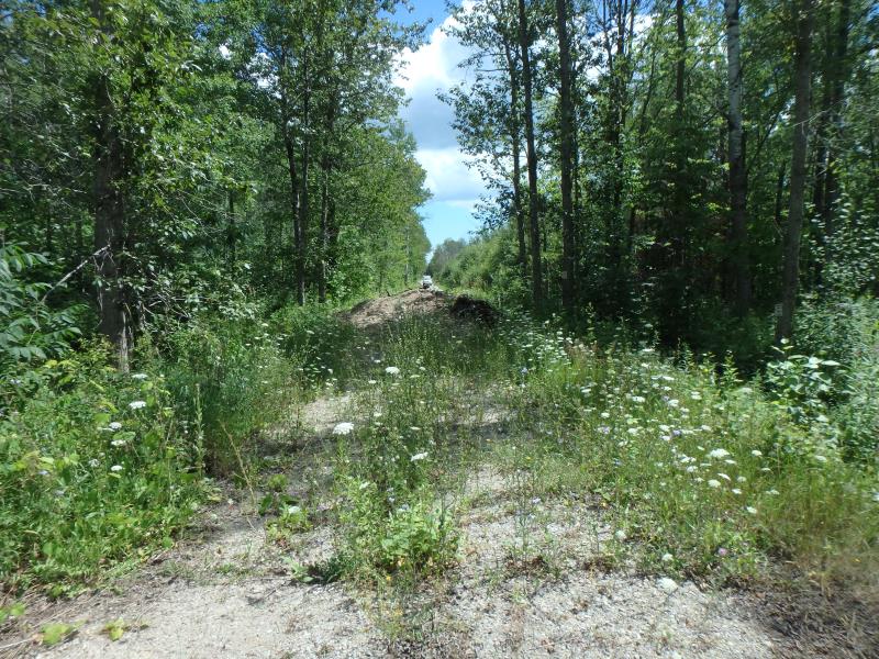
Road Information
Gravel
County Road
Road Condition: Poor
Road Width at Culvert: 12 ft.
Location of Low Point: Other
Runoff Path: Ditch
Fill Depth: 0 ft.
Fill Depth: 0 ft.
Length: 0 ft.
Vegetation: Heavy
Length: 0 ft.
Vegetation: Heavy
Erosion Information
Summary Information
Fish Passability 0.5
�