Road Stream Crossing Site TBW_TBAC113
Thunder Bay River Watershed, Little Wolf Creek tributary
Tower Road
Mitchell Twp,
Alcona County
Information collected by:
Site Location
GPS Coordinates: 44.71201
, -83.79214
T27N
R5E
Sec 23
Owned by Private
Fish Passability 0
Perch Height: 0.1 ft.
Total Erosion: 1.4687 tons/year
Severity: Severe
Year Inventoried: 2017
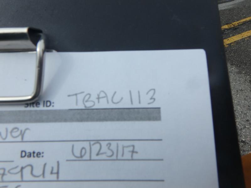
Site ID

Inlet
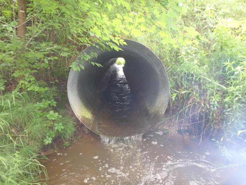
Outlet
Outlet
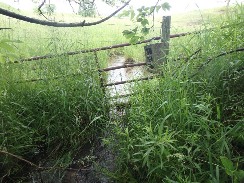
Upstream Conditions
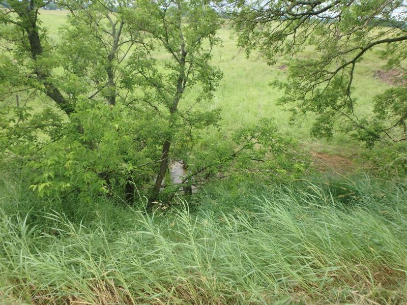
Upstream Conditions

Downstream Conditions
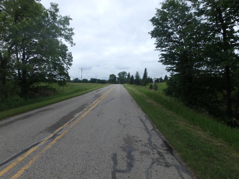
Road Approach - Left
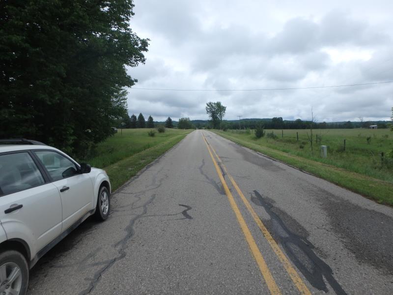
Road Approach - Right
Crossing Information
Type of Crossing: culvert(s)
Number of Structures: 1
Structure Shape: Round
Inlet Type: Projecting
Outlet Type: Freefall into Pool
Structure Material: Metal
Structure Substrate: None
General Conditions: Fair
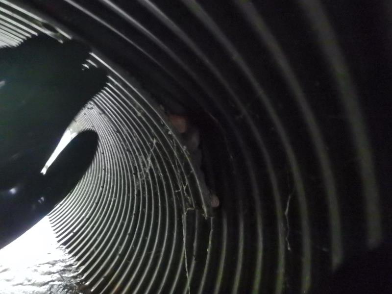
Structure Interior: corrugated
Structure is Rusted through
Dimensions of Structure: Length 71.5 ft.
, Width 5 ft.
, Height 5 ft.
Percentage Crushed:
In Pipe: 1% to 25%
Perch Height: 0.1 ft.
Structure Inlet
Water Depth: 0.6 ft.
Embedded Depth of Structure: 0 ft.
Water Velocity*: 1.6 ft./sec.
Structure Outlet
Water Depth: 0.4 ft.
Embedded Depth of Structure: 0 ft.
Water Velocity*: 3.7 ft./sec.
*Water Velocities were measured 0.3 ft. below Surface
(with Meter)
Stream Information
Stream Flow: Bankfull
Scour Pool: Length 16 ft.
, Width 9 ft.
, Depth 1.6 ft.
Riffle Information
Water Depth: 0.8 ft.
Bankfull Width: 4.7 ft.
Wetted Width: 4.7 ft.
Water Velocity: 1.2 ft./sec.
(Measured with Float Test)
Dominant Substrate: Clay
Road Information
Paved
County Road
Road Condition: Fair
Road Width at Culvert: 21 ft.
Location of Low Point: At Stream
Runoff Path: Ditch
Embankments
Upstream
Fill Depth: 13 ft.
Slope: 1:1
Downstream
Fill Depth: 10 ft.
Slope: 1:1
Approaches
Left Approach
Length: 320 ft.
Slope: 1% to 5%
Vegetation: Heavy
LS Factor: 0.464
Erosion: 0.1031 tons/year
Right Approach
Length: 0 ft.
Slope: Less Than 1%
Vegetation: Heavy
LS Factor: 0.05
Erosion: 0 tons/year
Erosion Information
Total Erosion at Crossing: 1.4687 tons/year
Extent of Erosion: Severe
Notes: STREAMBANK ERODING ON BEND
Location of Erosion | Erosion Dimensions | Eroded Material | Material Eroded | Total Erosion | ||
facing downstream | Length | Width | Depth | Reaching Stream? | (tons/year) | |
Left Upstream Embankment |
4 ft. |
4.6 ft. |
1.5 ft. |
yes |
Loam |
0.1056 |
Left Downstream Streambank |
30 ft. |
14 ft. |
3 ft. |
yes |
Clay |
1.26 |
Summary Information
Fish Passability 0
Erosion is an area of concern for this site.
ALTHOUGH THIS IS A PASSAGE BARRIER EROSION APPEARS TO BE MORE OF AN ISSUE THAN VALUABLE FISH PASSAGE BECAUSE OF THE LACK OF UPSTREAM MILES.
�