Road Stream Crossing Site TBW_TBAC141
Thunder Bay River Watershed, Buck's Pond
Lakesided Trail
Mitchell Twp,
Alcona County
Information collected by:
Site Location
GPS Coordinates: 44.69875
, -83.69463
T27N
R6E
Sec 27
Owned by Private
Fish Passability 0
Perch Height: 1.3 ft.
Total Erosion: 2.4194 tons/year
Severity: Severe
Year Inventoried: 2017
Site ID
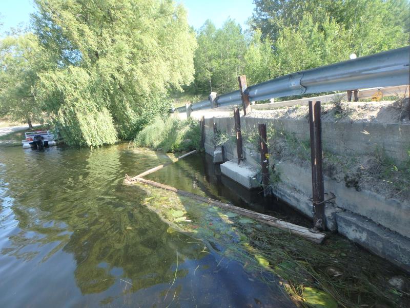
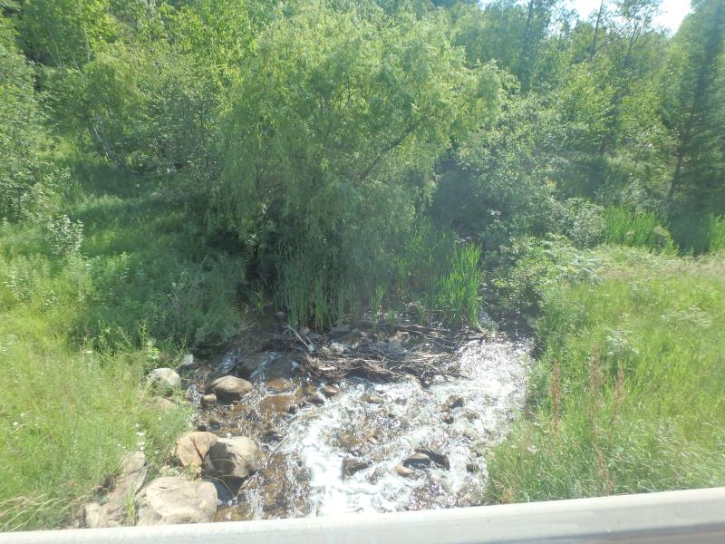
Inlet
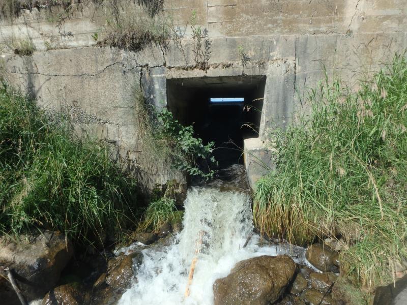
Outlet
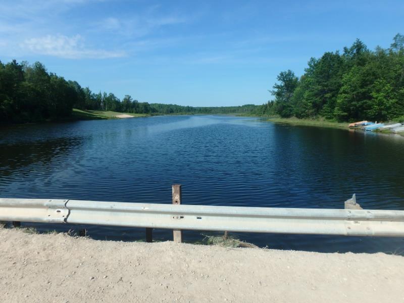
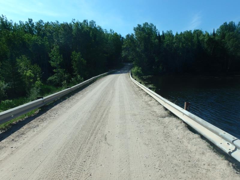
Upstream Conditions
Downstream Conditions
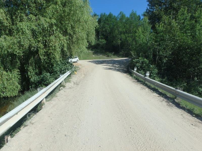
Road Approach - Left
Road Approach - Right
Crossing Information
Type of Crossing: Dam
Structure Shape: Square/Rectangle
Inlet Type: Headwall
Outlet Type: Cascade over Riprap
Structure Material: Concrete
Structure Substrate: None
General Conditions: Poor
Structure Interior: smooth
Dimensions of Structure: Length 16 ft.
, Width 4.1 ft.
, Height 4.8 ft.
Perch Height: 1.3 ft.
Structure Inlet
Water Depth: 0.3 ft.
Embedded Depth of Structure: 0 ft.
Water Velocity*: 3.9 ft./sec.
Structure Outlet
Water Depth: 0.3 ft.
Embedded Depth of Structure: 0 ft.
Water Velocity*: 10.2 ft./sec.
*Water Velocities were measured at the Surface
(with Meter)
Additional Comments
DAM IS WASHED OUT UNDERNEATH ON DOWNSTREAM SIDE
Stream Information
Stream Flow: Less than Bankfull
Upstream Pond: Length 1000 ft.
, Width 1000 ft.
Riffle Information
Water Depth: 0.8 ft.
Bankfull Width: 12 ft.
Wetted Width: 8.7 ft.
Water Velocity: 2 ft./sec.
(Measured with Meter)
Dominant Substrate: Gravel
Road Information
Sand
Private Road
(Seasonal)
Road Condition: Fair
Road Width at Culvert: 16 ft.
Location of Low Point: At Stream
Runoff Path: Roadway
Fill Depth: 0 ft.
Slope: Vertical
Fill Depth: 0 ft.
Slope: Vertical
Approaches
Left Approach
Length: 246 ft.
Slope: 6% to 10%
Vegetation: Heavy
LS Factor: 1.313
Erosion: 1.4235 tons/year
Right Approach
Length: 363 ft.
Slope: 1% to 5%
Vegetation: Heavy
LS Factor: 0.473
Erosion: 0.7562 tons/year
Erosion Information
Total Erosion at Crossing: 2.4194 tons/year
Extent of Erosion: Minor
Location of Erosion | Erosion Dimensions | Eroded Material | Material Eroded | Total Erosion | ||
facing downstream | Length | Width | Depth | Reaching Stream? | (tons/year) | |
Left Approach |
218 ft. |
2 ft. |
1 ft. |
yes |
Sand |
0.2398 |
Summary Information
Fish Passability 0
Fish Passage is an area of concern for this site.
DAM/VELOCITY
These non-native species were observerd at this site: Spotted Knapweed
�