Road Stream Crossing Site TBW_TBAC94
Thunder Bay River Watershed, Yoder Creek
M 65
Mitchell Twp,
Alcona County
Information collected by:
Site Location
GPS Coordinates: 44.72342
, -83.80762
T27N
R5E
Sec 23
Owned by Private
Fish Passability 0
Structure is NOT Perched
Total Erosion: 0.6783 tons/year
Severity: Severe
Year Inventoried: 2017
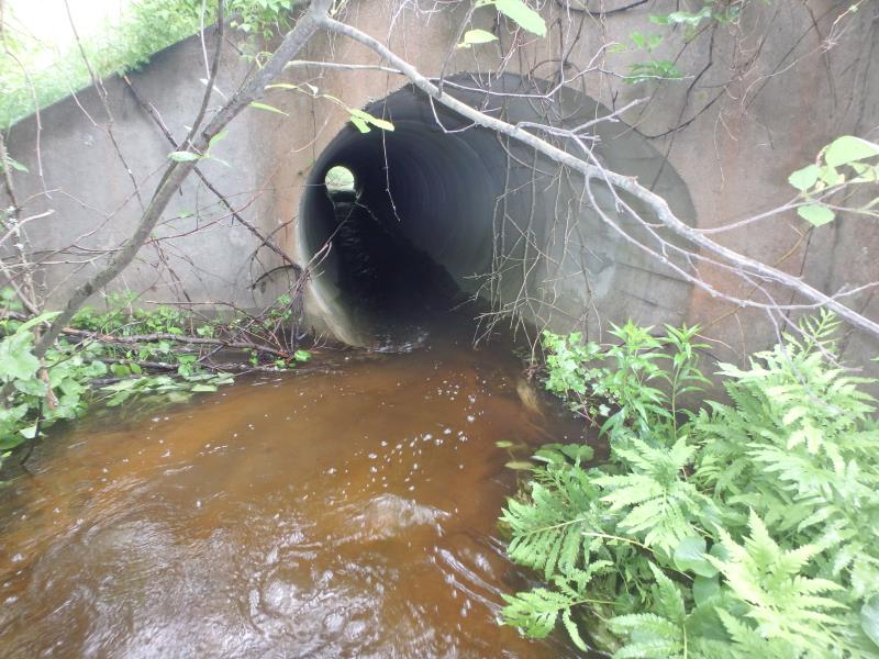
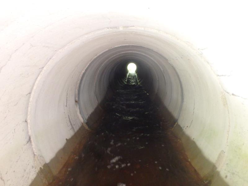
Inlet
Outlet
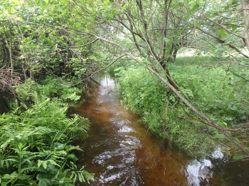
Upstream Conditions
Downstream Conditions
Crossing Information
Type of Crossing: culvert(s)
Number of Structures: 1
Structure Shape: Round
Inlet Type: Wingwall 30-70 Degree
Outlet Type: Outlet Apron
Structure Material: Concrete
Structure Substrate: None
General Conditions: Fair
Structure Interior: smooth
Dimensions of Structure: Length 110 ft.
, Width 6 ft.
, Height 6.1 ft.
Structure is NOT Perched
Structure Inlet
Water Depth: 0.9 ft.
Embedded Depth of Structure: 0 ft.
Water Velocity*: 3.6 ft./sec.
Structure Outlet
Water Depth: 1.5 ft.
Embedded Depth of Structure: 0 ft.
Water Velocity*: 8.7 ft./sec.
*Water Velocities were measured 0.4 ft. below Surface
(with Meter)
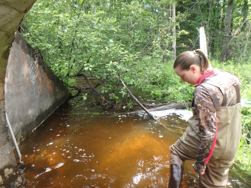
Additional Comments
CULVERT HAS A LOW END CAUSING EXTREME VELOCITY IN PIPE. OUTLET VELOCITY WAS TESTED AT 0.8 FT/SEC, BUT THE MIDDLE VELOCITY WAS ENTERED IN THE FORM INSTEAD TO FLAG THIS SITE AS A VELOCITY BARRIER. VELOCITY IN THE PIPE TESTED AT 8.7 FT/SEC. WATER HAS ALSO ERODED THE CONCRETE ON THE INLET AWAY.
Stream Information
Stream Flow: Bankfull
Riffle Information
Water Depth: 1.1 ft.
Bankfull Width: 14.5 ft.
Wetted Width: 12 ft.
Water Velocity: 1.1 ft./sec.
(Measured with Meter)
Dominant Substrate: Sand
Road Information
Paved
State Road
Road Condition: Good
Road Width at Culvert: 36 ft.
Location of Low Point: Other
Runoff Path: Ditch
Embankments
Upstream
Fill Depth: 10 ft.
Slope: More than 1:2
Downstream
Fill Depth: 9.5 ft.
Slope: More than 1:2
Approaches
Left Approach
Length: 0 ft.
Slope: 1% to 5%
Vegetation: Heavy
LS Factor: 0.26
Erosion: 0 tons/year
Right Approach
Length: 1000 ft.
Slope: 1% to 5%
Vegetation: Heavy
LS Factor: 0.57
Erosion: 0.6783 tons/year
Erosion Information
Total Erosion at Crossing: 0.6783 tons/year
Extent of Erosion: Minor
Notes: CULVERT ERODING, CONCRETE FROM THE TOP OF THE CULVERT FELL ON ME WHILE IN THE CULVERT
Summary Information
Fish Passability 0
Fish Passage is an area of concern for this site.
VELOCITY
A future visit to this site is recommended. PASSAGE BARRIER AND EROSION
�