Road Stream Crossing Site TBW_TBAP105
Thunder Bay River Watershed, Unnamed tributary to Thunder Bay River
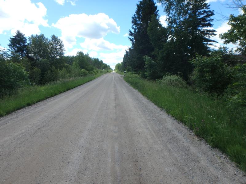
Calcut Road
Green Twp,
Alpena County
Information collected by:
Site Location
GPS Coordinates: 45.05864
, -83.78111
T31N
R5E
Sec 26
Owned by Private
Fish Passability 0
Perch Height: 0.1 ft.
Total Erosion: 3.8718 tons/year
Severity: Severe
Year Inventoried: 2017

Site ID
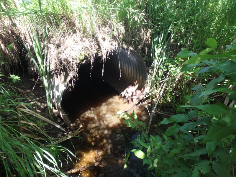
Inlet
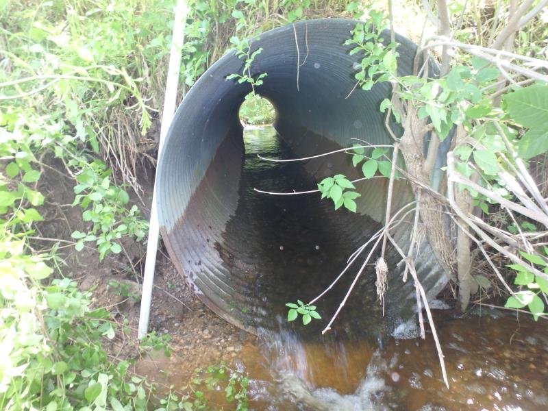
Outlet
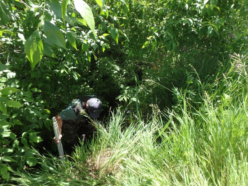
Upstream Conditions
Downstream Conditions
Road Approach - Left
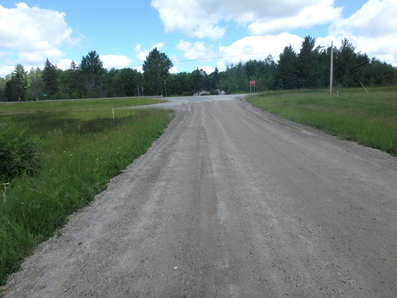
Road Approach - Left
other
Crossing Information
Type of Crossing: culvert(s)
Number of Structures: 1
Structure Shape: Round
Inlet Type: Projecting
Outlet Type: Freefall into Pool
Structure Material: Metal
Structure Substrate: None
General Conditions: Fair
Structure Interior: corrugated
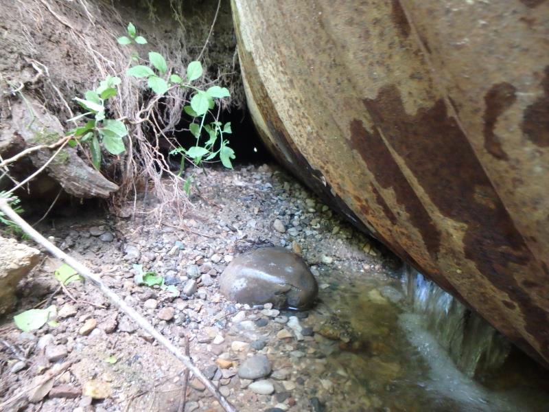
Structure is Rusted through
Dimensions of Structure: Length 37 ft.
, Width 4 ft.
, Height 4 ft.
Perch Height: 0.1 ft.
Structure Inlet
Water Depth: 0.7 ft.
Embedded Depth of Structure: 0 ft.
Water Velocity*: 0.8 ft./sec.
Structure Outlet
Water Depth: 0.3 ft.
Embedded Depth of Structure: 0 ft.
Water Velocity*: 5.3 ft./sec.
*Water Velocities were measured 0.4 ft. below Surface
(with Meter)
Additional Comments
WASHING OUT UNDER ROAD (BOTTOM RIGHT SIDE OF CULVERT SEE PHOTO)
Stream Information
Stream Flow: Bankfull
Riffle Information
Water Depth: 1.4 ft.
Bankfull Width: 8 ft.
Wetted Width: 17 ft.
Water Velocity: 0.1 ft./sec.
(Measured with Meter)
Dominant Substrate: Cobble
Road Information
Sand
County Road
Road Condition: Good
Road Width at Culvert: 20 ft.
Location of Low Point: At Stream
Runoff Path: Ditch
Embankments
Upstream
Fill Depth: 2 ft.
Slope: Vertical
Downstream
Fill Depth: 2.5 ft.
Slope: 1:1.5
Approaches
Left Approach
Length: 1000 ft.
Slope: 1% to 5%
Vegetation: Heavy
LS Factor: 0.57
Erosion: 3.1405 tons/year
Right Approach
Length: 180 ft.
Slope: 1% to 5%
Vegetation: Heavy
LS Factor: 0.418
Erosion: 0.4145 tons/year
Erosion Information
Total Erosion at Crossing: 3.8718 tons/year
Extent of Erosion: Severe
Notes: SOIL HAS WASHED OUT AT THE BOTTOM OF CULVERT. CAN SEE THROUGH FROM ONE SIDE OF THE ROAD TO THE OTHER.
Location of Erosion | Erosion Dimensions | Eroded Material | Material Eroded | Total Erosion | ||
facing downstream | Length | Width | Depth | Reaching Stream? | (tons/year) | |
Right Upstream Embankment |
4 ft. |
3 ft. |
3 ft. |
yes |
Loam |
0.2112 |
Left Upstream Embankment |
3 ft. |
3 ft. |
2 ft. |
yes |
Loam |
0.1056 |
Summary Information
Fish Passability 0
Fish Passage is an area of concern for this site.
PERCHED OUTLET
A future visit to this site is recommended. FISH PASSAGE & TRIB TO THUNDER BAY
These non-native species were observerd at this site: Autumn Olive and Spotted Knapweed
�