Road Stream Crossing Site TBW_TBAP170
Thunder Bay River Watershed, Lower South Branch Thunder Bay River
Hubert Road
Ossineke Twp,
Alpena County
Information collected by:
Site Location
GPS Coordinates: 44.85033
, -83.60824
T29N
R7E
Sec 33
Owned by Private
Fish Passability 0
Structure is NOT Perched
Total Erosion: 0.9205 tons/year
Severity: Severe
Year Inventoried: 2017
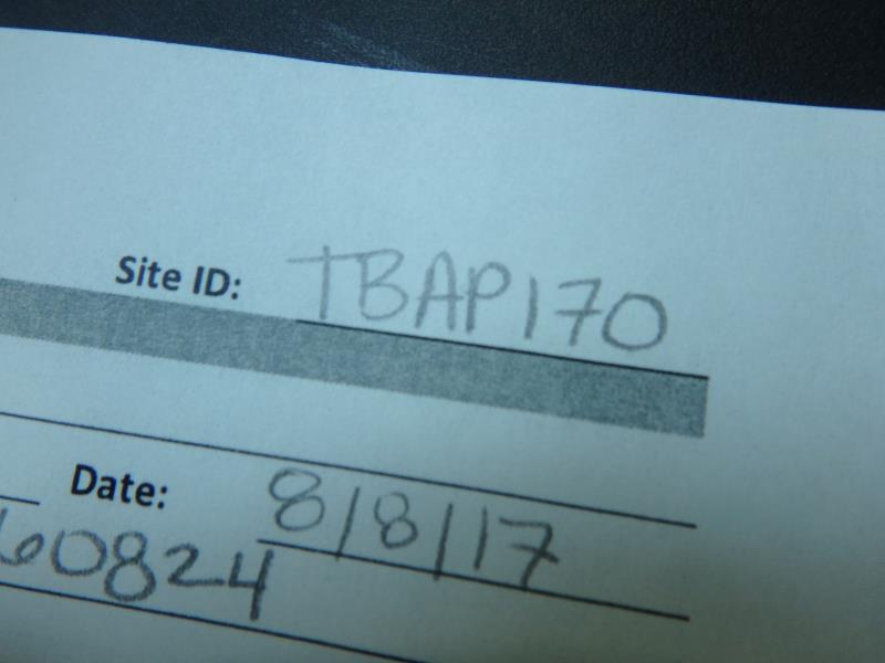
Site ID
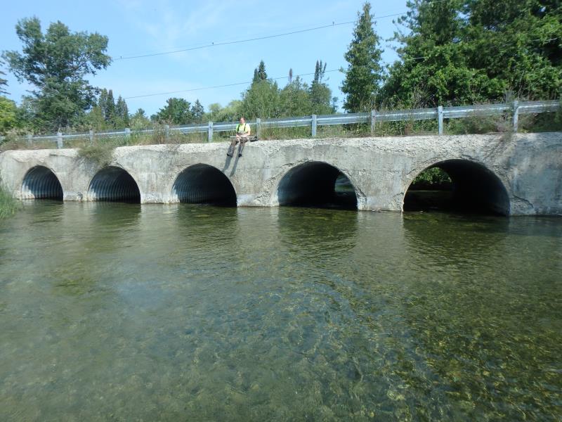
Inlet
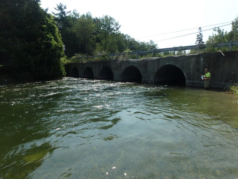
Outlet
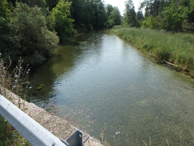
Upstream Conditions
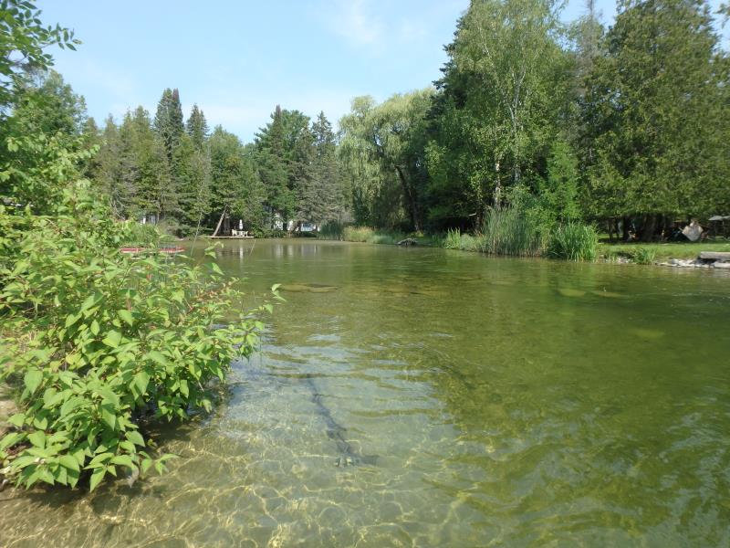
Downstream Conditions
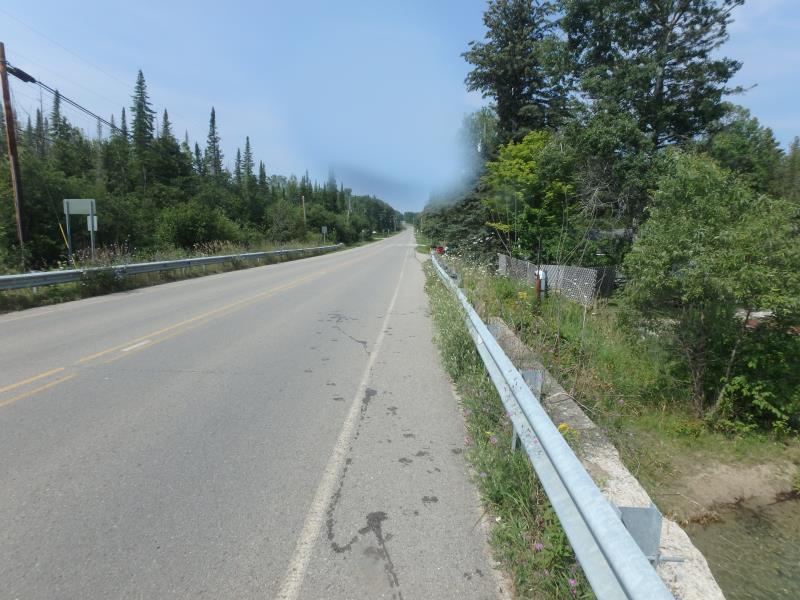
Road Approach - Left
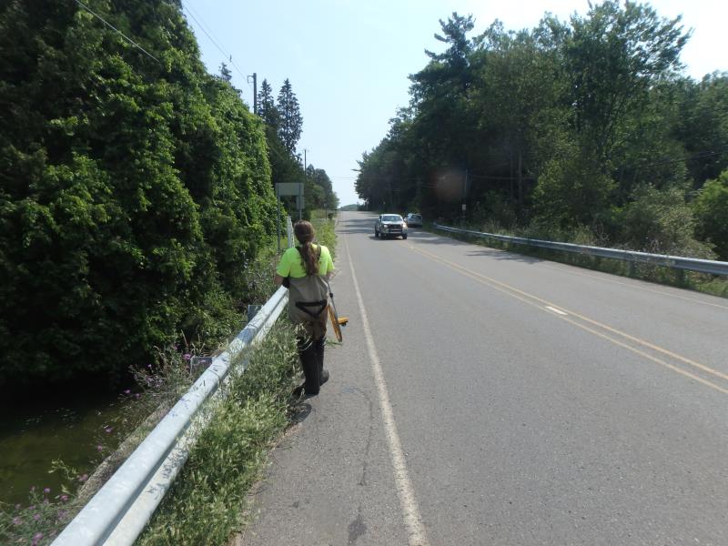
Road Approach - Right
Crossing Information
Type of Crossing: culvert(s)
Number of Structures: 5
Structure Shape: Pipe Arch
Inlet Type: Projecting
Outlet Type: At Stream Grade
Structure Material: Metal
Structure Substrate: Rock
General Conditions: Fair
Multiple Culverts/Spans | ||||
Culvert/Span | Width | Length | Height | Material |
1 |
9 ft. |
36 ft. |
6.2 ft. |
Metal |
2 |
9 ft. |
36 ft. |
6.2 ft. |
Metal |
3 |
9 ft. |
36 ft. |
6.2 ft. |
Metal |
Structure Interior: corrugated
Dimensions of Structure: Length 36 ft.
, Width 9 ft.
, Height 6.2 ft.
Structure is NOT Perched
Structure Inlet
Water Depth: 1.3 ft.
Embedded Depth of Structure: 0.1 ft.
Water Velocity*: 5.5 ft./sec.
Structure Outlet
Water Depth: 1.4 ft.
Embedded Depth of Structure: 0 ft.
Water Velocity*: 3.3 ft./sec.
*Water Velocities were measured 0.8 ft. below Surface
(with Meter)
Additional Comments
ALL 5 CULVERTS WERE THE SAME SIZE
Stream Information
Stream Flow: Less than Bankfull
Scour Pool: Length 30 ft.
, Width 75 ft.
, Depth 8 ft.
Riffle Information
Water Depth: 3.3 ft.
Bankfull Width: 42 ft.
Wetted Width: 39 ft.
Water Velocity: 1.5 ft./sec.
(Measured with Meter)
Dominant Substrate: Gravel
Road Information
Paved
County Road
Road Condition: Fair
Road Width at Culvert: 30 ft.
Location of Low Point: At Stream
Runoff Path: Ditch
Fill Depth: 0 ft.
Slope: Vertical
Fill Depth: 0 ft.
Slope: Vertical
Approaches
Left Approach
Length: 0 ft.
Slope: Less Than 1%
Vegetation: Heavy
LS Factor: 0.05
Erosion: 0 tons/year
Right Approach
Length: 550 ft.
Slope: 6% to 10%
Vegetation: Heavy
LS Factor: 1.688
Erosion: 0.9205 tons/year
Erosion Information
Total Erosion at Crossing: 0.9205 tons/year
Extent of Erosion: Stabilized
Erosion is occurring and corrective actions can be installed to address the problem.
Summary Information
Fish Passability 0
Fish Passage is an area of concern for this site.
VELOCITY
These non-native species were observerd at this site: Reed Canary Grass, Zebra Mussels, Rusty Crayfish, Spotted Knapweed
�