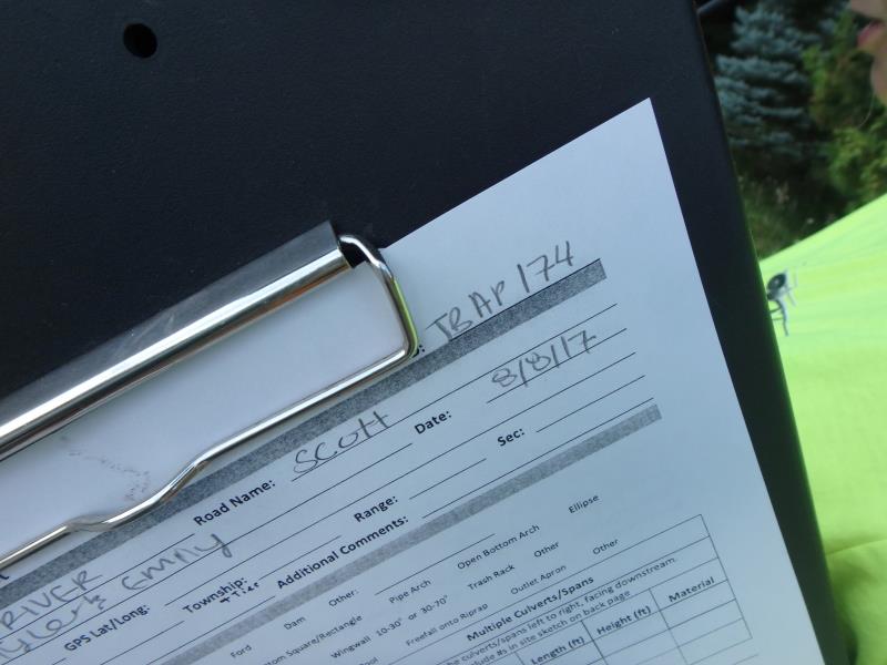
Road Stream Crossing Site TBW_TBAP174
Thunder Bay River Watershed, Lower South Branch Thunder Bay River
Scott Road
Ossineke Twp,
Alpena County
Information collected by:
Site Location
GPS Coordinates: 44.87365
, -83.59328
T29N
R7E
Sec 28
Owned by Private
Fish Passability 0.5
Structure is NOT Perched
Total Erosion: 1.5768 tons/year
Severity: Moderate
Year Inventoried: 2017
Site ID
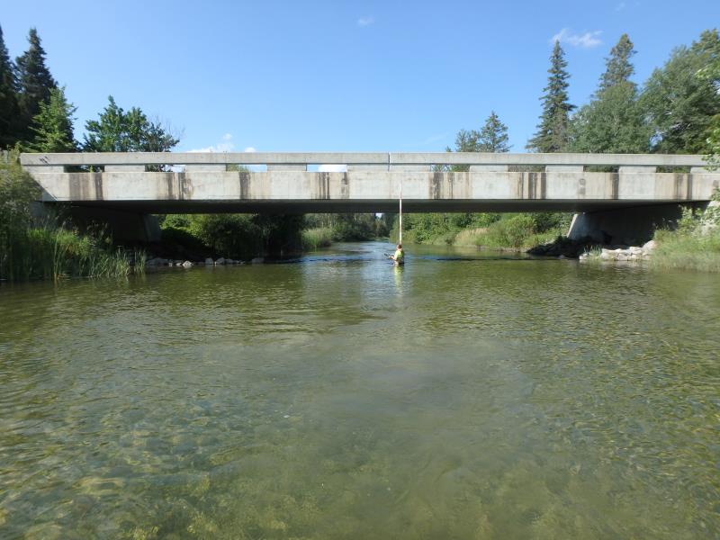
Inlet
Outlet
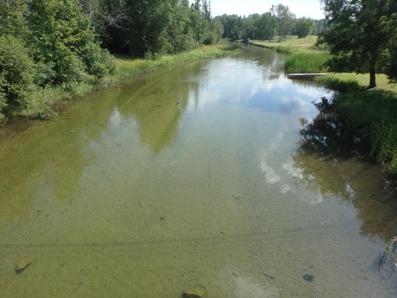
Upstream Conditions
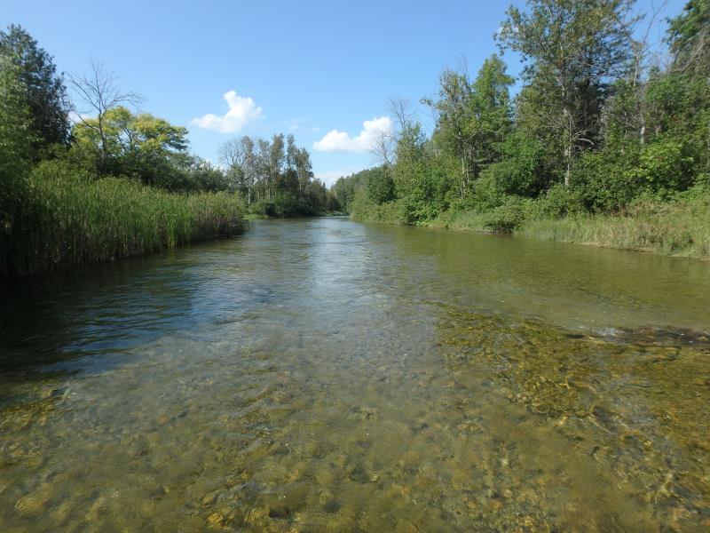
Downstream Conditions
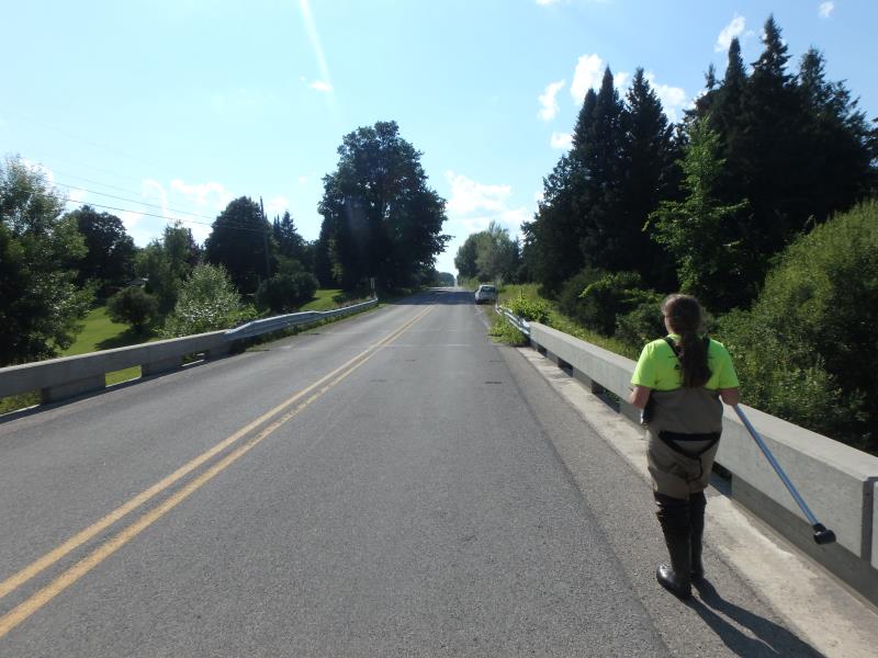
Road Approach - Left
Road Approach - Right
Crossing Information
Type of Crossing: Bridge
Structure Shape: Open Bottom Square/Rectangle
Inlet Type: Projecting
Outlet Type: At Stream Grade
Structure Material: Concrete
Structure Substrate: None
General Conditions: Good
Structure Interior: smooth
Dimensions of Structure: Length 30 ft.
, Width 84.5 ft.
, Height 11 ft.
Structure is NOT Perched
Structure Inlet
Water Depth: 2.9 ft.
Embedded Depth of Structure: 0 ft.
Water Velocity*: 2 ft./sec.
Structure Outlet
Water Depth: 4.3 ft.
Embedded Depth of Structure: 0 ft.
Water Velocity*: 1.7 ft./sec.
*Water Velocities were measured 1.3 ft. below Surface
(with Meter)
Additional Comments
2000 BUILD
Stream Information
Stream Flow: Less than Bankfull
Riffle Information
Water Depth: 1.3 ft.
Bankfull Width: 58 ft.
Wetted Width: 56 ft.
Water Velocity: 3.1 ft./sec.
(Measured with Meter)
Dominant Substrate: Cobble
Road Information
Paved
County Road
Road Condition: Fair
Road Width at Culvert: 30 ft.
Location of Low Point: At Stream
Runoff Path: Ditch
Fill Depth: 0 ft.
Slope: Vertical
Fill Depth: 0 ft.
Slope: Vertical
Approaches
Left Approach
Length: 484 ft.
Slope: 6% to 10%
Vegetation: Heavy
LS Factor: 1.618
Erosion: 0.7767 tons/year
Right Approach
Length: 495 ft.
Slope: 6% to 10%
Vegetation: Heavy
LS Factor: 1.63
Erosion: 0.8001 tons/year
Erosion Information
Total Erosion at Crossing: 1.5768 tons/year
Extent of Erosion: Stabilized
Summary Information
Fish Passability 0.5
These non-native species were observerd at this site: Spotted Knapweed, Queen Anne's Lace, and Zebra Mussels
�