Road Stream Crossing Site TBW_TBAP180
Thunder Bay River Watershed, Lower South Branch Thunder Bay River
W Nicholson Hill Road
Ossineke Twp,
Alpena County
Information collected by:
Site Location
GPS Coordinates: 44.90266
, -83.57738
T29N
R7E
Sec 15
Owned by Private
Fish Passability 0
Structure is NOT Perched
Total Erosion: 8.5473 tons/year
Severity: Severe
Year Inventoried: 2017
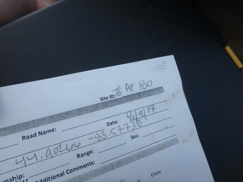
Site ID
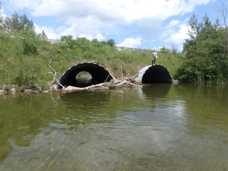
Inlet
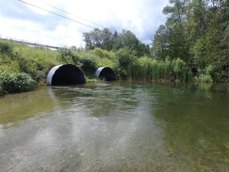
Outlet
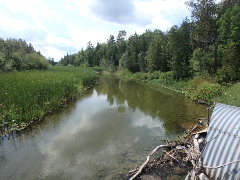
Upstream Conditions
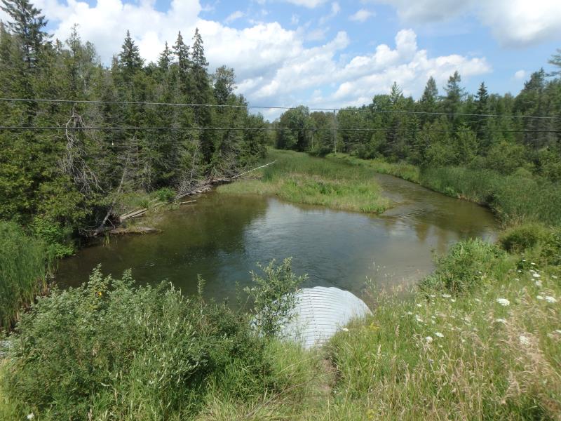
Downstream Conditions
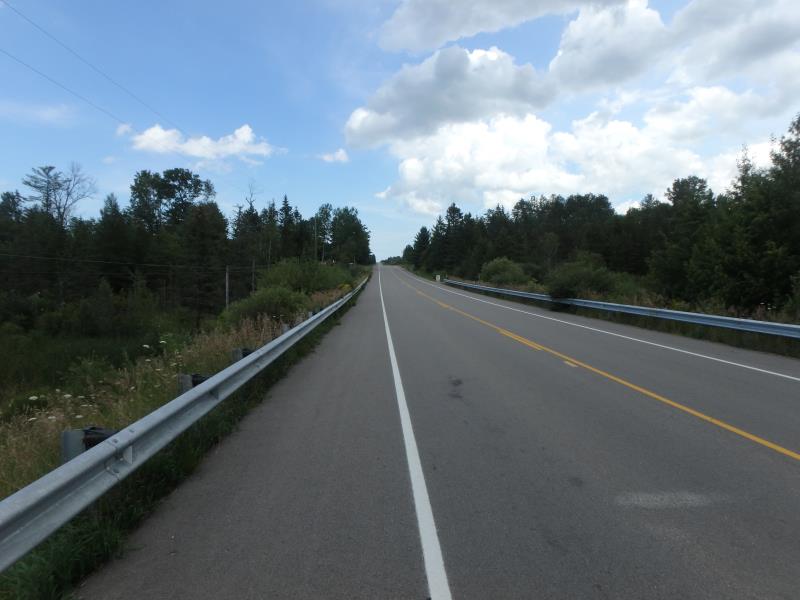
Road Approach - Left
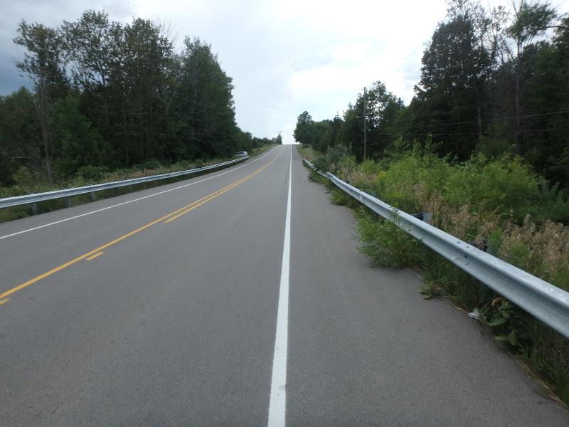
Road Approach - Right
Crossing Information
Type of Crossing: culvert(s)
Number of Structures: 2
Structure Shape: Pipe Arch
Inlet Type: Projecting
Outlet Type: At Stream Grade
Structure Material: Metal
Structure Substrate: None
General Conditions: Fair
Multiple Culverts/Spans | ||||
Culvert/Span | Width | Length | Height | Material |
1 |
16.5 ft. |
93 ft. |
9 ft. |
Metal |
2 |
16.5 ft. |
93 ft. |
9 ft. |
Metal |
Structure Interior: corrugated
Dimensions of Structure: Length 93 ft.
, Width 33 ft.
, Height 9 ft.
Percentage Plugged:
Inlet: 1% to 25%
Structure is NOT Perched
Structure Inlet
Water Depth: 2 ft.
Embedded Depth of Structure: 0 ft.
Water Velocity*: 3.7 ft./sec.
Structure Outlet
Water Depth: 2.6 ft.
Embedded Depth of Structure: 0 ft.
Water Velocity*: 3.2 ft./sec.
*Water Velocities were measured 1 ft. below Surface
(with Meter)
Stream Information
Stream Flow: Less than Bankfull
Scour Pool: Length 70 ft.
, Width 70 ft.
, Depth 10 ft.
Riffle Information
Water Depth: 1.8 ft.
Bankfull Width: 77 ft.
Wetted Width: 75 ft.
Water Velocity: 2.2 ft./sec.
(Measured with Meter)
Dominant Substrate: Gravel
Road Information
Paved
County Road
Road Condition: Good
Road Width at Culvert: 33 ft.
Location of Low Point: At Stream
Runoff Path: Ditch
Embankments
Upstream
Fill Depth: 9 ft.
Slope: 1:2
Downstream
Fill Depth: 9 ft.
Slope: 1:2
Approaches
Left Approach
Length: 1000 ft.
Slope: More Than 10%
Vegetation: Heavy
LS Factor: 5.785
Erosion: 6.3109 tons/year
Right Approach
Length: 1000 ft.
Slope: 6% to 10%
Vegetation: Heavy
LS Factor: 2.05
Erosion: 2.2364 tons/year
Erosion Information
Total Erosion at Crossing: 8.5473 tons/year
Extent of Erosion: Minor
Erosion is occurring and corrective actions can be installed to address the problem.
Summary Information
Fish Passability 0
Fish Passage is an area of concern for this site.
VELOCITY
These non-native species were observerd at this site: Spotted Knapweed, Queen Anne's Lace, Autumn Olive, and Reed Canary Grass
�