Road Stream Crossing Site TBW_TBAP226
Thunder Bay River Watershed, North Branch Thunder Bay River
Wikaryasz Road
Maple Ridge Twp,
Alpena County
Information collected by:
Site Location
GPS Coordinates: 45.17802
, -83.62698
T32N
R7E
Sec 07
Owned by Private
Fish Passability 1
Structure is NOT Perched
Total Erosion: 9.4327 tons/year
Severity: Severe
Year Inventoried: 2017
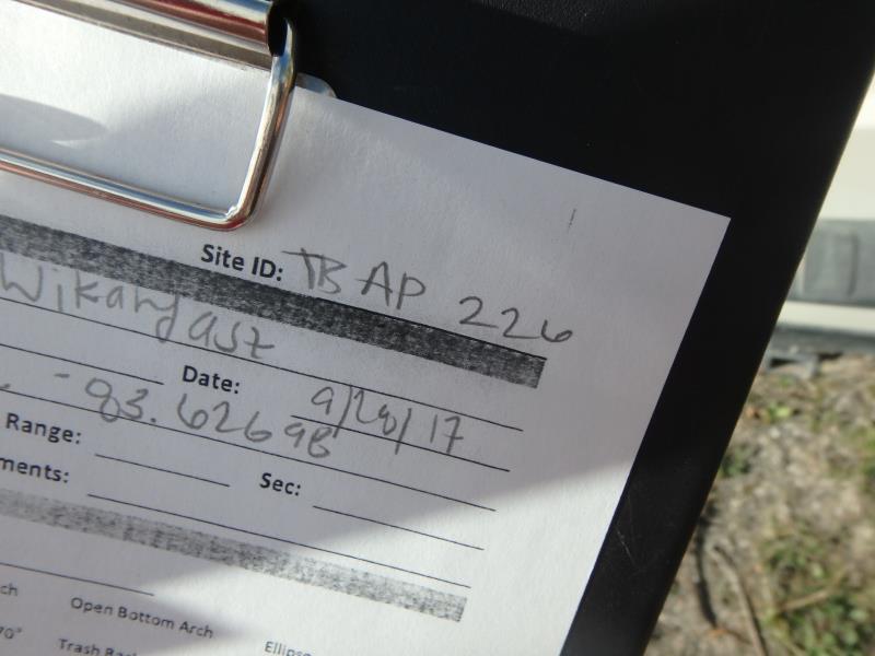
Site ID
Inlet
Outlet
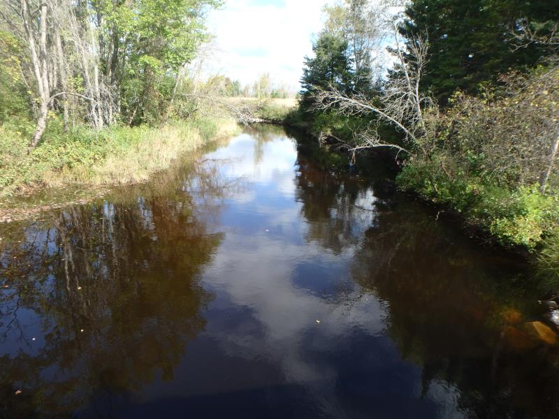
Upstream Conditions
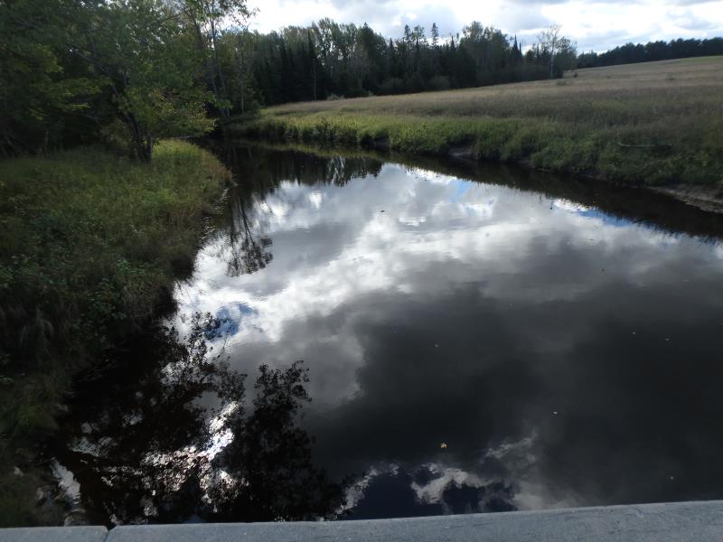
Downstream Conditions
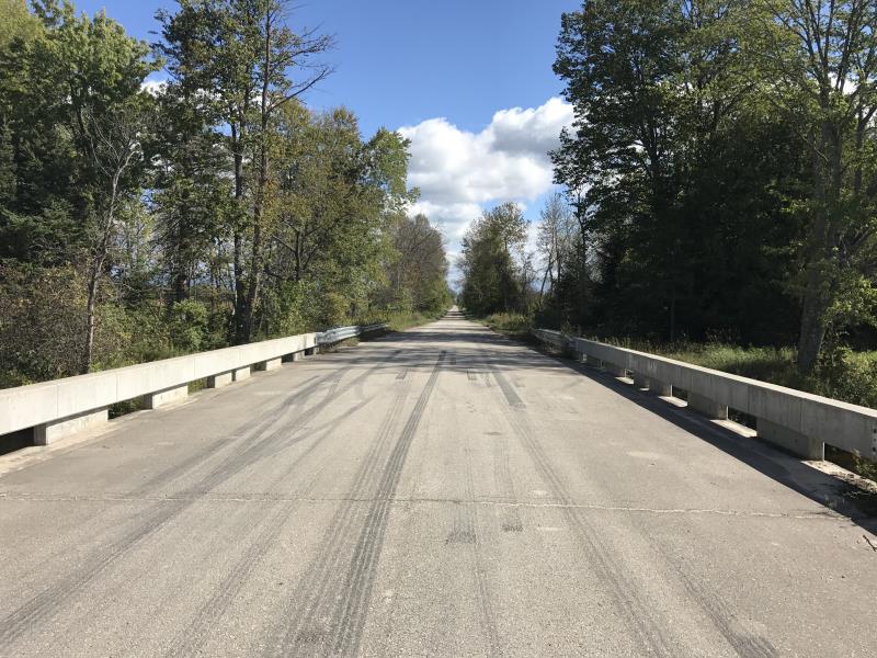
Road Approach - Left
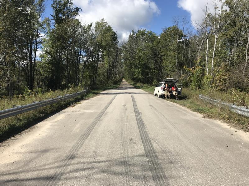
Road Approach - Right
Crossing Information
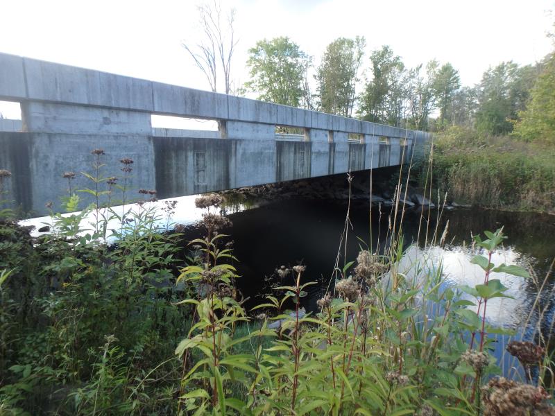
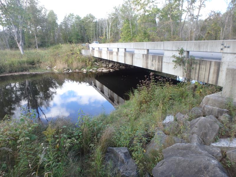
Type of Crossing: Bridge
Structure Shape: Open Bottom Square/Rectangle
Inlet Type: Projecting
Outlet Type: At Stream Grade
Structure Material: Concrete
Structure Substrate: Mixture
General Conditions: Good
Structure Interior: smooth
Dimensions of Structure: Length 62 ft.
, Width 30 ft.
, Height 10 ft.
Structure is NOT Perched
Structure Inlet
Water Depth: 4.6 ft.
Water Velocity*: 0.3 ft./sec.
Structure Outlet
Water Depth: 4.5 ft.
Water Velocity*: 0.3 ft./sec.
*Water Velocities were measured at the Surface
(with Float Test)
Additional Comments
BRIDGE BUILT IN 2006
Stream Information
Stream Flow: Less than 1/2 Bankfull
Riffle Information
Water Depth: 0.7 ft.
Bankfull Width: 59 ft.
Wetted Width: 52 ft.
Water Velocity: 2.2 ft./sec.
(Measured with Meter)
Dominant Substrate: Cobble
Road Information
Sand
County Road
Road Condition: Fair
Road Width at Culvert: 30 ft.
Location of Low Point: At Stream
Runoff Path: Roadway
Fill Depth: 0 ft.
Slope: Vertical
Fill Depth: 0 ft.
Slope: Vertical
Approaches
Left Approach
Length: 1000 ft.
Slope: 1% to 5%
Vegetation: Heavy
LS Factor: 0.57
Erosion: 4.7107 tons/year
Right Approach
Length: 1000 ft.
Slope: 1% to 5%
Vegetation: Heavy
LS Factor: 0.57
Erosion: 4.7107 tons/year
Erosion Information
Total Erosion at Crossing: 9.4327 tons/year
Extent of Erosion: Minor
Erosion is occurring and corrective actions can be installed to address the problem.
Location of Erosion | Erosion Dimensions | Eroded Material | Material Eroded | Total Erosion | ||
facing downstream | Length | Width | Depth | Reaching Stream? | (tons/year) | |
Right Downstream Streambank |
20 ft. |
2.5 ft. |
0.8 ft. |
yes |
Clay |
0.0112 |
Summary Information
Fish Passability 1
These non-native species were observerd at this site: Buckthorn and Spotted Knapweed
�