Road Stream Crossing Site TBW_TBAP234
Thunder Bay River Watershed, Butterfield Creek
Kanthack Road
Wilson Twp,
Alpena County
Information collected by:
Site Location
GPS Coordinates: 45.01293
, -83.58707
T30N
R7E
Sec 10
Owned by Private
Fish Passability 1
Structure is NOT Perched
Total Erosion: 0.6301 tons/year
Severity: Severe
Year Inventoried: 2017
Site ID
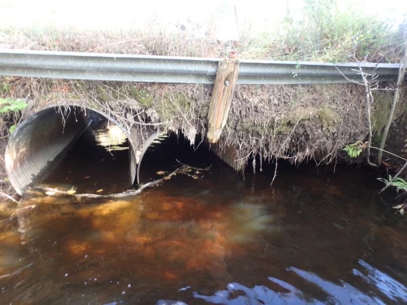
Inlet
Inlet
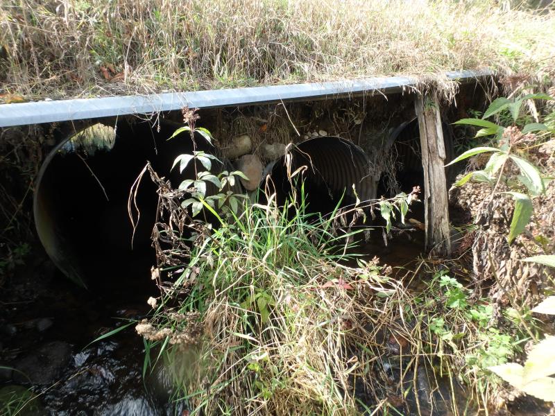
Outlet
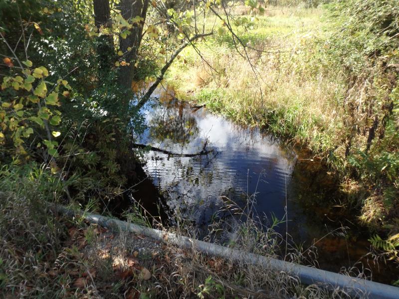
Upstream Conditions
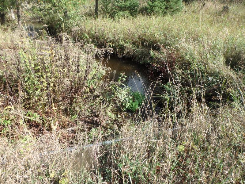
Downstream Conditions
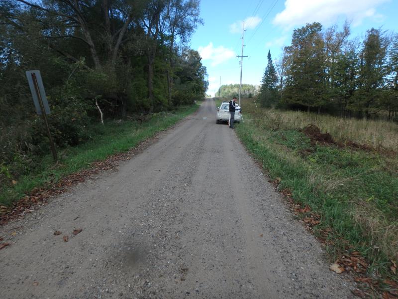
Road Approach - Left
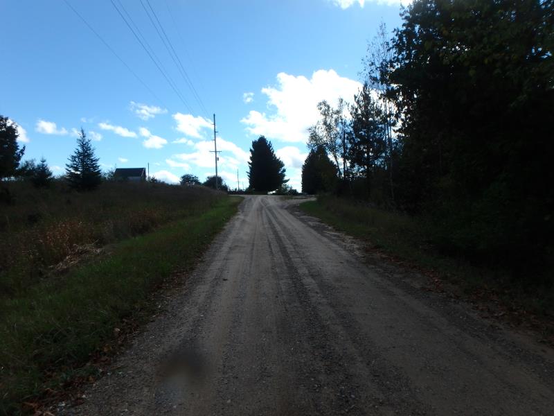
Road Approach - Right
Crossing Information
Type of Crossing: culvert(s)
Number of Structures: 3
Structure Shape: Round
Inlet Type: Headwall
Outlet Type: At Stream Grade
Structure Material: Metal
Structure Substrate: None
General Conditions: Poor
Multiple Culverts/Spans | ||||
Culvert/Span | Width | Length | Height | Material |
1 |
4 ft. |
23 ft. |
4 ft. |
Metal |
2 |
4 ft. |
23 ft. |
4 ft. |
Metal |
3 |
4 ft. |
23 ft. |
4 ft. |
Metal |
Structure Interior: corrugated
Structure is Rusted through
Dimensions of Structure: Length 4 ft.
, Width 23 ft.
, Height 4 ft.
Structure is NOT Perched
Structure Inlet
Water Depth: 1.7 ft.
Water Velocity*: 0 ft./sec.
Structure Outlet
Water Depth: 0.5 ft.
Water Velocity*: 0.2 ft./sec.
*Water Velocities were measured 0.8 ft. below Surface
(with Meter)
Additional Comments
CULVERT #2 IS MAIN FLOW
Stream Information
Stream Flow: Less than Bankfull
Riffle Information
Water Depth: 0.4 ft.
Bankfull Width: 12 ft.
Wetted Width: 10 ft.
Water Velocity: 0.8 ft./sec.
(Measured with Meter)
Dominant Substrate: Cobble
Road Information
Gravel
County Road
Road Condition: Poor
Road Width at Culvert: 14 ft.
Location of Low Point: Other
Runoff Path: Ditch
Embankments
Upstream
Fill Depth: 3.5 ft.
Slope: Vertical
Downstream
Fill Depth: 3.5 ft.
Slope: Vertical
Approaches
Left Approach
Length: 0 ft.
Slope: 1% to 5%
Vegetation: Heavy
LS Factor: 0.26
Erosion: 0 tons/year
Right Approach
Length: 175 ft.
Slope: 1% to 5%
Vegetation: Heavy
LS Factor: 0.415
Erosion: 0.2801 tons/year
Erosion Information
Total Erosion at Crossing: 0.6301 tons/year
Extent of Erosion: Very Severe
Notes: STRUCTURE WILL WASH OUT WITH HIGH FLOW
Location of Erosion | Erosion Dimensions | Eroded Material | Material Eroded | Total Erosion | ||
facing downstream | Length | Width | Depth | Reaching Stream? | (tons/year) | |
Right Downstream Embankment |
3.5 ft. |
7 ft. |
1 ft. |
yes |
Gravelly Loam |
0.0875 |
Left Downstream Embankment |
3.5 ft. |
7 ft. |
1 ft. |
yes |
Gravelly Loam |
0.0875 |
Right Upstream Embankment |
3.5 ft. |
7 ft. |
1 ft. |
yes |
Gravelly Loam |
0.0875 |
Left Upstream Embankment |
3.5 ft. |
7 ft. |
1 ft. |
yes |
Gravelly Loam |
0.0875 |
Summary Information
Fish Passability 1
Erosion is an area of concern for this site.
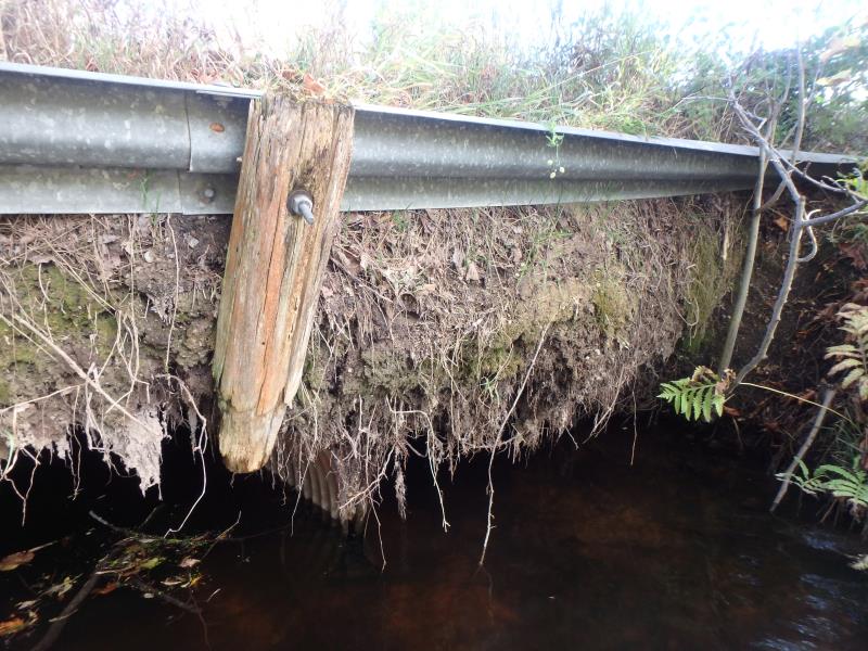
STRUCTURE SEVERELY ERODED AT BOTH HEADWALLS. HEADWALLS ARE JUST CRUMBLING DIRT BEING HELD BY FAILING GUARD RAILS
A future visit to this site is recommended. THIS IS SERIOUSLY A WASHOUT CONCERN WITH A NICE COBBLE RIFFLE IMMEDIATELY DOWNSTREAM. SEE PHOTOS!
These non-native species were observerd at this site: Autumn Olive
�