Road Stream Crossing Site TBW_TBMO01
Thunder Bay River Watershed, Thunder Bay River
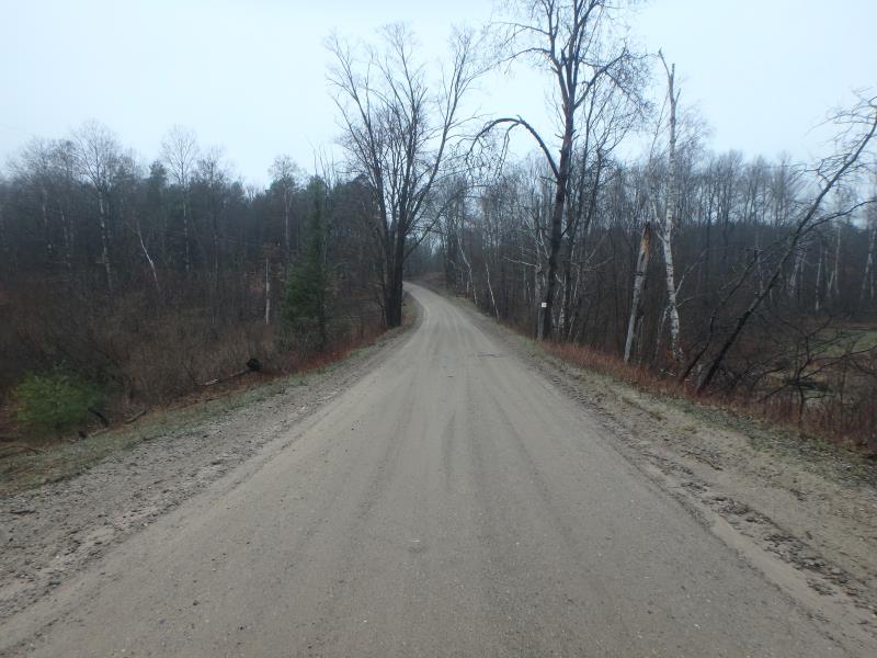
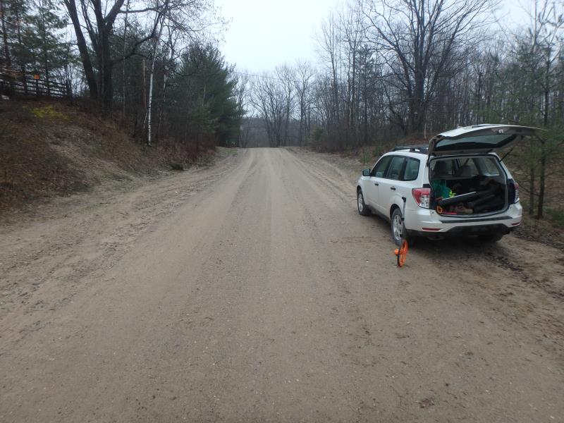
Lutz Road
Briley Twp,
Montmorency County
Information collected by:
Site Location
GPS Coordinates: 44.96173
, -84.24081
T30N
R2E
Sec 30
Owned by Private
Structure is NOT Perched
Total Erosion: 0.7893 tons/year
Severity: Moderate
Year Inventoried: 2017
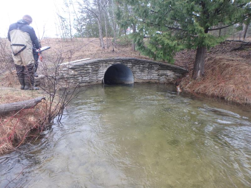
Inlet
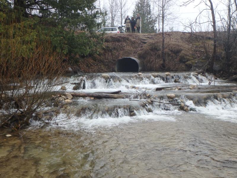
Outlet
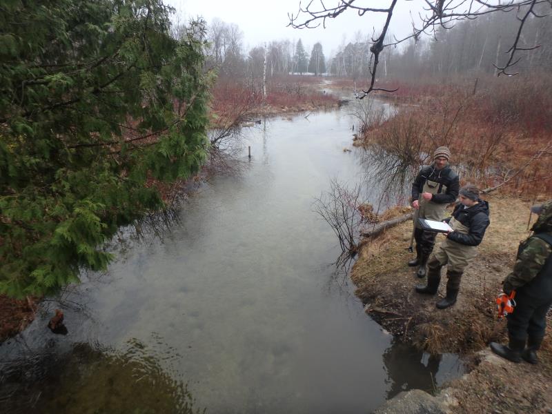
Upstream Conditions
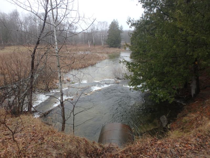
Downstream Conditions
Road Approach - Left
Road Approach - Right
Crossing Information
Type of Crossing: culvert(s)
Number of Structures: 1
Structure Shape: Round
Inlet Type: Headwall
Outlet Type: Cascade over Riprap
Structure Material: Metal
Structure Substrate: Sand
General Conditions: Fair
Structure Interior: corrugated
Dimensions of Structure: Length 73 ft.
, Width 5.5 ft.
, Height 5.5 ft.
Structure is NOT Perched
Structure Inlet
Water Depth: 2.1 ft.
Embedded Depth of Structure: 0 ft.
Water Velocity*: 4.9 ft./sec.
Structure Outlet
Water Depth: 2.1 ft.
Embedded Depth of Structure: 0 ft.
Water Velocity*: 7.3 ft./sec.
*Water Velocities were measured 2 ft. below Surface
(with Meter)
Additional Comments
Cascading rock dams after outlet/Outlet is 1ft above stream grade but not perched. No riffle sampled.
Stream Information
Stream Flow: Less than 1/2 Bankfull
Scour Pool: Length 33 ft.
, Width 31 ft.
, Depth 5 ft.
Upstream Pond: Length 0 ft.
, Width 0 ft.
, Depth 0 ft.
Road Information
Sand
County Road
Road Condition: Fair
Road Width at Culvert: 18.6 ft.
Location of Low Point: Other
Runoff Path: Roadway
Embankments
Upstream
Fill Depth: 5 ft.
Slope: More than 1:2
Downstream
Fill Depth: 6.6 ft.
Slope: More than 1:2
Approaches
Left Approach
Length: 0 ft.
Slope: Less Than 1%
Vegetation: None
LS Factor: 0.05
Erosion: 0 tons/year
Right Approach
Length: 240 ft.
Slope: 1% to 5%
Vegetation: None
LS Factor: 0.626
Erosion: 0.7698 tons/year
Erosion Information
Total Erosion at Crossing: 0.7893 tons/year
Extent of Erosion: Minor
Erosion is occurring and corrective actions can be installed to address the problem.
Notes: Foot Traffic
Location of Erosion | Erosion Dimensions | Eroded Material | Material Eroded | Total Erosion | ||
facing downstream | Length | Width | Depth | Reaching Stream? | (tons/year) | |
Left Downstream Embankment |
13 ft. |
3 ft. |
1.5 ft. |
yes |
Gravel |
0.0195 |
Summary Information
Fish Passage is an area of concern for this site.
Velocity barrier and structural barrier
�