Road Stream Crossing Site TBW_TBMO09
Thunder Bay River Watershed, Haymeadow Creek
Reimann
Briley Twp,
Montmorency County
Information collected by:
Site Location
GPS Coordinates: 45.01166
, -84.16338
T30N
R2E
Sec 11
Owned by Private
Structure is NOT Perched
Total Erosion: 1.22 tons/year
Severity: Moderate
Year Inventoried: 2017
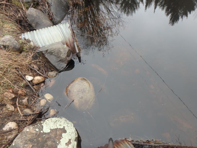
Inlet
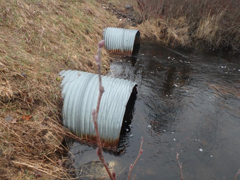
Outlet
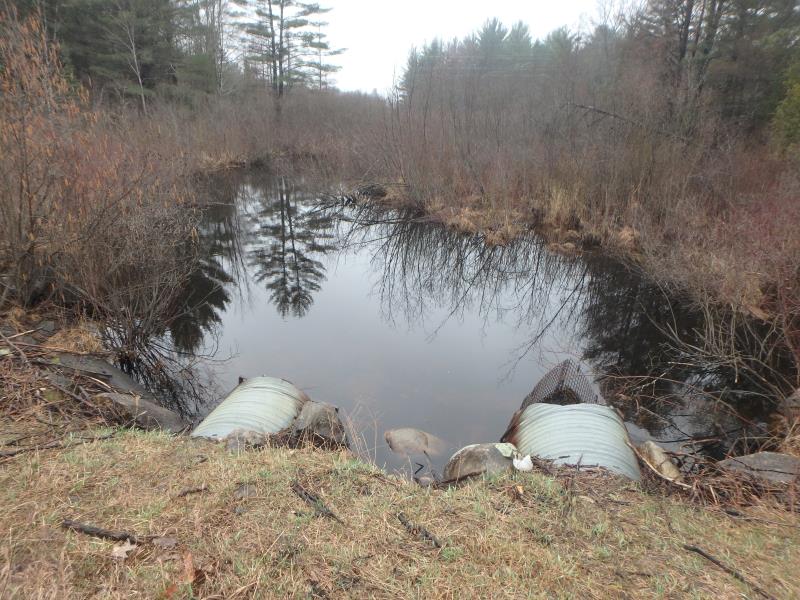
Upstream Conditions
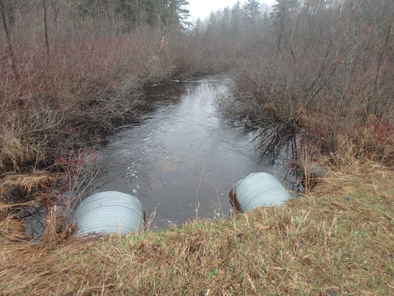
Downstream Conditions
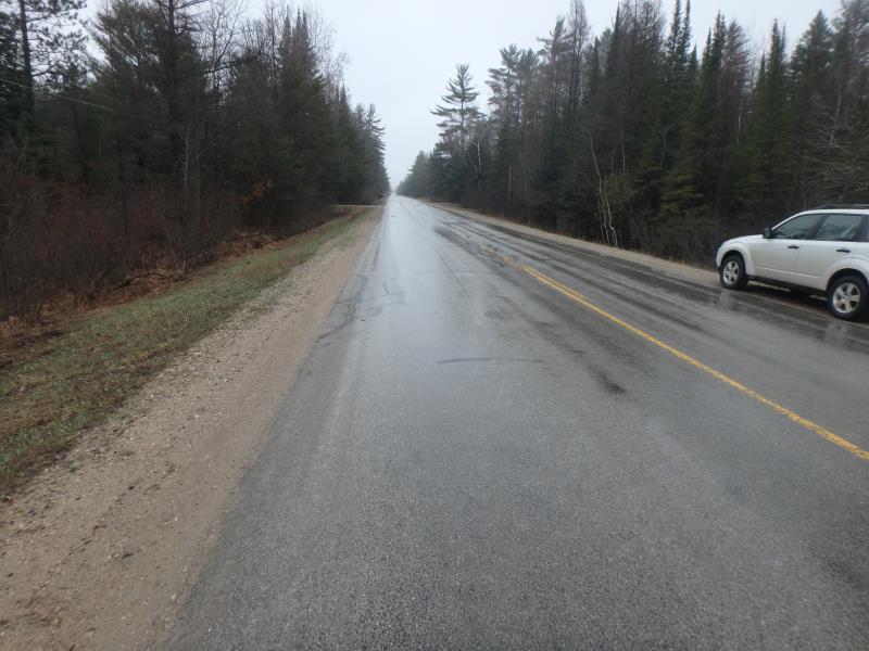
Road Approach - Left
Crossing Information
Type of Crossing: culvert(s)
Number of Structures: 2
Structure Shape: Round
Inlet Type: Trash Rack
Outlet Type: At Stream Grade
Structure Material: Metal
Structure Substrate: Sand
General Conditions: Fair
Multiple Culverts/Spans | ||||
Culvert/Span | Width | Length | Height | Material |
1 |
4.6 ft. |
76 ft. |
4.6 ft. |
Metal |
2 |
4.6 ft. |
76 ft. |
4.6 ft. |
Metal |
Structure Interior: corrugated
Percentage Plugged:
Inlet: 26% to 50%
Outlet: 0%
In Pipe: 0%
Structure is NOT Perched
Structure Inlet
Water Depth: 2.4 ft.
Embedded Depth of Structure: 0 ft.
Water Velocity*: 1.6 ft./sec.
Structure Outlet
Water Depth: 2.2 ft.
Embedded Depth of Structure: 0 ft.
Water Velocity*: 3 ft./sec.
*Water Velocities were measured 1 ft. below Surface
(with Meter)
Additional Comments
MARSH - NO RIFFLE TESTED
Stream Information
Stream Flow: More than Bankfull
Road Information
Paved
County Road
Road Condition: Good
Road Width at Culvert: 24 ft.
Location of Low Point: At Stream
Runoff Path: Roadway
Embankments
Upstream
Fill Depth: 5.2 ft.
Slope: More than 1:2
Downstream
Fill Depth: 5.9 ft.
Slope: 1:2
Approaches
Left Approach
Length: 1000 ft.
Slope: 1% to 5%
Vegetation: None
LS Factor: 1.23
Erosion: 0.9759 tons/year
Right Approach
Length: 390 ft.
Slope: 1% to 5%
Vegetation: None
LS Factor: 0.789
Erosion: 0.2441 tons/year
Erosion Information
Total Erosion at Crossing: 1.22 tons/year
Extent of Erosion: Minor
Erosion is occurring and corrective actions can be installed to address the problem.
Summary Information
Fish Passage is an area of concern for this site.
TRASH RACK
A future visit to this site is recommended. FISH PASSAGE
�