Road Stream Crossing Site TBW_TBMO196
Thunder Bay River Watershed, Sucker Creek
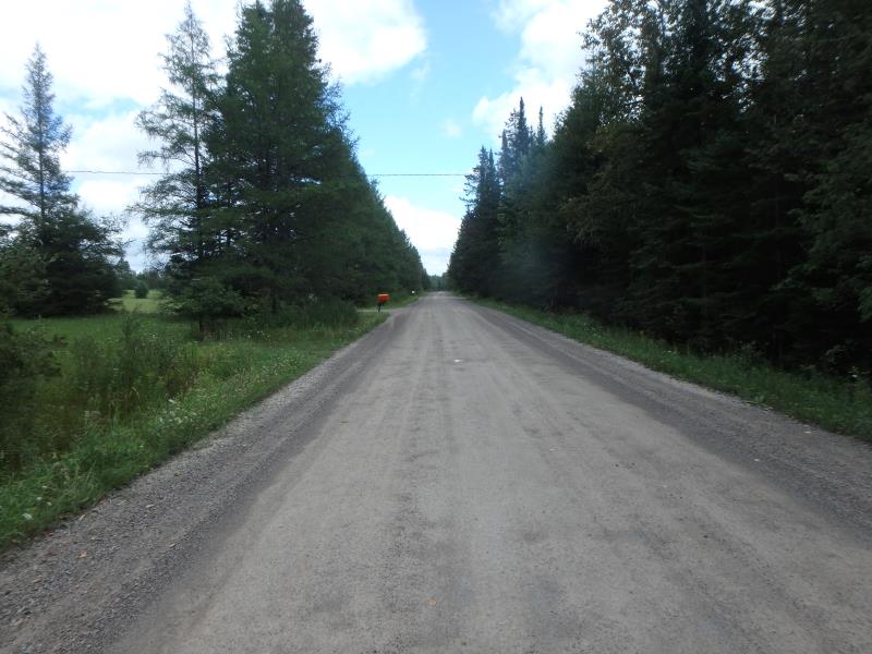
Funk Road
Hillman Twp,
Montmorency County
Information collected by:
Site Location
GPS Coordinates: 45.0445
, -83.9521
T31N
R4E
Sec 28
Fish Passability 0
Structure is NOT Perched
Total Erosion: 4.9812 tons/year
Severity: Severe
Year Inventoried: 2017
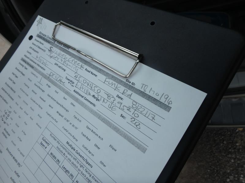
Site ID
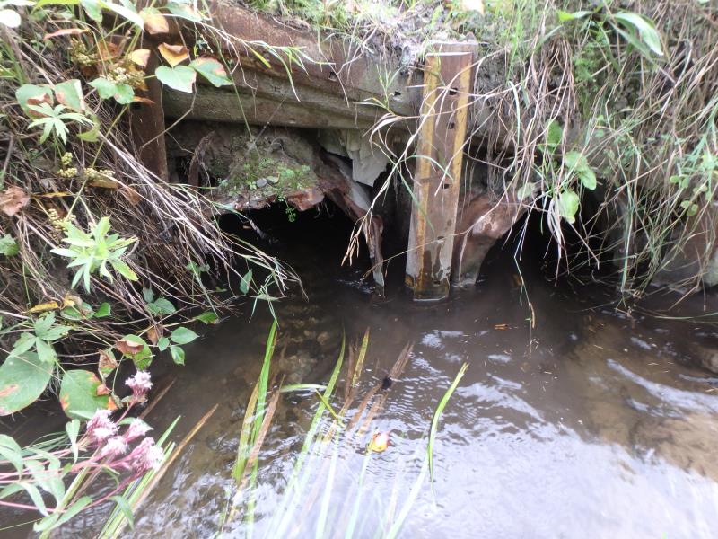
Inlet
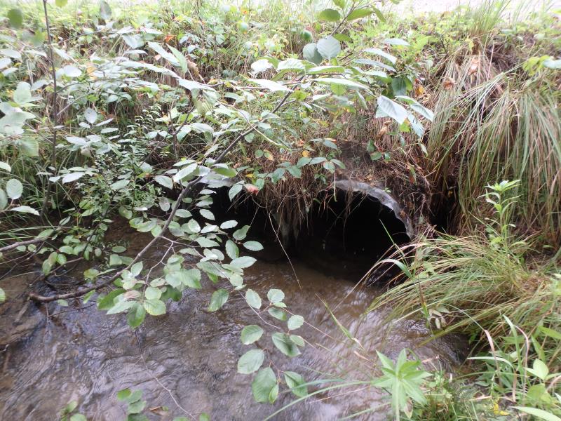
Outlet
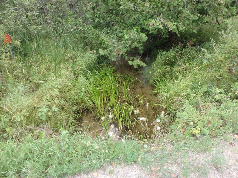
Upstream Conditions
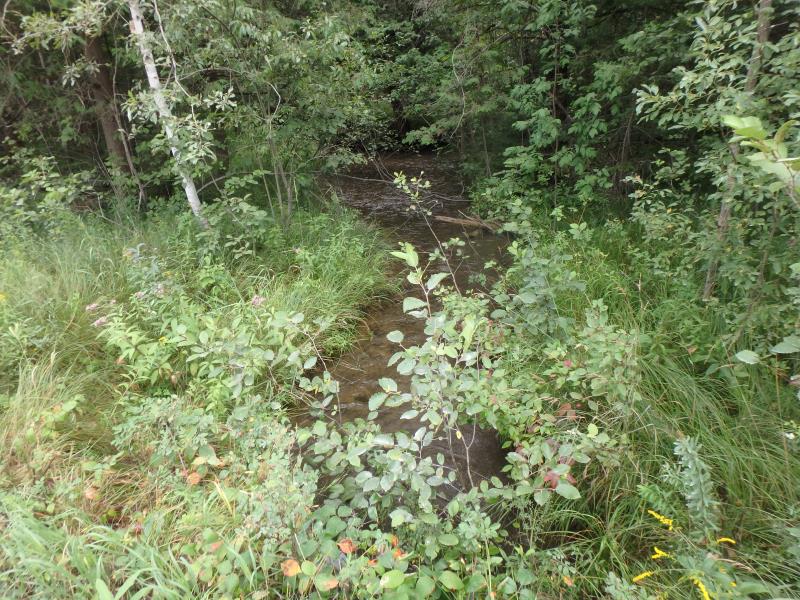
Downstream Conditions
Road Approach - Left
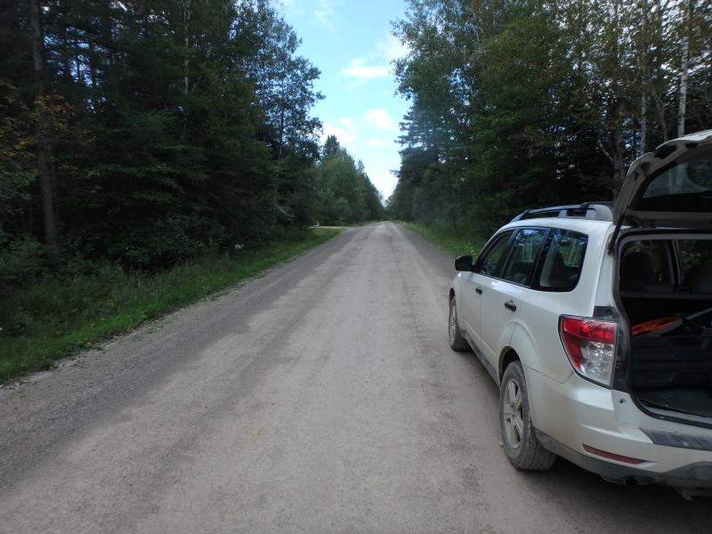
Road Approach - Right
Crossing Information
Type of Crossing: culvert(s)
Number of Structures: 1
Structure Shape: Round
Inlet Type: Projecting
Outlet Type: At Stream Grade
Structure Material: Metal
Structure Substrate: None
General Conditions: Poor
Structure Interior: corrugated
Structure is Rusted through
Dimensions of Structure: Length 30 ft.
, Width 2 ft.
, Height 2 ft.
Structure is NOT Perched
Structure Inlet
Water Depth: 1 ft.
Embedded Depth of Structure: 0 ft.
Water Velocity*: 2.4 ft./sec.
Structure Outlet
Water Depth: 0.7 ft.
Embedded Depth of Structure: 0 ft.
Water Velocity*: 3.6 ft./sec.
*Water Velocities were measured 0.4 ft. below Surface
(with Meter)
Stream Information
Stream Flow: Less than Bankfull
Riffle Information
Water Depth: 0.7 ft.
Bankfull Width: 16 ft.
Wetted Width: 14 ft.
Water Velocity: 1.5 ft./sec.
(Measured with Meter)
Dominant Substrate: Sand
Road Information
Sand
County Road
Road Condition: Fair
Road Width at Culvert: 29 ft.
Location of Low Point: At Stream
Runoff Path: Ditch
Embankments
Upstream
Fill Depth: 2 ft.
Slope: Vertical
Downstream
Fill Depth: 2.2 ft.
Slope: 1:1
Approaches
Left Approach
Length: 1000 ft.
Slope: Less Than 1%
Vegetation: Heavy
LS Factor: 0.05
Erosion: 0.3994 tons/year
Right Approach
Length: 1000 ft.
Slope: 1% to 5%
Vegetation: Heavy
LS Factor: 0.57
Erosion: 4.5537 tons/year
Erosion Information
Total Erosion at Crossing: 4.9812 tons/year
Extent of Erosion: Moderate
Erosion is occurring and corrective actions can be installed to address the problem.
Location of Erosion | Erosion Dimensions | Eroded Material | Material Eroded | Total Erosion | ||
facing downstream | Length | Width | Depth | Reaching Stream? | (tons/year) | |
Right Upstream Embankment |
2 ft. |
3 ft. |
1 ft. |
yes |
Gravelly Loam |
0.014 |
Left Downstream Embankment |
1 ft. |
1 ft. |
2 ft. |
yes |
Gravelly Loam |
0.014 |
Summary Information
Fish Passability 0
Fish Passage is an area of concern for this site.
VELOCITY
These non-native species were observerd at this site: Spotted Knapweed
�