Road Stream Crossing Site TBW_TBMO197
Thunder Bay River Watershed, Sucker Creek
Thunder Aalley
Hillman Twp,
Montmorency County
Information collected by:
Site Location
GPS Coordinates: 45.042
, -83.94792
T31N
R4E
Sec 33
Fish Passability 0.5
Structure is NOT Perched
Total Erosion: 0.4263 tons/year
Severity: Moderate
Year Inventoried: 2017
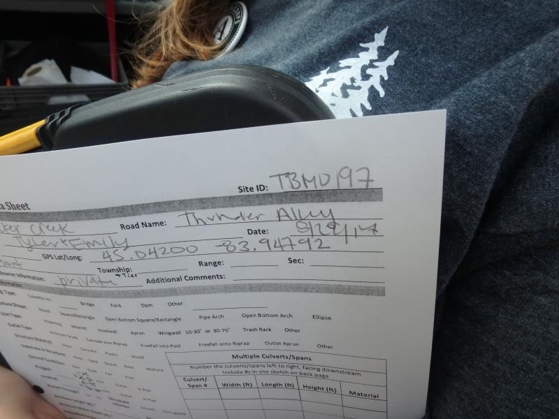
Site ID
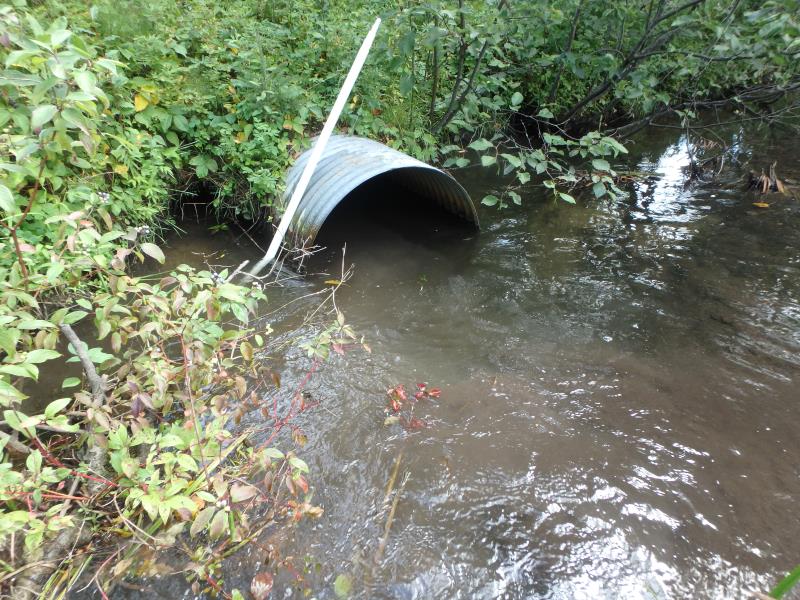
Inlet
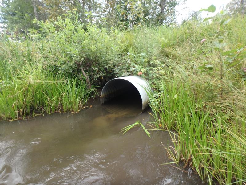
Outlet
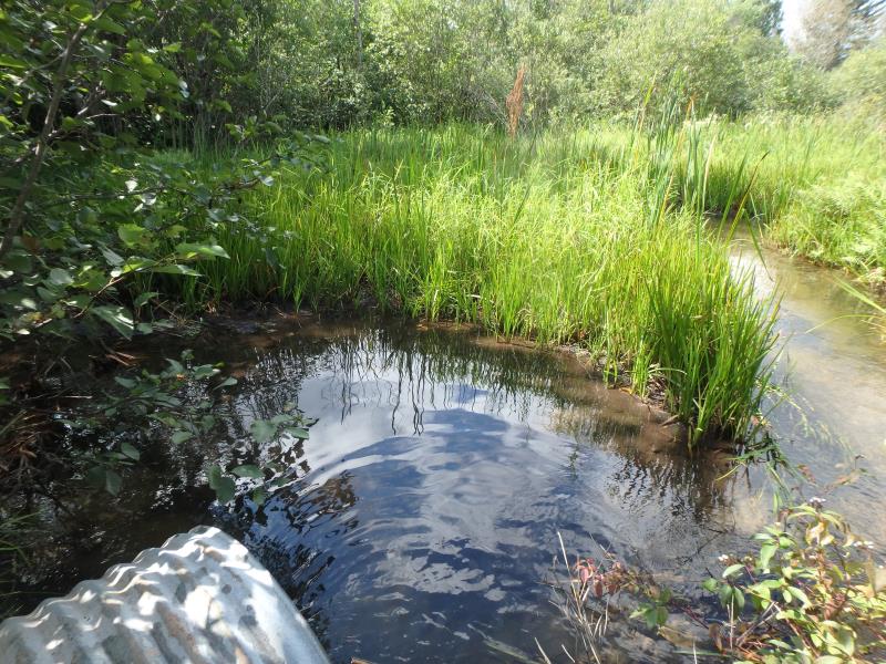
Upstream Conditions
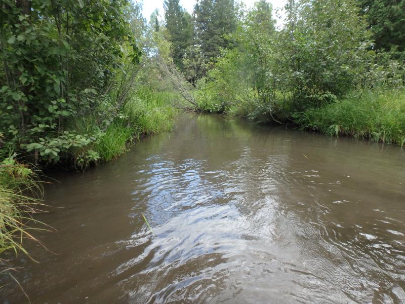
Downstream Conditions
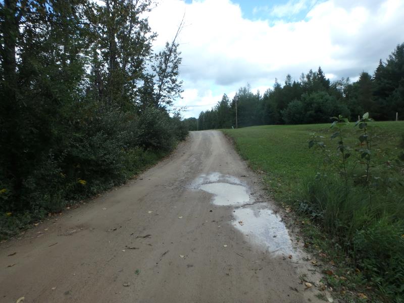
Road Approach - Left

Road Approach - Right
Crossing Information
Type of Crossing: culvert(s)
Number of Structures: 1
Structure Shape: Round
Inlet Type: Projecting
Outlet Type: At Stream Grade
Structure Material: Metal
Structure Substrate: None
General Conditions: Fair
Structure Interior: corrugated
Dimensions of Structure: Length 42 ft.
, Width 3 ft.
, Height 3 ft.
Structure is NOT Perched
Structure Inlet
Water Depth: 1.7 ft.
Embedded Depth of Structure: 0 ft.
Water Velocity*: 1.1 ft./sec.
Structure Outlet
Water Depth: 1.1 ft.
Embedded Depth of Structure: 0 ft.
Water Velocity*: 1.9 ft./sec.
*Water Velocities were measured 0.9 ft. below Surface
(with Meter)
Additional Comments
RIFFLE NOT SAFELY ACCESSIBLE (USED RIFFLE DATA FROM TBMO196)
Stream Information
Stream Flow: Less than Bankfull
Scour Pool: Length 32 ft.
, Width 19 ft.
, Depth 3.5 ft.
Riffle Information
Water Depth: 0.7 ft.
Bankfull Width: 16 ft.
Wetted Width: 14 ft.
Water Velocity: 1.5 ft./sec.
(Measured with Meter)
Dominant Substrate: Sand
Road Information
Sand
County Road
Road Condition: Fair
Road Width at Culvert: 15 ft.
Location of Low Point: At Stream
Runoff Path: Roadway
Embankments
Upstream
Fill Depth: 3.2 ft.
Slope: More than 1:2
Downstream
Fill Depth: 2.7 ft.
Slope: More than 1:2
Approaches
Left Approach
Length: 129 ft.
Slope: 1% to 5%
Vegetation: Heavy
LS Factor: 0.392
Erosion: 0.2087 tons/year
Right Approach
Length: 132 ft.
Slope: 1% to 5%
Vegetation: Heavy
LS Factor: 0.393
Erosion: 0.2143 tons/year
Erosion Information
Total Erosion at Crossing: 0.4263 tons/year
Extent of Erosion: Minor
Erosion is occurring and corrective actions can be installed to address the problem.
Location of Erosion | Erosion Dimensions | Eroded Material | Material Eroded | Total Erosion | ||
facing downstream | Length | Width | Depth | Reaching Stream? | (tons/year) | |
Left Upstream Embankment |
1.5 ft. |
2 ft. |
2.5 ft. |
yes |
Loam |
0.0033 |
Summary Information
Fish Passability 0.5
A future visit to this site is recommended. SCOURING
These non-native species were observerd at this site: Queen Anne's Lace
�