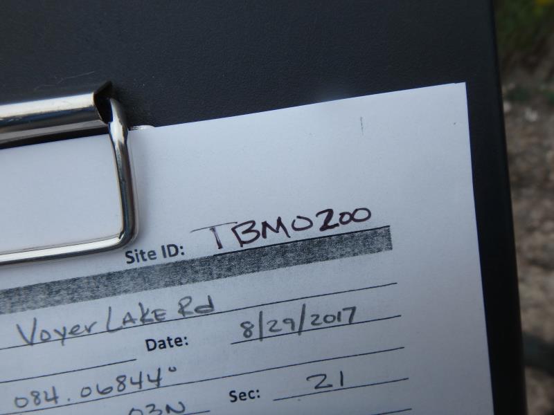
Road Stream Crossing Site TBW_TBMO200
Thunder Bay River Watershed, North Branch Thunder Bay River
Voyer Lake Road
Montmorency Twp,
Montmorency County
Information collected by:
Site Location
GPS Coordinates: 45.14803
, -84.06844
T32N
R3E
Sec 21
Fish Passability 0.9
Structure is NOT Perched
Total Erosion: 14.6483 tons/year
Severity: Severe
Year Inventoried: 2017
Site ID
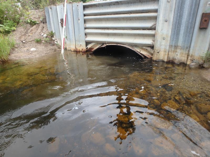
Inlet
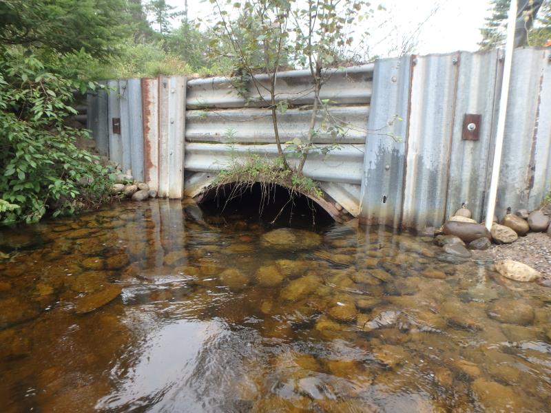
Outlet
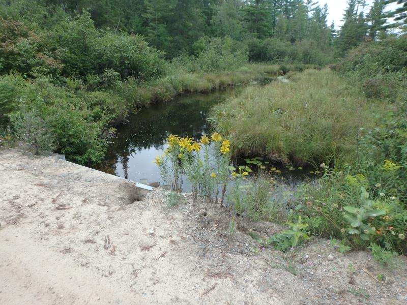
Upstream Conditions
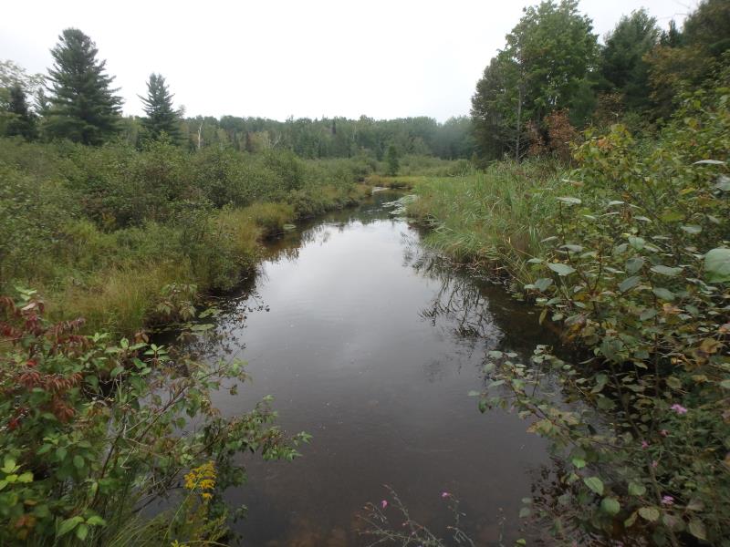
Downstream Conditions
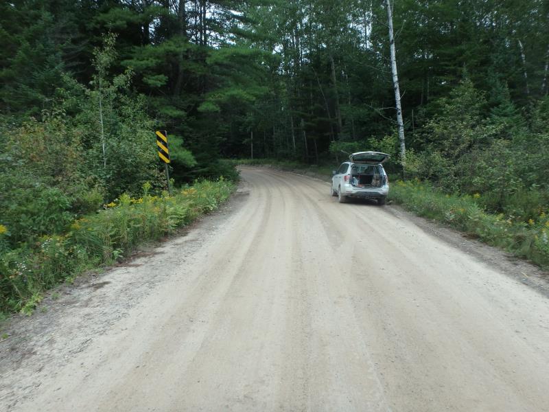
Road Approach - Left
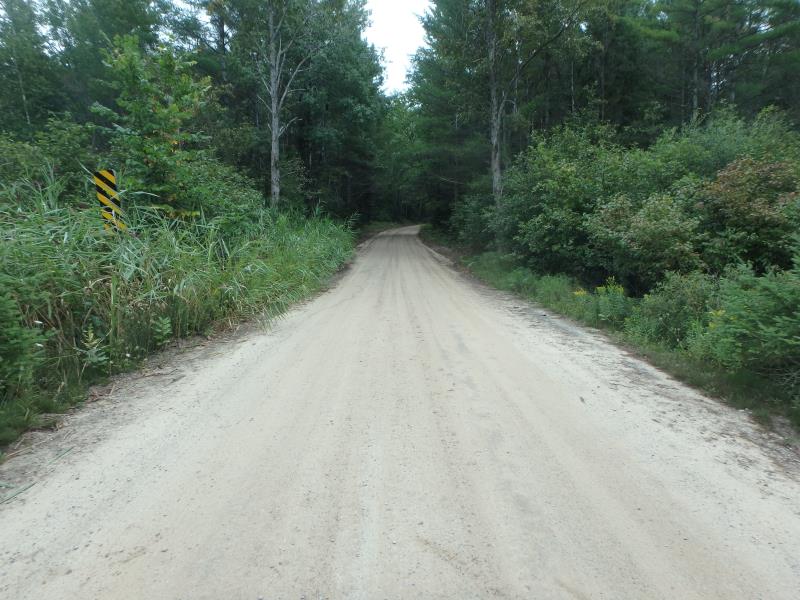
Road Approach - Right
Crossing Information
Type of Crossing: culvert(s)
Number of Structures: 1
Structure Shape: Pipe Arch
Inlet Type: Headwall
Outlet Type: At Stream Grade
Structure Material: Metal
Structure Substrate: Gravel
General Conditions: Poor
Structure Interior: corrugated
Structure is Rusted through
Dimensions of Structure: Length 22 ft.
, Width 6 ft.
, Height 3.8 ft.
Structure is NOT Perched
Structure Inlet
Water Depth: 2.8 ft.
Embedded Depth of Structure: 0 ft.
Water Velocity*: 0.7 ft./sec.
Structure Outlet
Water Depth: 3 ft.
Embedded Depth of Structure: 0.7 ft.
Water Velocity*: 0.8 ft./sec.
*Water Velocities were measured 1.5 ft. below Surface
(with Meter)
Stream Information
Stream Flow: Less than Bankfull
Scour Pool: Length 32 ft.
, Width 29 ft.
, Depth 3 ft.
Riffle Information
Water Depth: 1.5 ft.
Bankfull Width: 33 ft.
Wetted Width: 30 ft.
Water Velocity: 0.7 ft./sec.
(Measured with Meter)
Dominant Substrate: Sand
Road Information
Sand
County Road
Road Condition: Fair
Road Width at Culvert: 17 ft.
Location of Low Point: At Stream
Runoff Path: Roadway
Embankments
Upstream
Fill Depth: 3 ft.
Slope: Vertical
Downstream
Fill Depth: 3.2 ft.
Slope: Vertical
Approaches
Left Approach
Length: 605 ft.
Slope: 6% to 10%
Vegetation: Heavy
LS Factor: 1.744
Erosion: 4.942 tons/year
Right Approach
Length: 1000 ft.
Slope: 6% to 10%
Vegetation: Heavy
LS Factor: 2.05
Erosion: 9.6006 tons/year
Erosion Information
Total Erosion at Crossing: 14.6483 tons/year
Extent of Erosion: Moderate
Erosion is occurring and corrective actions can be installed to address the problem.
Notes: STRUCTURING IS WASHING OUT FROM RUNOFF
Location of Erosion | Erosion Dimensions | Eroded Material | Material Eroded | Total Erosion | ||
facing downstream | Length | Width | Depth | Reaching Stream? | (tons/year) | |
Left Upstream Embankment |
1.5 ft. |
1.5 ft. |
3.4 ft. |
yes |
Gravelly Loam |
0.0357 |
Left Upstream Embankment |
10 ft. |
5 ft. |
0.6 ft. |
yes |
Gravelly Loam |
0.042 |
Right Upstream Embankment |
8 ft. |
4 ft. |
0.5 ft. |
yes |
Gravelly Loam |
0.028 |
Summary Information
Fish Passability 0.9
Erosion is an area of concern for this site.
STRUCTURE IS OLD AND IS GIVING WAY TO EROSION
These non-native species were observerd at this site: Phragmites and Spotted Knapweed
�