Road Stream Crossing Site TBW_TBMO204
Thunder Bay River Watershed, North Branch Thunder Bay River
Hubert Road
Montmorency Twp,
Montmorency County
Information collected by:
Site Location
GPS Coordinates: 45.18776
, -83.90945
T32N
R4E
Sec 02
Fish Passability 0.5
Total Erosion: 1.1984 tons/year
Severity: Moderate
Year Inventoried: 2017
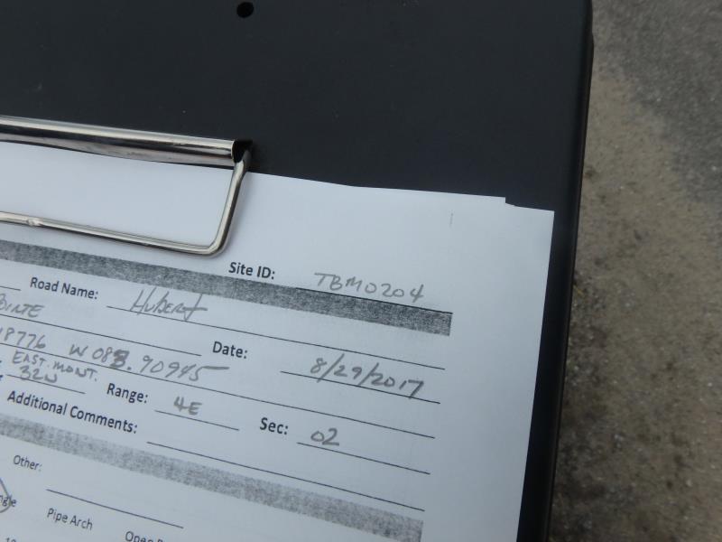
Site ID
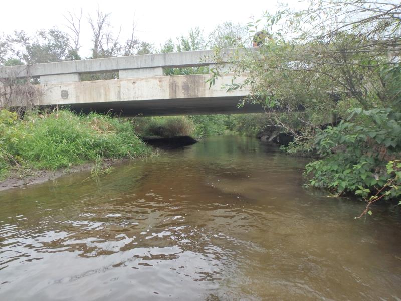
Inlet
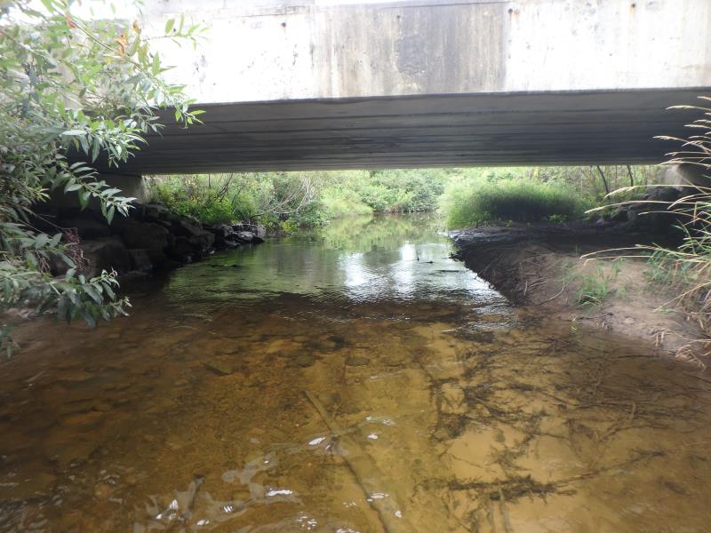
Outlet
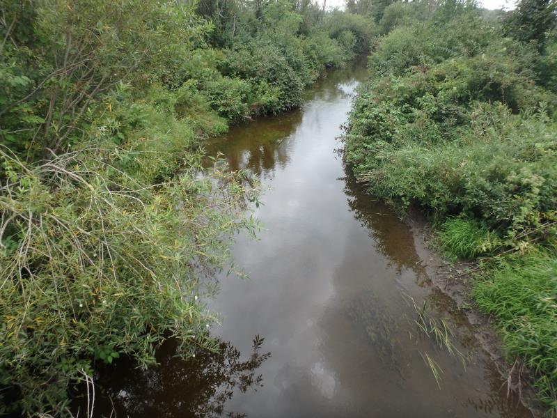
Upstream Conditions
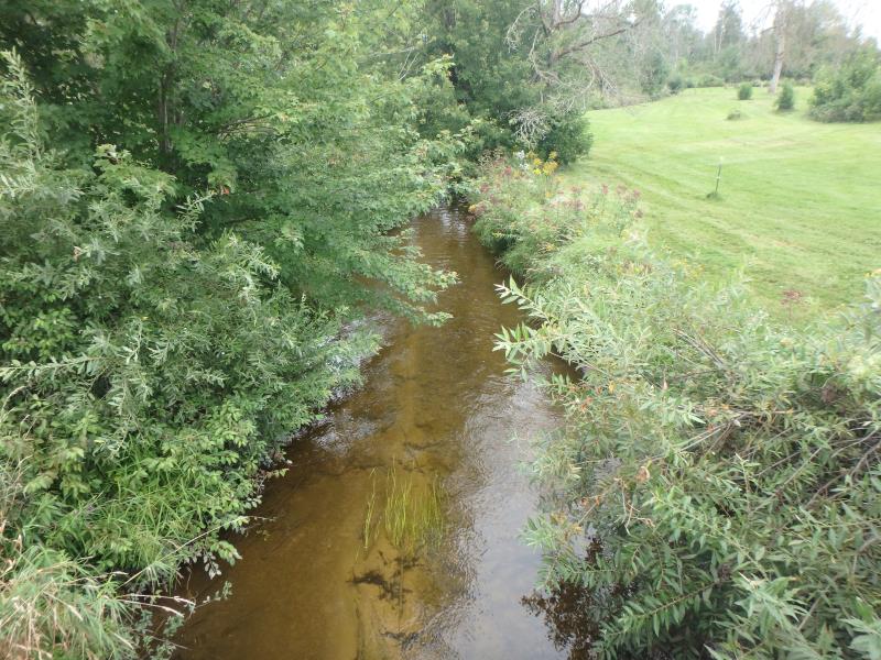
Downstream Conditions
Road Approach - Left
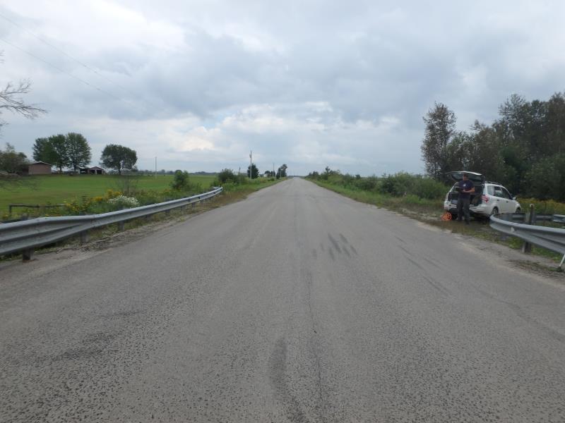
Road Approach - Right
Crossing Information
Type of Crossing: Bridge
Structure Shape: Open Bottom Square/Rectangle
Inlet Type: Projecting
Outlet Type: At Stream Grade
Structure Material: Concrete
Structure Substrate: Rock
General Conditions: Good
Structure Interior: smooth
Dimensions of Structure: Length 33.8 ft.
, Width 56.2 ft.
, Height 8.2 ft.
Structure Inlet
Water Depth: 2.1 ft.
Water Velocity*: 0.9 ft./sec.
Structure Outlet
Water Depth: 1.2 ft.
Water Velocity*: 2.4 ft./sec.
*Water Velocities were measured 0.9 ft. below Surface
(with Meter)
Stream Information
Stream Flow: Less than Bankfull
Riffle Information
Water Depth: 2.4 ft.
Bankfull Width: 20 ft.
Wetted Width: 17.5 ft.
Water Velocity: 0.6 ft./sec.
(Measured with Meter)
Dominant Substrate: Sand
Road Information
Paved
County Road
Road Condition: Good
Road Width at Culvert: 31.8 ft.
Location of Low Point: At Stream
Runoff Path: Ditch
Fill Depth: 0 ft.
Slope: Vertical
Fill Depth: 0 ft.
Slope: Vertical
Approaches
Left Approach
Length: 1000 ft.
Slope: 1% to 5%
Vegetation: Heavy
LS Factor: 0.57
Erosion: 0.5992 tons/year
Right Approach
Length: 1000 ft.
Slope: 1% to 5%
Vegetation: Heavy
LS Factor: 0.57
Erosion: 0.5992 tons/year
Erosion Information
Total Erosion at Crossing: 1.1984 tons/year
Extent of Erosion: Minor
Summary Information
Fish Passability 0.5
These non-native species were observerd at this site: Reed Canary Grass, Mullein, and Queen Anne's Lace
�