Road Stream Crossing Site TBW_TBMO209
Thunder Bay River Watershed, Brush Creek
Elizabeth Street
Hillman Twp,
Montmorency County
Information collected by:
Site Location
GPS Coordinates: 45.06463
, -83.90587
T31N
R4E
Sec 23
Owned by Local Government
Structure is NOT Perched
Total Erosion: 0.1185 tons/year
Severity: Minor
Year Inventoried: 2017
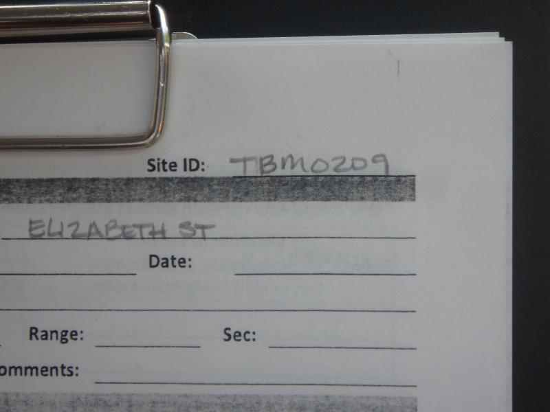
Site ID
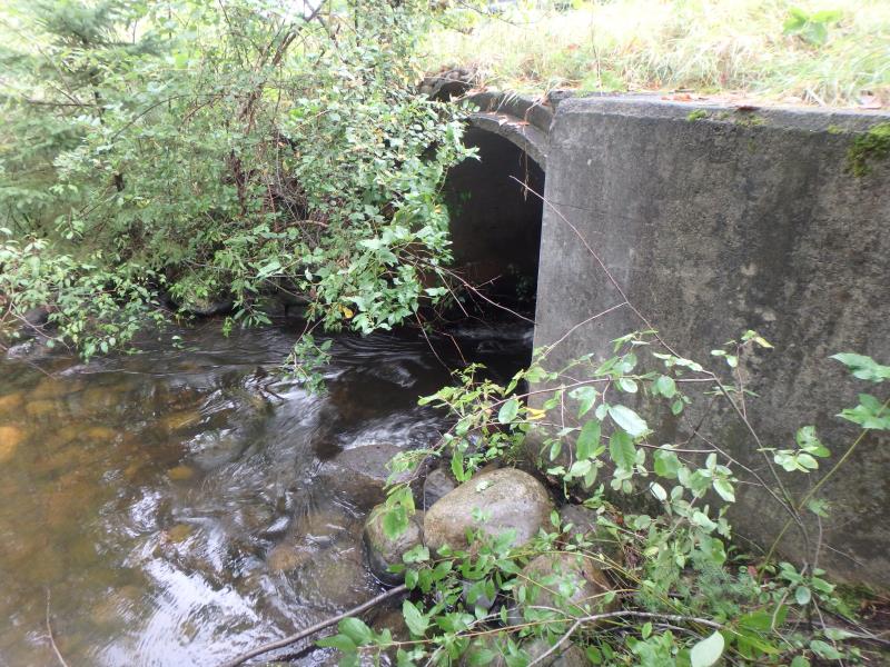
Inlet
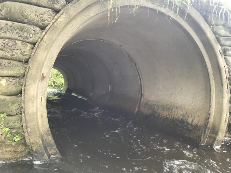
Outlet
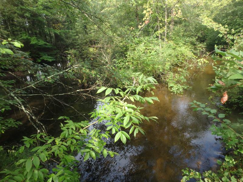
Upstream Conditions
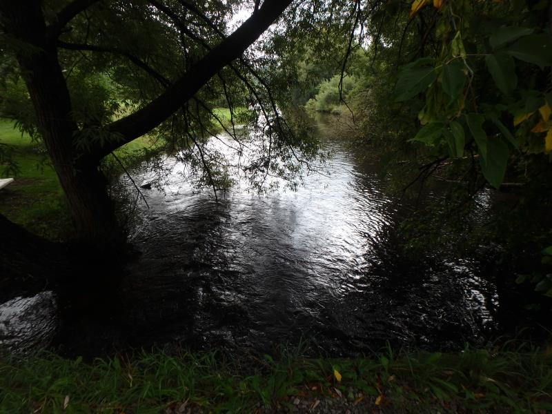
Downstream Conditions
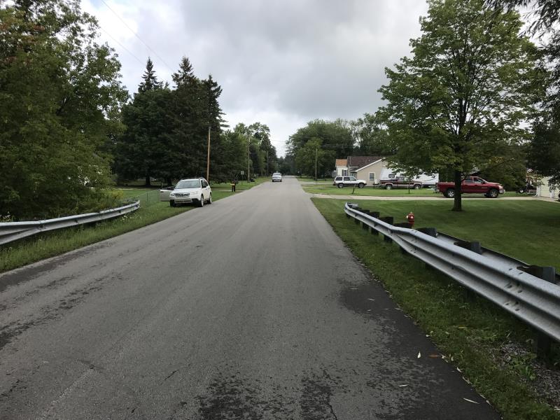
Road Approach - Left
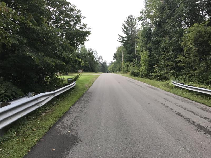
Road Approach - Right
Crossing Information
Type of Crossing: culvert(s)
Number of Structures: 1
Structure Shape: Round
Inlet Type: Headwall
Outlet Type: At Stream Grade
Structure Material: Concrete
Structure Substrate: None
General Conditions: Poor
Structure Interior: smooth
Dimensions of Structure: Length 43 ft.
, Width 7 ft.
, Height 7 ft.
Structure is NOT Perched
Structure Inlet
Water Depth: 1.3 ft.
Embedded Depth of Structure: 0 ft.
Water Velocity*: 6.7 ft./sec.
Structure Outlet
Water Depth: 1.5 ft.
Embedded Depth of Structure: 0 ft.
Water Velocity*: 5.4 ft./sec.
*Water Velocities were measured 0.3 ft. below Surface
(with Meter)
Additional Comments
RIFFLE NOT ACCESSIBLE SAFELY
Stream Information
Stream Flow: Less than Bankfull
Scour Pool: Length 120 ft.
, Width 120 ft.
, Depth 4.3 ft.
Upstream Pond: Length 150 ft.
, Width 75 ft.
, Depth 2 ft.
Road Information
Paved
Town Road
Road Condition: Good
Road Width at Culvert: 22 ft.
Location of Low Point: Other
Runoff Path: Ditch
Fill Depth: 0 ft.
Slope: Vertical
Fill Depth: 0 ft.
Slope: Vertical
Approaches
Left Approach
Length: 0 ft.
Slope: 1% to 5%
Vegetation: Partial
LS Factor: 0.22
Erosion: 0 tons/year
Right Approach
Length: 270 ft.
Slope: 1% to 5%
Vegetation: Partial
LS Factor: 0.532
Erosion: 0.1045 tons/year
Erosion Information
Total Erosion at Crossing: 0.1185 tons/year
Extent of Erosion: Minor
Erosion is occurring and corrective actions can be installed to address the problem.
Location of Erosion | Erosion Dimensions | Eroded Material | Material Eroded | Total Erosion | ||
facing downstream | Length | Width | Depth | Reaching Stream? | (tons/year) | |
Right Downstream Embankment |
10 ft. |
2 ft. |
1.4 ft. |
yes |
Gravelly Loam |
0.014 |
Summary Information
Fish Passage is an area of concern for this site.
VELOCITY
These non-native species were observerd at this site: Reed Canary Grass
�