Road Stream Crossing Site TBW_TBMO35
Thunder Bay River Watershed, Thunder Bay River
Keego Drive
Avery Twp,
Montmorency County
Information collected by:
Site Location
GPS Coordinates: 44.98595
, -84.1047
T30N
R3E
Sec 17
Owned by Private
Fish Passability 0.5
Structure is NOT Perched
Total Erosion: 4.5179 tons/year
Severity: Severe
Year Inventoried: 2017
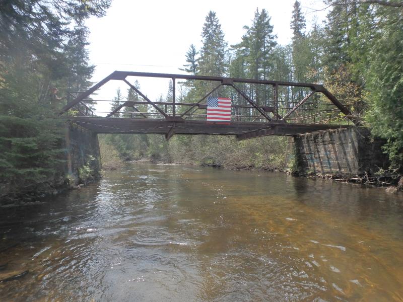
Inlet
Outlet
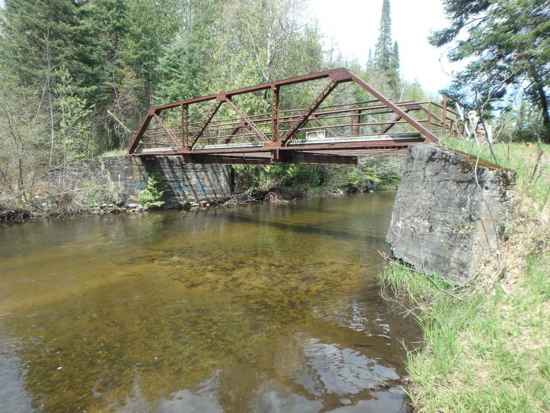
Upstream Conditions
Downstream Conditions
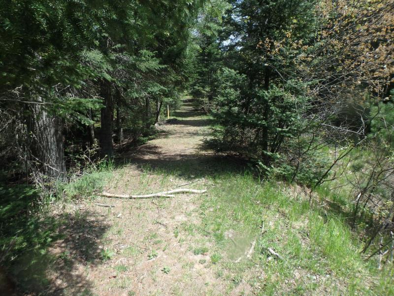
Road Approach - Left
Road Approach - Right
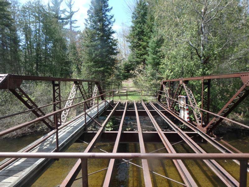
Crossing Information
Type of Crossing: Bridge
Structure Shape: Open Bottom Square/Rectangle
Inlet Type: Wingwall 10-30 Degree
Outlet Type: At Stream Grade
Structure Material: Concrete
Structure Substrate: Mixture
General Conditions: Good
Structure Interior: smooth
Dimensions of Structure: Length 19 ft.
, Width 45 ft.
, Height 10.7 ft.
Structure is NOT Perched
Structure Inlet
Water Depth: 2.3 ft.
Water Velocity*: 2.7 ft./sec.
Structure Outlet
Water Depth: 2.3 ft.
Water Velocity*: 2.4 ft./sec.
*Water Velocities were measured 1.5 ft. below Surface
(with Meter)
Additional Comments
NOT A MOTOR VEHICLE ROAD CROSSING
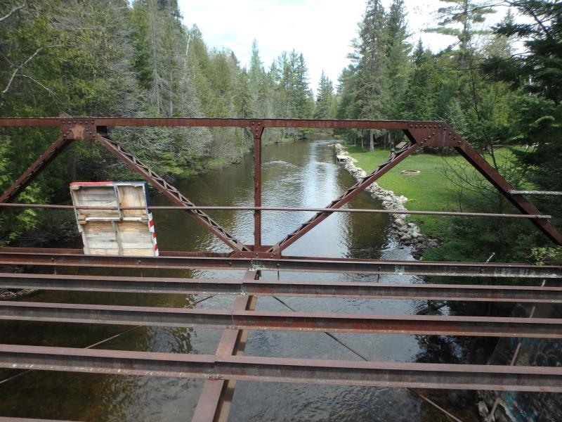
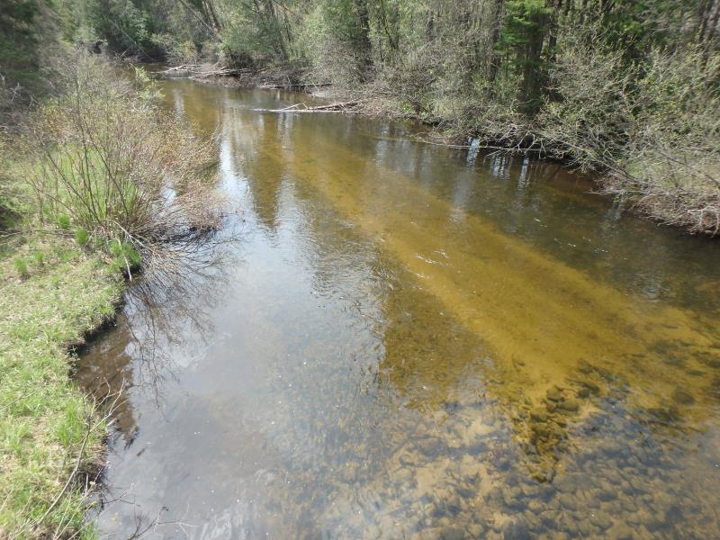
Stream Information
Stream Flow: Less than Bankfull
Riffle Information
Water Depth: 3.6 ft.
Bankfull Width: 49.5 ft.
Wetted Width: 47.5 ft.
Water Velocity: 2.9 ft./sec.
(Measured with Meter)
Dominant Substrate: Sand
Road Information
Native Surface
Other Road
Road Condition: Fair
Road Width at Culvert: 8 ft.
Location of Low Point: Other
Runoff Path: Ditch
Approaches
Left Approach
Length: 0 ft.
Slope: Less Than 1%
Vegetation: Heavy
LS Factor: 0.05
Erosion: 0 tons/year
Right Approach
Length: 1000 ft.
Slope: 6% to 10%
Vegetation: Heavy
LS Factor: 2.05
Erosion: 4.5179 tons/year
Erosion Information
Total Erosion at Crossing: 4.5179 tons/year
Extent of Erosion: Minor
Notes: CONCRETE SUPPORTS ON THE BRIDGE ARE DETERIORATING AT THE BOTTOM.
Summary Information
Fish Passability 0.5
These non-native species were observerd at this site: Spotted Knapweed
�