Road Stream Crossing Site TBW_TBMO42
Thunder Bay River Watershed, Hunt Creek
East Fish Lake Road
Albert Twp,
Montmorency County
Information collected by:
Site Location
GPS Coordinates: 44.86196
, -84.18095
T29n
R2E
Sec 35
Owned by State
Fish Passability 0
Perch Height: 1 ft.
Total Erosion: 1.7759 tons/year
Severity: Severe
Year Inventoried: 2017
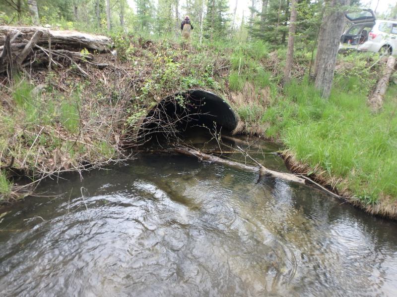
Inlet
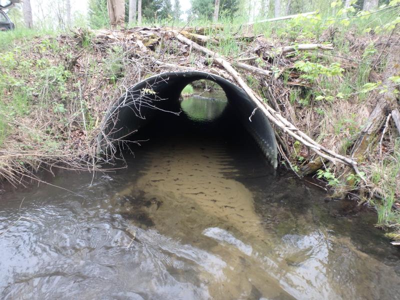
Outlet
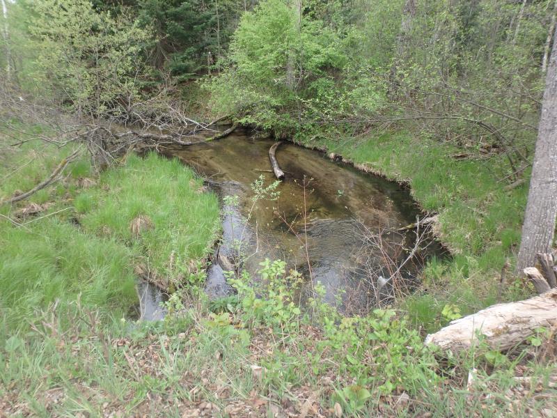
Upstream Conditions
Downstream Conditions
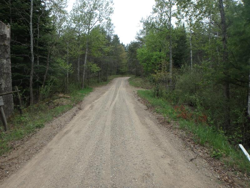
Road Approach - Left
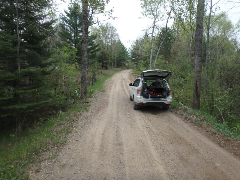
Road Approach - Right
Crossing Information
Type of Crossing: culvert(s)
Number of Structures: 1
Structure Shape: Pipe Arch
Inlet Type: Projecting
Outlet Type: At Stream Grade
Structure Material: Metal
Structure Substrate: None
General Conditions: Fair
Structure Interior: corrugated
Dimensions of Structure: Length 30 ft.
, Width 8 ft.
, Height 5.4 ft.
Perch Height: 1 ft.
Structure Inlet
Water Depth: 1.7 ft.
Embedded Depth of Structure: 0 ft.
Water Velocity*: 0.9 ft./sec.
Structure Outlet
Water Depth: 1.4 ft.
Embedded Depth of Structure: 0 ft.
Water Velocity*: 1.3 ft./sec.
*Water Velocities were measured 1.4 ft. below Surface
(with Meter)
Additional Comments
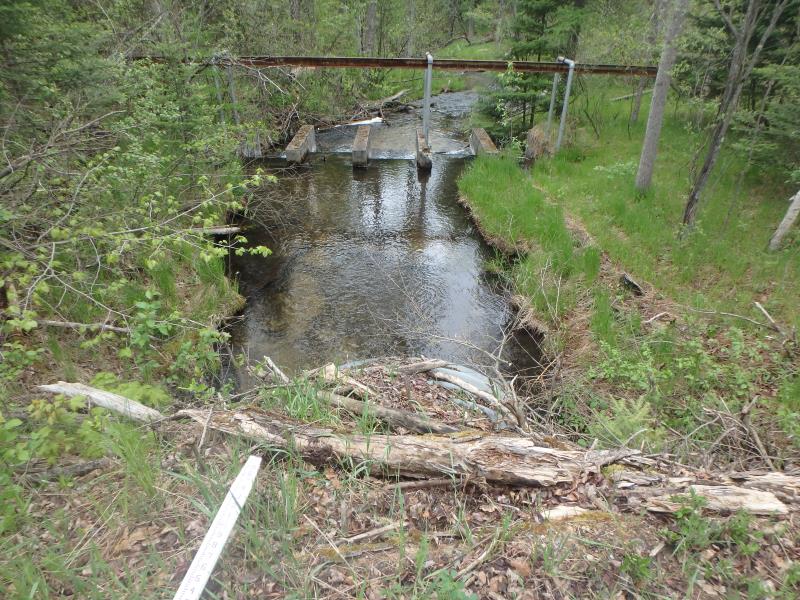
Dam directly downstream (Perch of 1ft added to flag culvert as severity)
Stream Information
Stream Flow: Less than 1/2 Bankfull
Riffle Information
Water Depth: 0.75 ft.
Bankfull Width: 15.3 ft.
Wetted Width: 11.9 ft.
Water Velocity: 2.8 ft./sec.
(Measured with Meter)
Dominant Substrate: Gravel
Road Information
Sand
County Road
Road Condition: Fair
Road Width at Culvert: 12 ft.
Location of Low Point: At Stream
Runoff Path: Roadway
Embankments
Upstream
Fill Depth: 2.5 ft.
Slope: More than 1:2
Downstream
Fill Depth: 3.1 ft.
Slope: More than 1:2
Approaches
Left Approach
Length: 310 ft.
Slope: 1% to 5%
Vegetation: Heavy
LS Factor: 0.462
Erosion: 0.4735 tons/year
Right Approach
Length: 286 ft.
Slope: 6% to 10%
Vegetation: Heavy
LS Factor: 1.378
Erosion: 1.3025 tons/year
Erosion Information
Total Erosion at Crossing: 1.7759 tons/year
Extent of Erosion: Minor
Summary Information
Fish Passability 0
Fish Passage is an area of concern for this site.
Dam immediately downstream is a complete barrier.
�