Road Stream Crossing Site TBW_TBMO89
Thunder Bay River Watershed, BargerCreek
Beltz Road
Briley Twp,
Montmorency County
Information collected by:
Site Location
GPS Coordinates: 45.00223
, -84.23593
T30N
R2E
Sec 07
Owned by Private
Fish Passability 0.5
Structure is NOT Perched
Total Erosion: 1.7442 tons/year
Severity: Severe
Year Inventoried: 2017
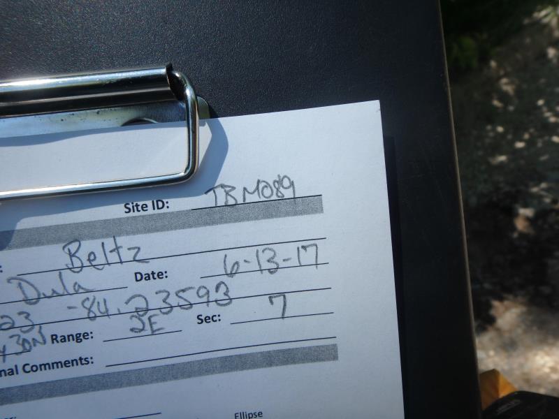
Site ID
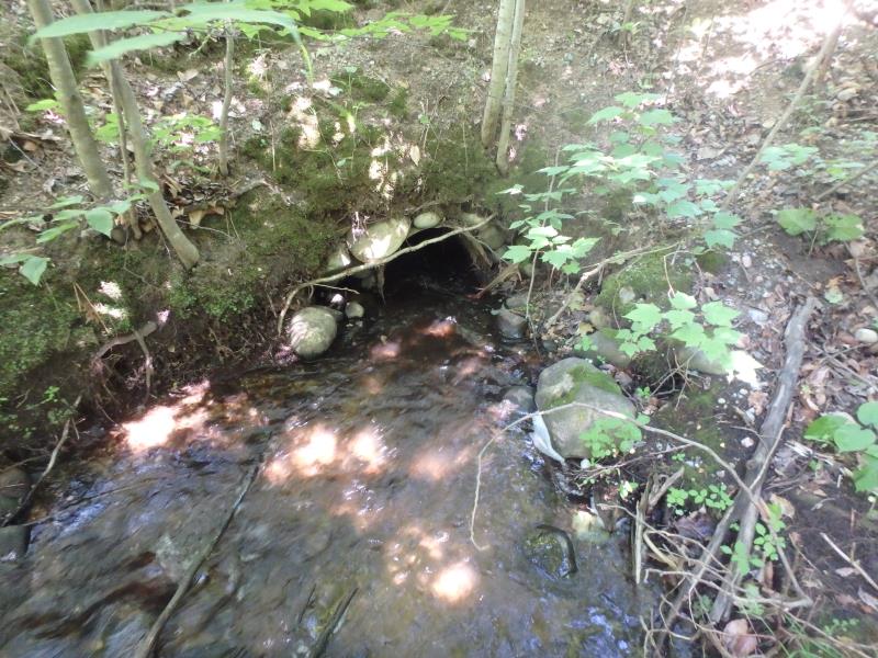
Inlet
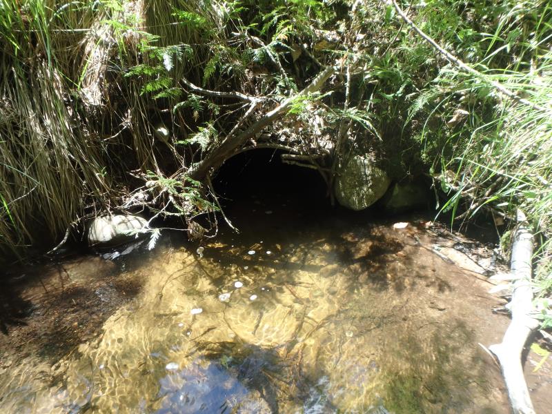
Outlet
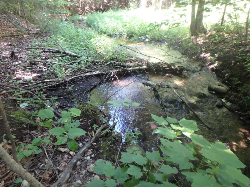
Upstream Conditions
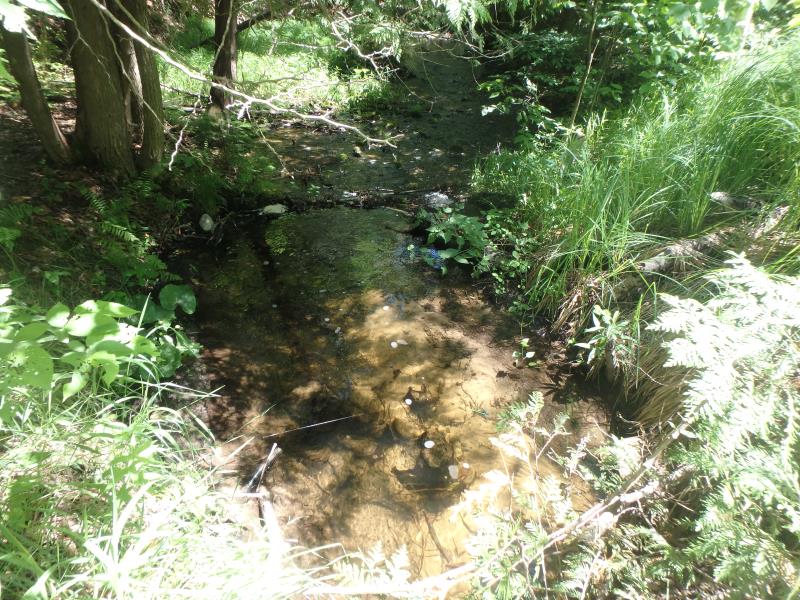
Downstream Conditions
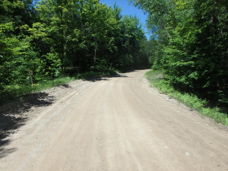
Road Approach - Left
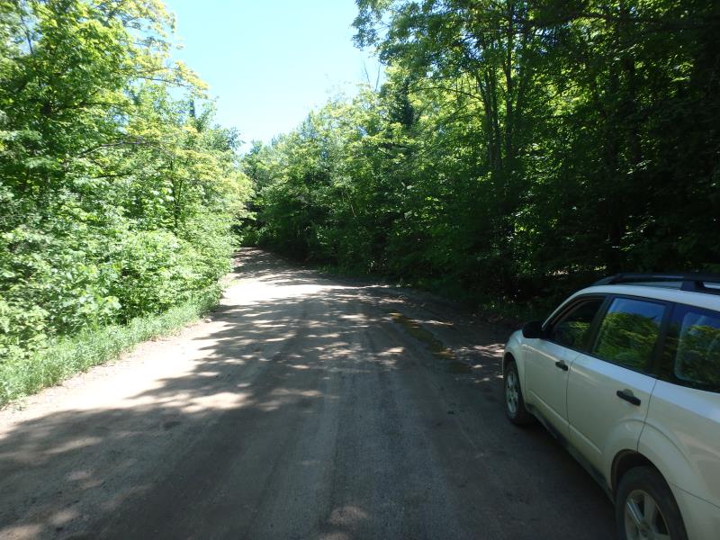
Road Approach - Right
Crossing Information
Type of Crossing: culvert(s)
Number of Structures: 1
Structure Shape: Round
Inlet Type: Projecting
Outlet Type: At Stream Grade
Structure Material: Metal
Structure Substrate: Sand
General Conditions: Fair
Structure Interior: corrugated
Dimensions of Structure: Length 45 ft.
, Width 2.1 ft.
, Height 2.1 ft.
Percentage Plugged:
Inlet: 1% to 25%
Structure is NOT Perched
Structure Inlet
Water Depth: 0.9 ft.
Embedded Depth of Structure: 0 ft.
Water Velocity*: 2.1 ft./sec.
Structure Outlet
Water Depth: 0.9 ft.
Embedded Depth of Structure: 0.1 ft.
Water Velocity*: 1 ft./sec.
*Water Velocities were measured 0.3 ft. below Surface
(with Meter)
Stream Information
Stream Flow: Bankfull
Riffle Information
Water Depth: 0.6 ft.
Bankfull Width: 6 ft.
Wetted Width: 6 ft.
Water Velocity: 1.2 ft./sec.
(Measured with Meter)
Dominant Substrate: Sand
Road Information
Sand
County Road
Road Condition: Poor
Road Width at Culvert: 21 ft.
Location of Low Point: Other
Runoff Path: Roadway
Embankments
Upstream
Fill Depth: 6 ft.
Slope: 1:1
Downstream
Fill Depth: 5.7 ft.
Slope: 1:1
Approaches
Left Approach
Length: 229 ft.
Slope: 6% to 10%
Vegetation: Heavy
LS Factor: 1.282
Erosion: 1.6987 tons/year
Right Approach
Length: 0 ft.
Slope: 1% to 5%
Vegetation: Heavy
LS Factor: 0.26
Erosion: 0 tons/year
Erosion Information
Total Erosion at Crossing: 1.7442 tons/year
Extent of Erosion: Moderate
Erosion is occurring and corrective actions can be installed to address the problem.
Notes: EROSION OF ROAD CAVING IN AROUND CULVERT
Location of Erosion | Erosion Dimensions | Eroded Material | Material Eroded | Total Erosion | ||
facing downstream | Length | Width | Depth | Reaching Stream? | (tons/year) | |
Left Approach |
5 ft. |
3 ft. |
1.3 ft. |
no |
Gravelly Loam |
0.0455 |
Summary Information
Fish Passability 0.5
Erosion is an area of concern for this site.
STREAM LOOKS LIKE HIGH QUALITY BUT INFRASTRUCTURE NEEDS UPDATING
�