Road Stream Crossing Site TBW_TBPI216
Thunder Bay River Watershed, Quinn Creek
County Road 634
Metz Twp,
Presque Isle County
Information collected by:
Site Location
GPS Coordinates: 45.25958
, -83.87275
T33N
R5E
Sec 07
Owned by Private
Fish Passability 1
Structure is NOT Perched
Total Erosion: 2.8582 tons/year
Severity: Severe
Year Inventoried: 2017
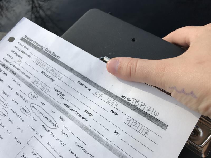
Site ID
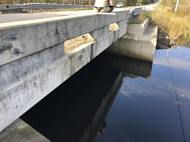
Inlet
Outlet
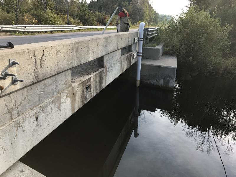
Outlet
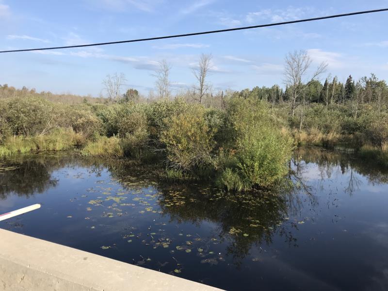
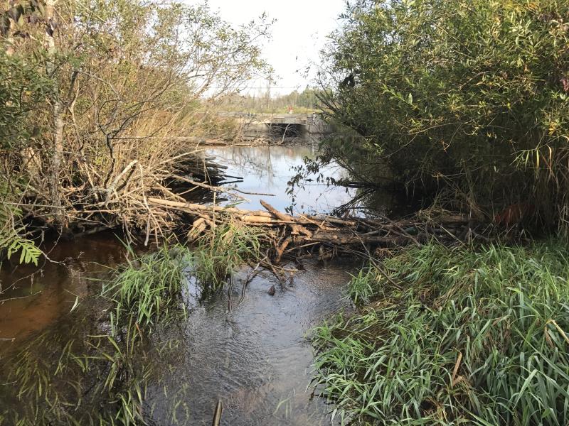
Upstream Conditions
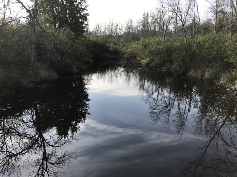
Downstream Conditions
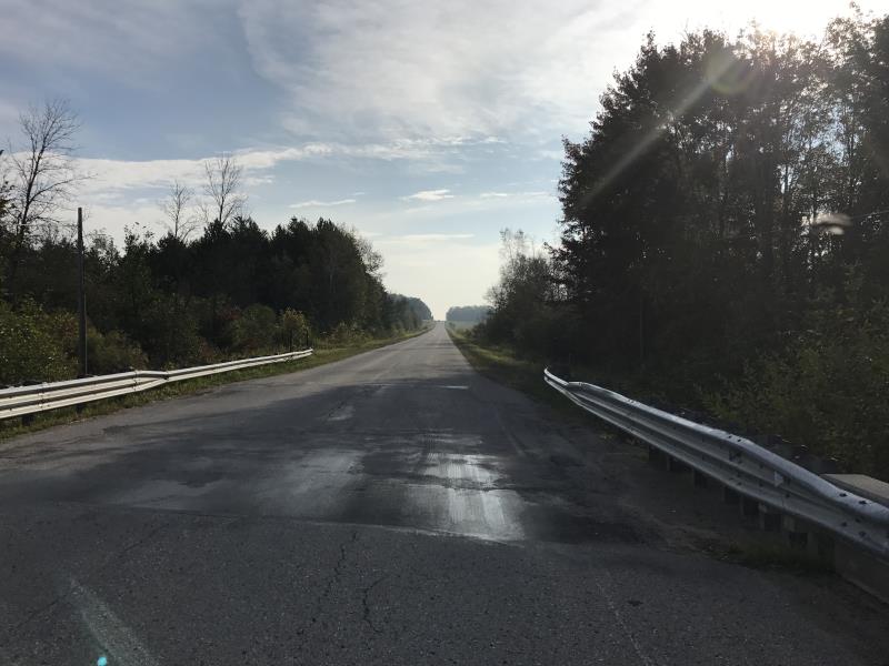
Road Approach - Left
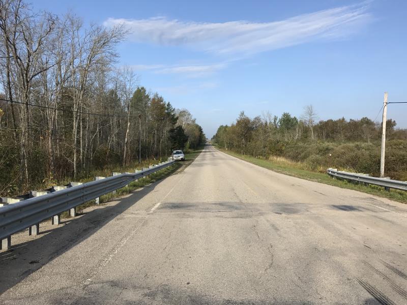
Road Approach - Right
Crossing Information
Type of Crossing: Bridge
Structure Shape: Open Bottom Square/Rectangle
Inlet Type: Headwall
Outlet Type: At Stream Grade
Structure Material: Concrete
Structure Substrate: Sand
General Conditions: Good
Structure Interior: smooth
Dimensions of Structure: Length 33 ft.
, Width 30 ft.
, Height 8 ft.
Structure is NOT Perched
Structure Inlet
Water Depth: 4.3 ft.
Water Velocity*: 0 ft./sec.
Structure Outlet
Water Depth: 3 ft.
Water Velocity*: 0 ft./sec.
*Water Velocities were measured at the Surface
(with Meter)
Additional Comments
BEAVER DAM
Stream Information
Stream Flow: More than Bankfull
Upstream Pond: Length 30 ft.
, Width 60 ft.
, Depth 2 ft.
Riffle Information
Water Depth: 1.4 ft.
Bankfull Width: 8 ft.
Wetted Width: 15 ft.
Water Velocity: 1.8 ft./sec.
(Measured with Meter)
Dominant Substrate: Sand
Road Information
Paved
County Road
Road Condition: Fair
Road Width at Culvert: 33 ft.
Location of Low Point: At Stream
Runoff Path: Ditch
Fill Depth: 0 ft.
Slope: Vertical
Fill Depth: 0 ft.
Slope: Vertical
Approaches
Left Approach
Length: 1000 ft.
Slope: 1% to 5%
Vegetation: Heavy
LS Factor: 0.57
Erosion: 0.6218 tons/year
Right Approach
Length: 1000 ft.
Slope: 6% to 10%
Vegetation: Heavy
LS Factor: 2.05
Erosion: 2.2364 tons/year
Erosion Information
Total Erosion at Crossing: 2.8582 tons/year
Extent of Erosion: Minor
Summary Information
Fish Passability 1
These non-native species were observerd at this site: Spotted Knapweed and Reed Canary Grass
�