Road Stream Crossing Site CRW_003
Cedar River Watershed, North Branch Cedar River
South Loop (Field Trial Area)
Sherman Twp,
Gladwin County
Information collected by:
Site Location
GPS Coordinates: 44.137983
, -84.551983
T20N
R2W
Sec 9
Owned by State
Fish Passability 0
Perch Height: 0.5 ft.
Total Erosion: 1.0761 tons/year
Severity: Severe
Year Inventoried: 2018
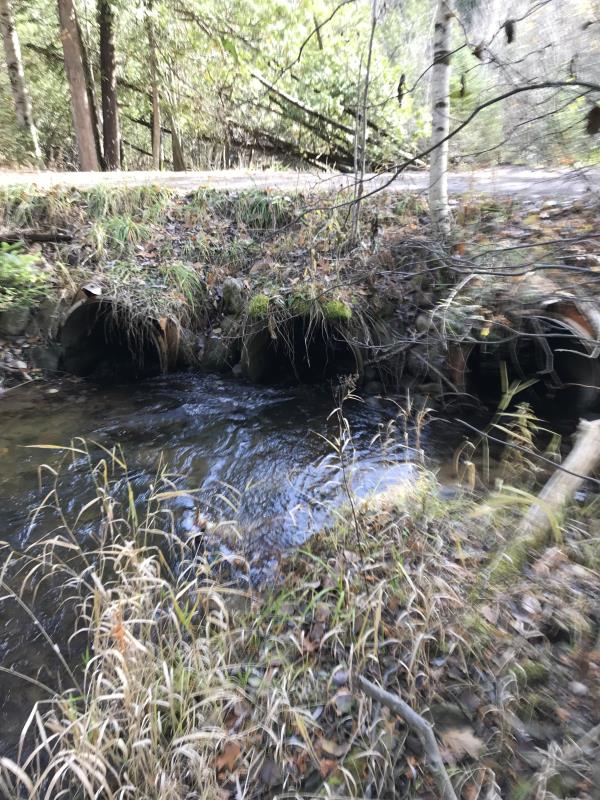
Inlet
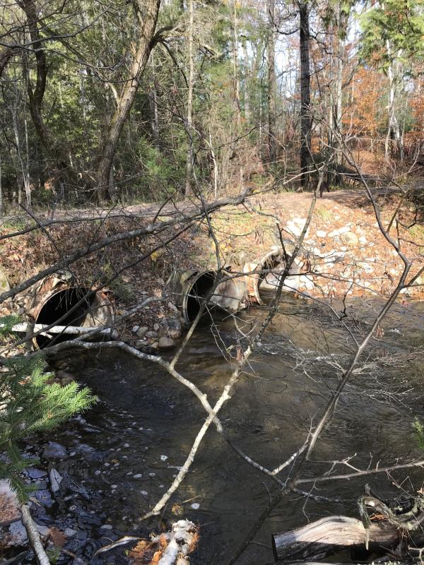
Outlet
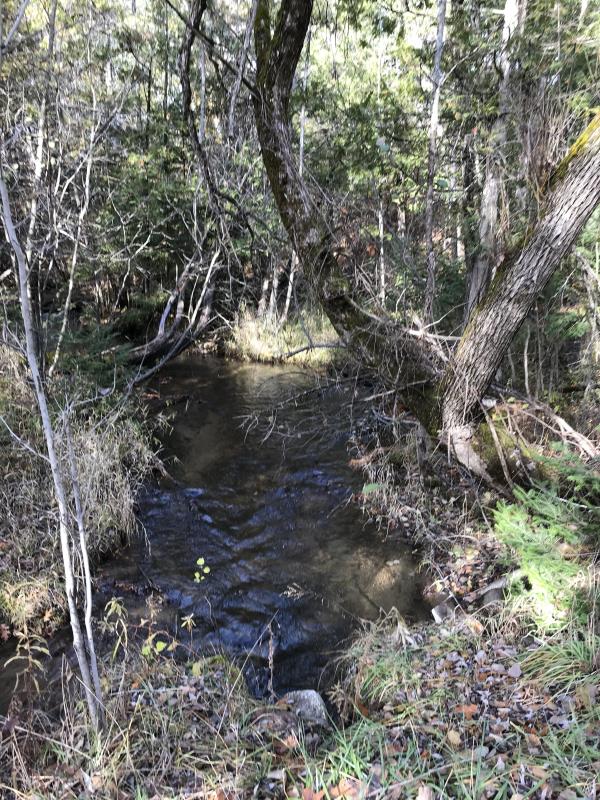
Upstream Conditions
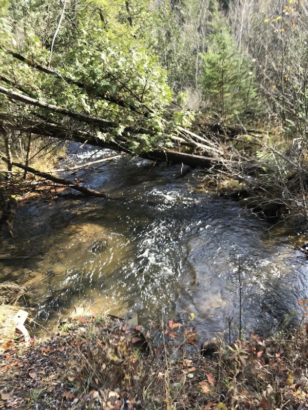
Downstream Conditions
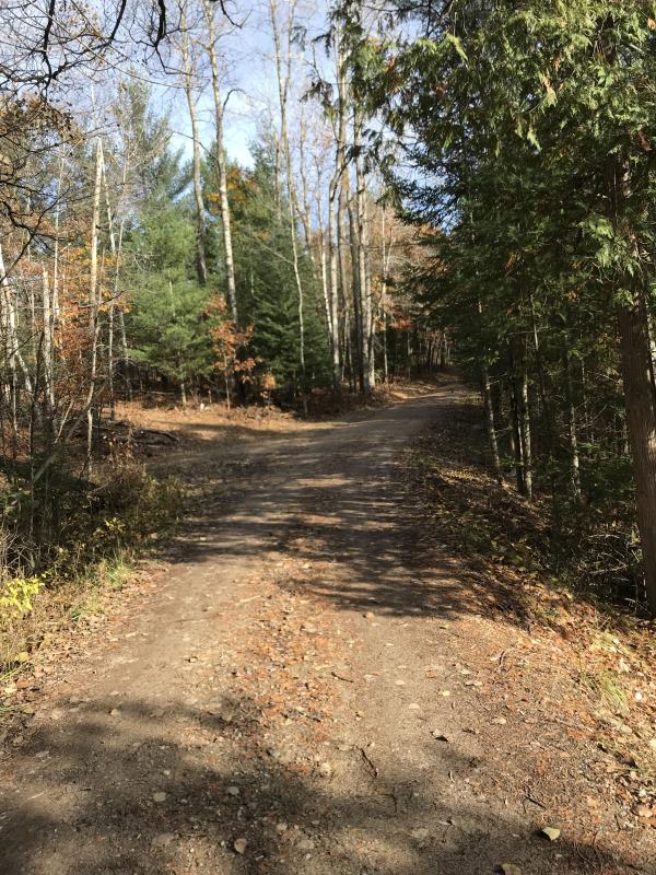
Road Approach - Left
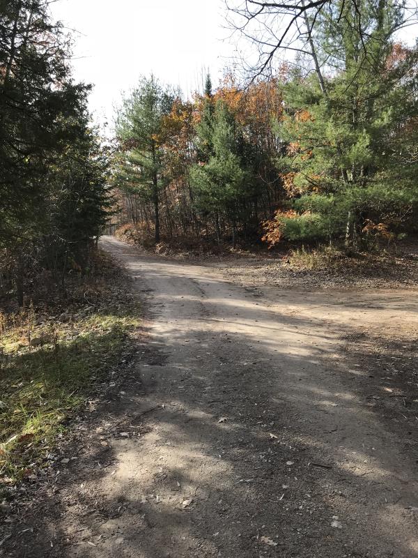
Road Approach - Right
Crossing Information
Type of Crossing: culvert(s)
Number of Structures: 3
Structure Shape: Round
Inlet Type: Projecting
Outlet Type: Freefall into Pool
Structure Material: Metal
Structure Substrate: None
General Conditions: Good
Multiple Culverts/Spans | ||||
Culvert/Span | Width | Length | Height | Material |
1 |
3 ft. |
21 ft. |
3 ft. |
Metal |
2 |
3 ft. |
21 ft. |
3 ft. |
Metal |
3 |
3 ft. |
21 ft. |
3 ft. |
Metal |
Structure Interior: corrugated
Dimensions of Structure: Length 17 ft.
, Width 22 ft.
, Height 3 ft.
Percentage Plugged:
Inlet: 0%
Outlet: 0%
In Pipe: 0%
Percentage Crushed:
Inlet: 0%
Outlet: 0%
In Pipe: 0%
Perch Height: 0.5 ft.
Structure Inlet
Water Depth: 0.5 ft.
Embedded Depth of Structure: 0 ft.
Water Velocity*: 3.3 ft./sec.
Structure Outlet
Water Depth: 0.5 ft.
Embedded Depth of Structure: 0 ft.
Water Velocity*: 6.7 ft./sec.
*Water Velocities were measured 0.5 ft. below Surface
(with Meter)
Additional Comments
Lat: 44-08.279' Long: 84-33.119'
Stream Information
Stream Flow: Less than 1/2 Bankfull
Scour Pool: Length 17 ft.
, Width 22 ft.
, Depth 2.5 ft.
Upstream Pond: Length 0 ft.
, Width 0 ft.
, Depth 0 ft.
Riffle Information
Water Depth: 0.5 ft.
Bankfull Width: 18 ft.
Wetted Width: 16 ft.
Water Velocity: 2.5 ft./sec.
(Measured with Meter)
Dominant Substrate: Gravel
Road Information
Gravel
State Road
(Seasonal)
Road Condition: Good
Road Width at Culvert: 11 ft.
Location of Low Point: At Stream
Runoff Path: Ditch
Embankments
Upstream
Fill Depth: 2 ft.
Slope: 1:2
Downstream
Fill Depth: 2.5 ft.
Slope: 1:2
Approaches
Left Approach
Length: 500 ft.
Slope: 1% to 5%
Vegetation: Heavy
LS Factor: 0.5
Erosion: 0.7576 tons/year
Right Approach
Length: 240 ft.
Slope: 1% to 5%
Vegetation: Heavy
LS Factor: 0.438
Erosion: 0.3185 tons/year
Erosion Information
Total Erosion at Crossing: 1.0761 tons/year
Extent of Erosion: Minor
Notes: Historically this was an erosion site. About 2 years ago the DNR (Gladwin) repaired the site and raised the road at the crossing to devert runoff into ditches
Summary Information
Fish Passability 0
Erosion is an area of concern for this site.
Keep track of possible erosion issues
A future visit to this site is recommended. Keep track of possible erosion issues
�