Road Stream Crossing Site CRW_013
Cedar River Watershed, Stoney Creek
Main Rd
Sherman Twp,
Gladwin County
Information collected by:
Site Location
GPS Coordinates: 44.13835
, -84.530017
T20N
R2W
Sec 10
Owned by State
Fish Passability 1
Structure is NOT Perched
Total Erosion: 1.0156 tons/year
Severity: Moderate
Year Inventoried: 2018
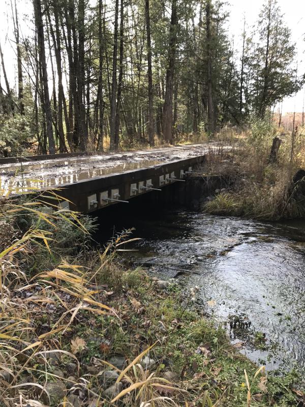
Inlet
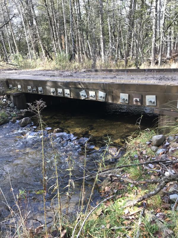
Outlet
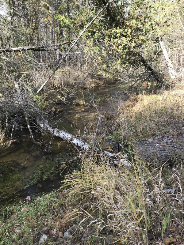
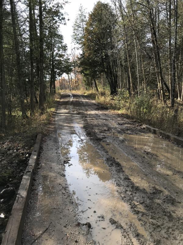
Upstream Conditions
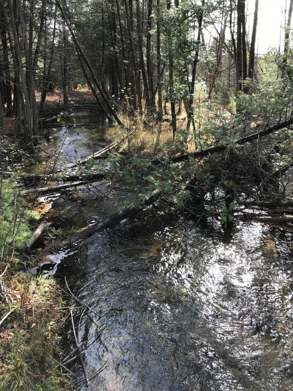
Downstream Conditions
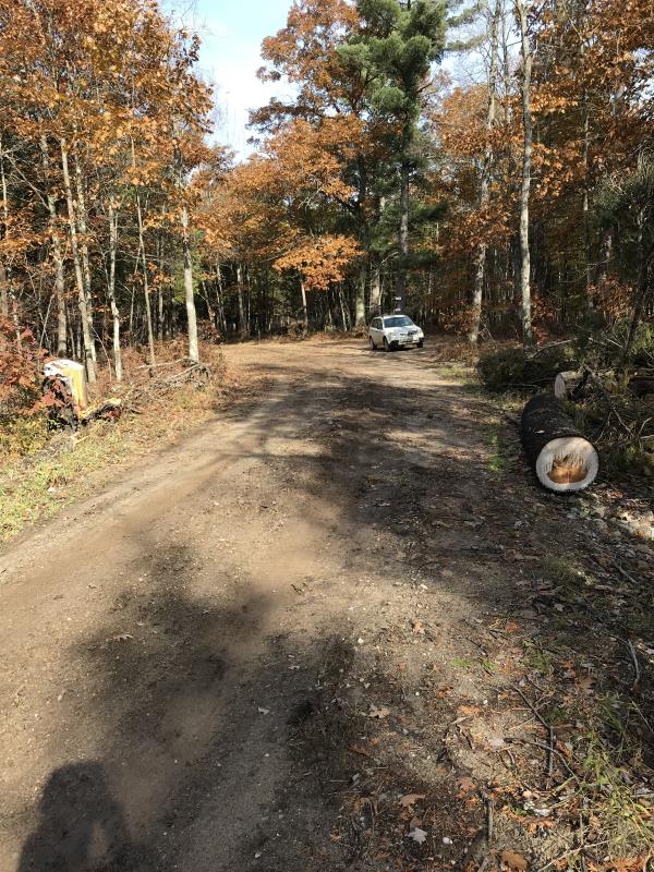
Road Approach - Left
Road Approach - Right
Crossing Information
Type of Crossing: Bridge
Structure Shape: Open Bottom Square/Rectangle
Inlet Type: Wingwall 10-30 Degree
Outlet Type: At Stream Grade
Structure Material: Wood
Structure Substrate: None
General Conditions: Good
Structure Interior: smooth
Dimensions of Structure: Length 19 ft.
, Width 17 ft.
, Height 3.3 ft.
Percentage Plugged:
Inlet: 0%
Outlet: 0%
In Pipe: 0%
Percentage Crushed:
Inlet: 0%
Outlet: 0%
In Pipe: 0%
Structure is NOT Perched
Structure Inlet
Water Depth: 0.7 ft.
Embedded Depth of Structure: 0 ft.
Water Velocity*: 1.6 ft./sec.
Structure Outlet
Water Depth: 1 ft.
Embedded Depth of Structure: 0 ft.
Water Velocity*: 1.6 ft./sec.
*Water Velocities were measured 0.5 ft. below Surface
(with Meter)
Additional Comments
Lat: 44-08.301' Long: 84-31.801'
Stream Information
Stream Flow: Less than 1/2 Bankfull
Scour Pool: Length 0 ft.
, Width 0 ft.
, Depth 0 ft.
Upstream Pond: Length 0 ft.
, Width 0 ft.
, Depth 0 ft.
Riffle Information
Water Depth: 0.8 ft.
Bankfull Width: 24 ft.
Wetted Width: 13 ft.
Water Velocity: 0.8 ft./sec.
(Measured with Meter)
Dominant Substrate: Sand
Road Information
Gravel
State Road
(Seasonal)
Road Condition: Good
Road Width at Culvert: 14 ft.
Location of Low Point: Other
Runoff Path: Ditch
Embankments
Upstream
Fill Depth: 1 ft.
Slope: 1:2
Downstream
Fill Depth: 1 ft.
Slope: 1:2
Approaches
Left Approach
Length: 180 ft.
Slope: 1% to 5%
Vegetation: Heavy
LS Factor: 0.418
Erosion: 0.2902 tons/year
Right Approach
Length: 393 ft.
Slope: 1% to 5%
Vegetation: Heavy
LS Factor: 0.479
Erosion: 0.7254 tons/year
Erosion Information
Total Erosion at Crossing: 1.0156 tons/year
Extent of Erosion: Minor
Notes: Bridge timbers are showing in some places
Summary Information
Fish Passability 1
�